1909 Fire Insurance Maps and Atlas of Melrose, Massachusetts
1909 Fire Insurance Maps and Atlas of Melrose, Massachusetts
Couldn't load pickup availability
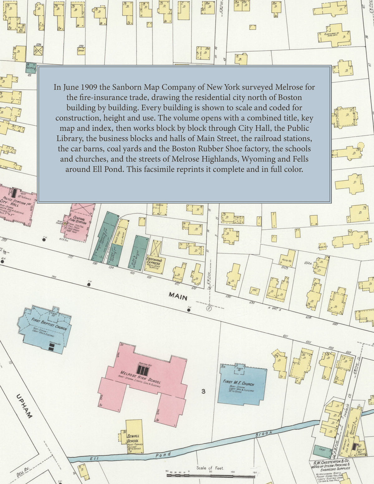
Facsimile of the 1909 Sanborn fire-insurance atlas of Melrose, Massachusetts, reproduced in full color from the Library of Congress copy. It covers the whole Middlesex County city of 15,500 people between Wakefield, Stoneham, Saugus and Malden, from City Hall and the stores, blocks and halls of Main Street out along the Boston & Maine railroad to Melrose Highlands, Wyoming and Fells, with Ell Pond, the schools, churches and residential streets, the Boston Rubber Shoe Company factory and the ice houses on Swains Pond.
The thirty-two numbered sheets that follow work block by block from the stores, blocks and offices along Main Street, Essex Street, Emerson Street and Foster Street - City Hall, the Post Office, the Carnegie Public Library, the Central Telephone Exchange, the Masonic Temple, the Y. M. C. A., Franklin Hall, the Waverly Building, Barret's, Bugbee and Barrett's, Carter Brothers' and Sweet blocks, the Colonial and Ionic flats, the Oxford, the Hotel Otis and the fire department - through the Boston & Maine depots at Melrose, Melrose Highlands, Wyoming and Fells, the Boston & Northern Street Railway car barns, the Boston Rubber Shoe Company factory, the Shepard silversmith works, the Herman jewelry factory, the Boston Sculpture Company, the Chemical Specialty Company, the Morse engraving works, the Sircom petticoat factory, the Munn artificial-flower works, the Deering lumber yard, the coal pockets and coal yards, the garages and stables, the custom laundry, the green houses and the ice houses on Swains Pond, to the Melrose Hospital, the city poor farm, the Boston Stammerers' Institute, the Melrose High School and the Horace Mann, Sewall, Lincoln, Washington, Whittier, Franklin, Joseph Warren, Gooch and Mary A. Livermore schools, St. Mary's Catholic church and school, the Baptist, Congregational, Methodist, Episcopal, Universalist and Unitarian churches, the Highlands Club House, and the residential streets of Melrose Highlands, Wyoming and Fells, round Ell Pond and Melrose Common.
In 1909 the Sanborn Map Company of New York surveyed Melrose for the fire-insurance trade, drawing the city at fifty feet to the inch. Every building is shown to scale and color-coded for construction (yellow for frame, pink for brick, blue for stone), with heights, uses, windows, party walls, hydrants, water mains and fire stations all marked. The index lists every street and every named business, church, school, hotel, mill and works with the sheet it appears on, and the key map places the colored sheet grid over the whole city.
This edition is an unabridged facsimile republication of the atlas: the combined title, key map and index sheet with its report on the water works and fire department, and all thirty-two numbered map sheets, 2 to 33, covering the whole city from Melrose Highlands to Wyoming and Fells, with the Boston Rubber Shoe Company factory, the city poor farm and the ice houses on Swains Pond. Ideal for local historians, genealogists, architects, preservationists and anyone tracing a Melrose address back to 1909.
34 pages. 8.5" x 11". Full color. Paperback.
Printed to order and shipped directly to you — please allow up to 7 business days before shipment.
Satisfaction guaranteed or you can send it back!