1910 Fire Insurance Maps and Atlas of Augusta, Maine
1910 Fire Insurance Maps and Atlas of Augusta, Maine
Couldn't load pickup availability
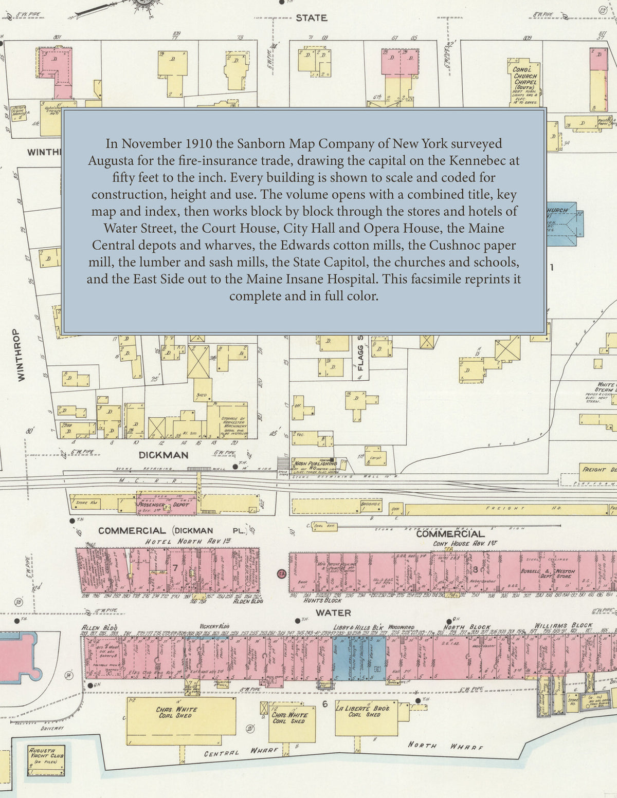
Facsimile of the 1910 Sanborn fire-insurance atlas of Augusta, Maine, reproduced in full color from the Library of Congress copy. It covers the Kennebec County capital of 13,000 people on both banks of the Kennebec River, from the stores, banks and hotels of Water Street and the Maine Central depots out to the State Capitol and Capitol Park, the Edwards cotton mills, the paper and lumber mills, the schools and churches, and across the river to the East Side, Cony High School and the Maine Insane Hospital.
The twenty-four numbered sheets that follow work block by block from the stores, banks and offices along Water Street, State Street, Winthrop Street and Western Avenue - the County Court House and Jail, the Augusta City Hall, the Post Office, the United States Pension Office, the Lithgow Library, the Augusta Opera House, the Comique Moving Picture Theatre, the Masonic Temple, the Odd Fellows', Allen, Alden, Journal, Vickery and Bennett buildings, the Libby and Hills, Williams, Woodward, North, Darby and Edwards blocks, the Bussell & Weston department store and the Augusta, Cony, Cushnoc, Hartford, Lawrence, Riverside and Farmers' hotels and the Hotel North - through the Maine Central depots and freight house, the Central and North wharves, the Eastern Steamship Company, the Lewiston, Augusta and Waterville Electric Railway car barn, the Kennebec Heat and Light Company, the Edwards Manufacturing Company's cotton mills, the Cushnoc Paper Company, the Augusta Lumber Company's saw mills, the Boyd & Harvey lumber mill, the Newhall & Page window-frame and sash factory, the Eaton shoe factory, the Augusta Marble & Granite Works, the Harvey granite-tool works, the Gay machine shop, the Vickery & Hill and Nash publishing houses, the Gannett publishing house, the Glenwood Spring bottling works, the Augusta and White Cloud steam laundries, the Parrott grist mill, the Swift beef house, the Standard Oil Company and the coal sheds and brick yard, to the State Capitol, the State Laboratory of Hygiene, the Augusta City Hospital, the Children's Home, the City Poor Farm, the Maine Insane Hospital, Cony High School, the Smith Grammar, Lincoln, Webster, Williams, Nash and Middle Street schools, the French Catholic church, school and convent, St. Mark's and St. Barnabas Episcopal, the South Congregational, First Baptist, Green Street Methodist, Penney Memorial, Unitarian and Universalist churches, the Augusta Yacht Club, the Rollaway skating rink, and the residential streets of the city and the East Side.
In November 1910 the Sanborn Map Company of New York surveyed Augusta for the fire-insurance trade, drawing the city at fifty feet to the inch. Every building is shown to scale and color-coded for construction (yellow for frame, pink for brick, blue for stone), with heights, uses, windows, party walls, hydrants, water mains and fire stations all marked. The index lists every street and every named business, church, school, hotel, mill and works with the sheet it appears on, and the key map places the colored sheet grid over the whole city.
This edition is an unabridged facsimile republication of the atlas: all twenty-five map sheets, 1 to 25, sheet 1 being the combined title, key map and index sheet with its report on the water facilities and fire department, the others covering the city from the business blocks of Water Street on the Kennebec River out to the State Capitol, the Edwards cotton mills, the East Side and the Maine Insane Hospital. Ideal for local historians, genealogists, architects, preservationists and anyone tracing a Augusta address back to 1910.
32 pages. 8.5" x 11". Full color. Paperback.
Printed to order and shipped directly to you — please allow up to 7 business days before shipment.
Satisfaction guaranteed or you can send it back!