ExileBooks
1910 Fire Insurance Maps and Atlas of Medford, Massachusetts
1910 Fire Insurance Maps and Atlas of Medford, Massachusetts
Couldn't load pickup availability
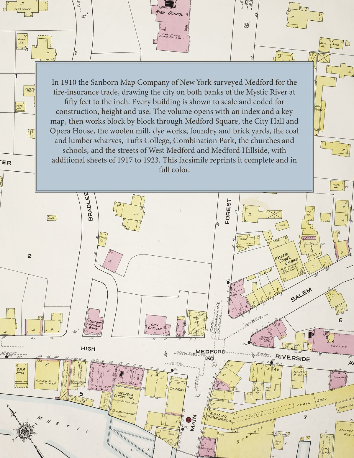
Facsimile of the 1910 Sanborn fire-insurance atlas of Medford, Massachusetts, reproduced in full color from the Library of Congress copy. It covers the whole city of 24,000 people on both banks of the Mystic River, from the City Hall, bank and opera house of Medford Square out through Glenwood, Medford Hillside, Tufts College and the Somerville line, West Medford by the Mystic Lakes, and the streets reaching to the Fells, Malden and Everett, with six additional sheets of 1917 to 1923.
The sixty-one numbered sheets work block by block from the stores, banks and halls of Medford Square, High Street, Salem Street, Main Street and Riverside Avenue - the City Hall and City Offices, the Post Office, the Public Library, the Massachusetts Volunteer Militia Armory, the Medford Savings Bank, the Medford Opera House, the G. A. R. Hall, the Medford Club, the Telephone Exchange, the Police Headquarters, the Medford Inn and the Royal House - through the Boston & Maine depots at Medford, Glenwood, Medford Hillside, Tufts College and West Medford, the Boston Elevated car house, the Medford Woolen mill, the Glenwood bleaching and dyeing works, the Chelmsford Foundry, the New England Brick Company, the old Mystic print works, the Teel carriage and machine works, the Toppan boat works, the Warner & Childs paper-box works, the Stone, Timlow sheep-skin works, the United States Rubber Tire Company, the Tutten granite works, the coal, lumber and ice yards and the city water, sewer and highway yards, to the Sherman Hospital, the Home for Aged Men and Women, the City Alms House, Tufts College, the High School and the Brooks, Centre, Curtis, Hillside, Lincoln and Washington schools, St. Joseph's and St. Raphael's churches, the Mystic, Union and West Medford Congregational, the Baptist, Methodist, Universalist and Unitarian churches, Combination Park and the Boulevard Summer Theatre, and the streets of West Medford and Medford Hillside, with six additional sheets of 1917 to 1923 showing the American Woolen mill and the Sarah Fuller Home.
In 1910 the Sanborn Map Company of New York surveyed Medford for the fire-insurance trade, drawing the city at fifty feet to the inch and a few outlying tracts at one hundred feet; six additional sheets of 1917 to 1923 add the new streets and the American Woolen mill. Every building is shown to scale and color-coded for construction (yellow for frame, pink for brick, blue for stone), with heights, uses, windows, party walls, hydrants, water mains and fire stations all marked. The index lists every street and every named business, church, school, hotel, mill and works with the sheet it appears on, and the key map places the colored sheet grid over the whole city.
This edition is an unabridged facsimile republication of the atlas: the combined title and index sheet, the key map with the report, all sixty-one numbered map sheets, 1 to 61, and the six additional sheets 64 to 69 of 1917 to 1923. Ideal for local historians, genealogists, architects, preservationists and anyone tracing a Medford address back to 1910.
70 pages. 8.5" x 11". Full color. Paperback.
Printed to order and shipped directly to you — please allow up to 7 business days before shipment.
Satisfaction guaranteed or you can send it back!