1911 Fire Insurance Maps and Atlas of Berkeley, California, Volume 2
1911 Fire Insurance Maps and Atlas of Berkeley, California, Volume 2
Couldn't load pickup availability
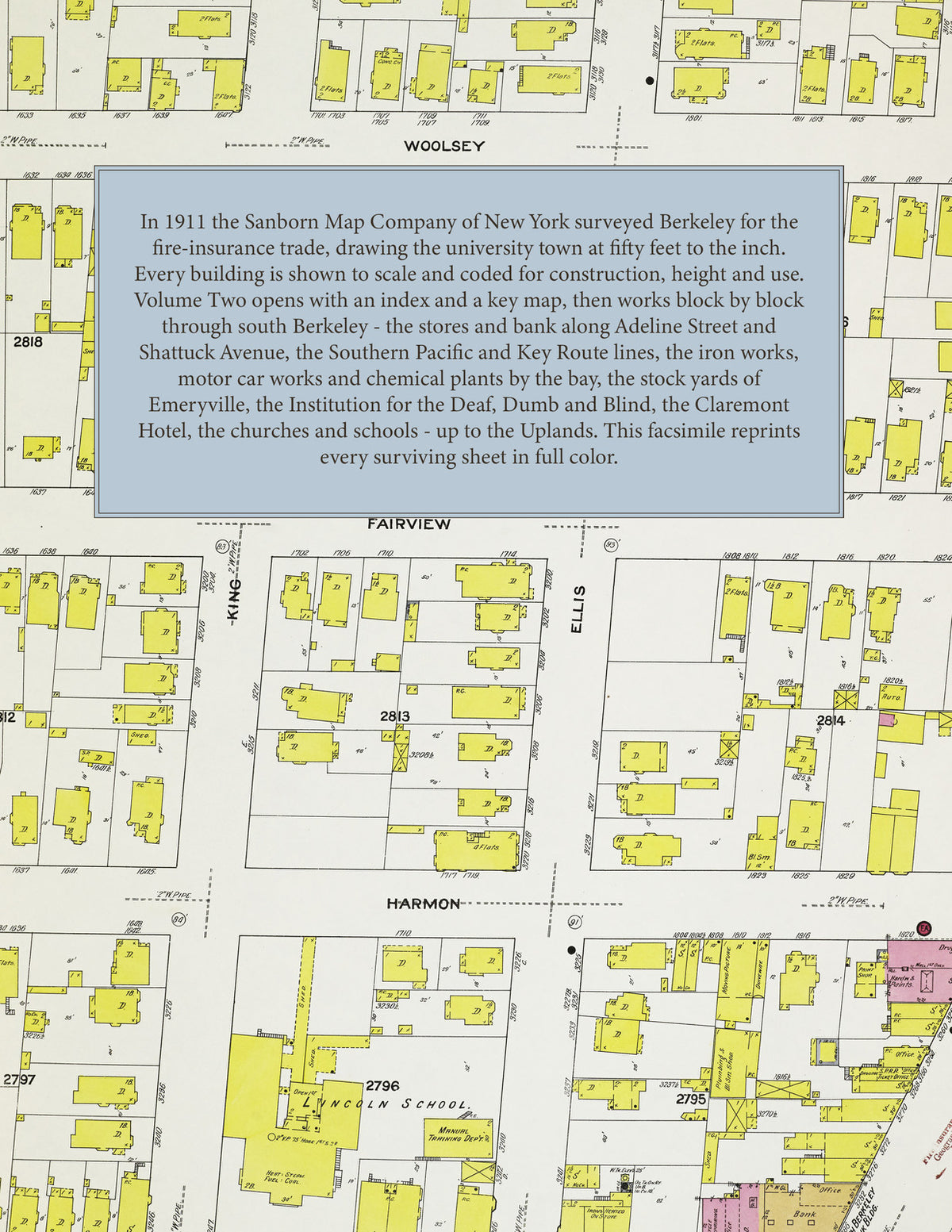
Facsimile of the 1911 Sanborn fire-insurance atlas of Berkeley, California (Volume Two), reproduced in full color from the Library of Congress copy. Volume Two covers south Berkeley - everything south of Bancroft Way from the bay shore to Shattuck Avenue and south of Dwight Way from Shattuck Avenue to the hills - through South Berkeley, San Pablo Park and the Ashby and Alcatraz Avenue blocks, and up through Claremont and the Uplands to the Tunnel Road, together with the north end of Emeryville and the edge of Oakland along the city line; Albany, though named on the title, is not sheeted in this volume.
The one hundred and six numbered sheets work block by block from the stores, banks and halls along Shattuck Avenue, Adeline Street, Telegraph Avenue, San Pablo Avenue, Ashby Avenue and Alcatraz Avenue - the South Berkeley Bank Building and the Post Office, the Barker Block, the Edlington Court, the Regent Street, No. 3 and No. 7 fire stations and the Stock Yards Hotel - through the Southern Pacific's Carlton Street station, freight house, ticket office and Emeryville station and the Key Route line on Adeline Street, the Byron Jackson and B. Jackson iron works, the Macauley foundry, the Hall Scott Motor Car Company, the Cutter Laboratory, the San Francisco Sulphur Company and the old Stauffer chemical works, the California Corrugated Culvert Company, the Sunlit Fruit cannery, the Griswold sal-soda works, the Pacific Spring Bed and Western Furniture factories, the Pfister knitting mill, the Whalley church organ factory, the Oregon Street and Dobson & Creagmile planing mills, the Hunter and Taylor lumber yards, the Renas and People's Express warehouses, the Manhattan, Troy and French laundries, the Mayama and Sanborn nurseries, and at Emeryville the Oakland Meat Company's stock stables, the slaughter houses, the Corders tannery and wool pullery, the Bayle, Lacoste fertilizer works, the California Soap factory and the Capitol Refining Company, to the Institution for the Deaf, Dumb and Blind, the Alta Bates Sanitarium and the Roosevelt Hospital, the Claremont Hotel and Riding Academy, Boone's University School and Miss Randolph's Preparatory School, the Emerson, Hawthorne, Le Conte, Lincoln, Longfellow, Washington, Russell Street and Peralta Annex schools, the churches of every denomination, San Pablo Park, and the residential streets of South Berkeley, Claremont and the Uplands out to the Oakland line.
In 1911 the Sanborn Map Company of New York surveyed Berkeley for the fire-insurance trade, drawing the city at fifty feet to the inch. Every building is shown to scale and color-coded for construction (yellow for frame, pink for brick, blue for stone), with heights, uses, windows, party walls, hydrants, water mains and fire stations all marked. The index lists every street and every named business, church, school, hotel, mill and works with the sheet it appears on, and the key map places the colored sheet grid over the whole city.
This edition is an unabridged facsimile republication of the atlas: the title sheet, the index, the block index, the key map and the one hundred and six numbered map sheets present in the Library of Congress copy (sheets 121 through 227 as issued; sheet 135 is wanting in that copy). Ideal for local historians, genealogists, architects, preservationists and anyone tracing a Berkeley address back to 1911.
112 pages. 8.5" x 11". Full color. Paperback.
Printed to order and shipped directly to you — please allow up to 7 business days before shipment.
Satisfaction guaranteed or you can send it back!