1911 Fire Insurance Maps and Atlas of Galena and Empire City, Kansas
1911 Fire Insurance Maps and Atlas of Galena and Empire City, Kansas
Couldn't load pickup availability
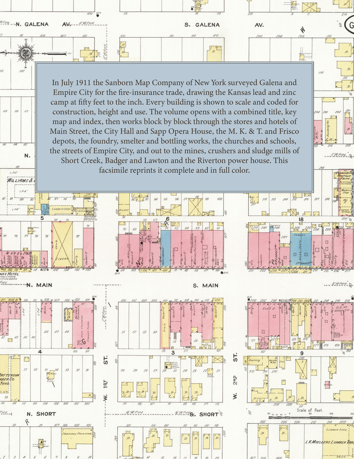
Facsimile of the 1911 Sanborn fire-insurance atlas of Galena and Empire City, Kansas, reproduced in full color from the Library of Congress copy. It covers the Cherokee County mining town of 6,000 people with its neighbor Empire City across Short Creek, from the stores, hotels and City Hall of Main Street and the Missouri, Kansas & Texas and Frisco depots, through the residential additions of the Original Town, out to the lead and zinc mines, crushers and sludge mills of the camps around it and the power houses at Riverton and Lowell on Spring River.
The twenty-three numbered sheets work block by block from the stores, banks and hotels along Main Street, Galena Avenue, Front Street and Seventh Street - the City Hall, the Post Office, the Public Library, the Odd Fellows' Hall, the Elks' Club House, the Sapp Opera House, the Banks and Oxford hotels, the Galena Times and Republican printing offices and the fire stations - through the Missouri, Kansas & Texas depot, the Frisco depot, the Southwest Missouri electric railroad sub-station, the Empire District Electric Company sub-station, the Galena Foundry and Machine Shop, the Galena Harrow Company, the Galena Smelting and Manufacturing Company, the Galena Bottling Works, the Galena Mill and Elevator, the Jaqueth feed mill, the Rauch and Kennedy machine shops, the Independent Oil Company, the Union Ice and Fuel Company and the Moeller, Patterson and Williams & Robeson's lumber yards, to the High School, the Central, Ward, East Galena and Spring Grove public schools, the Catholic, Episcopal, Methodist Episcopal, Presbyterian, Christian, First Baptist, Sixth Street Baptist, Mt. Zion Baptist, A. M. E., Apostolic Faith, Holiness, Latter Day Saints and Seventh Day Adventist churches and the Church of Christ Scientist, and the residential streets of the Original Town, Rosenthal's, Cornwall's, Bane's and Galena Land & Zinc Company additions and Spring Grove. The Empire City sheets show its Main Street, Post Office, Town Hall, public school and old pumping station, and the outlying sheets map the mines, crushers and sludge mills of the camps - the Galena Open Cut Mine, the Blind Mule, Big Shaft and Prospect mines, the Black Hills custom mill, the Badger, Boston, Chase, Hubbard, Lockport and New Century mill and mining companies, the Eagle and Pilot sludging mills, the Clara Louise and Keys crushers, the Kress, Newton and Shoemann lead and zinc mines, the Galena water works pumping station, and the Empire District Electric power house at Riverton and the Spring River Power Company at Lowell.
In 1911 the Sanborn Map Company of New York surveyed Galena for the fire-insurance trade, drawing the city at fifty feet to the inch. Every building is shown to scale and color-coded for construction (yellow for frame, pink for brick, blue for stone), with heights, uses, windows, party walls, hydrants, water mains and fire stations all marked. The index lists every street and every named business, church, school, hotel, mill and works with the sheet it appears on, and the key map places the colored sheet grid over the whole city.
This edition is an unabridged facsimile republication of the atlas: the combined title, key map and index sheet and all twenty-three numbered map sheets that follow it, 2 to 24, covering Galena, Empire City and the lead and zinc mines and mills around them. Ideal for local historians, genealogists, architects, preservationists and anyone tracing a Galena address back to 1911.
32 pages. 8.5" x 11". Full color. Paperback.
Printed to order and shipped directly to you — please allow up to 7 business days before shipment.
Satisfaction guaranteed or you can send it back!