1911 Fire Insurance Maps and Atlas of Waterville, Maine
1911 Fire Insurance Maps and Atlas of Waterville, Maine
Couldn't load pickup availability
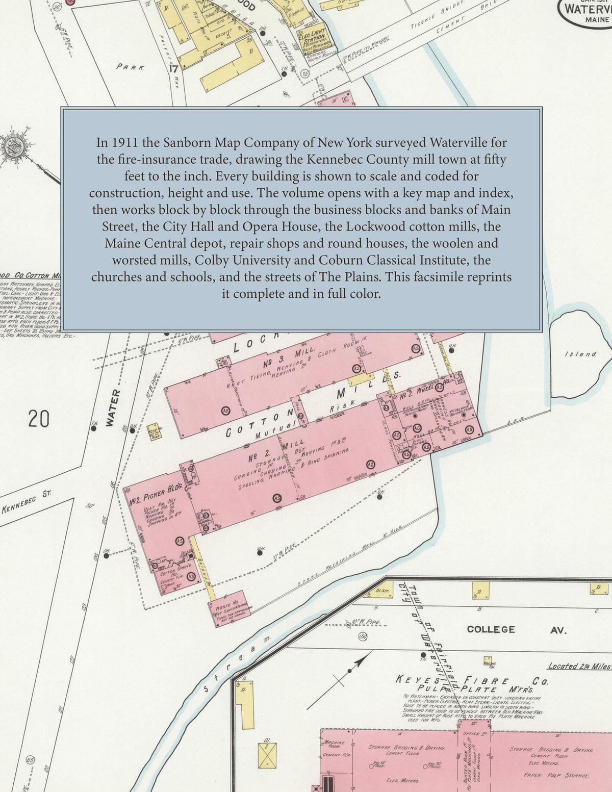
Facsimile of the 1911 Sanborn fire-insurance atlas of Waterville, Maine, reproduced in full color from the Library of Congress copy. It covers the whole city of 13,000 people, from the business blocks of Main Street, Common Street and Silver Street and the Lockwood cotton mills at the Kennebec River, through the Maine Central depots and repair shops and Colby University, to The Plains and the residential streets out along the Messalonskee Stream to Pine Grove Cemetery.
The thirty numbered sheets work block by block from the stores, banks, hotels and halls along Main Street, Common Street, Silver Street, Temple Street, Front Street, Water Street and College Avenue - the City Hall and Opera House, the Post Office, the Public Library, the Armory, the Masonic Building and Hall, the I. O. O. F. Hall, Foss Hall, the Elks' Block and Club House, the Eagles' Club House, the Women's Association Hall, the Silver Theatre, the People's National and Ticonic National banks, the Haines, Edith, Moor, Peavey, Plaisted, Phenix, Simpson, Milliken, Hussey and Flood blocks, the L. H. Soper department store, the Wardwell Emery dry goods store, the Morning Sentinel printing office, the Colonial, the Hanford and the Raymond, the Elmwood, Exchange, Bowker, Appleton Inn and Railroad Inn hotels and the Railroad Y. M. C. A. - through the Maine Central passenger depot, freight houses, repair shops and round houses, the American Express offices, the Lockwood Company's cotton mills and storehouses at the Head of the Falls, the Keyes Fibre Company's pulp plate works, the Wyandotte Worsted Mills, the National Woolen Company, the Noone woolen mill, the Hathaway shirt factory, the Merrill, Runnels & Mayo grist mills, the Waterville Iron Works, the Lombard Steam Log Hauler machine shop, the Kennebec Boat and Canoe Company, the Noyes Stove Company, the Fitzgerald woodworking shop, the Burns tannery, the Waterville Tallow Company, the Schwarzschild & Sulzberger beef warehouse, the Frye ice house, the coal and wood yards, the Standard Oil Company, the city yard and stone crusher, the electric light station and the Waterville pumping station on the Messalonskee, to Colby University, the Coburn Classical Institute, the Waterville High School and the High School on Pleasant Street, the Brook Street, North Grammar, South Grammar and Myrtle Street schools and the public schools at The Plains, St. Francis de Sales and Sacred Heart Catholic churches, St. Mark's Episcopal, the Baptist, Congregational, Methodist, Unitarian, Universalist, Advent Christian and Getchell Street Free Baptist churches, the French Baptist Church at The Plains and the synagogue, and the residential streets of The Plains, Western Avenue and Silver Street out to Pine Grove Cemetery.
In 1911 the Sanborn Map Company of New York surveyed Waterville for the fire-insurance trade, drawing the city at fifty feet to the inch. Every building is shown to scale and color-coded for construction (yellow for frame, pink for brick, blue for stone), with heights, uses, windows, party walls, hydrants, water mains and fire stations all marked. The index lists every street and every named business, church, school, hotel, mill and works with the sheet it appears on, and the key map places the colored sheet grid over the whole city.
This edition is an unabridged facsimile republication of the atlas: the combined title, key map and index sheet and all thirty numbered map sheets. Ideal for local historians, genealogists, architects, preservationists and anyone tracing a Waterville address back to 1911.
32 pages. 8.5" x 11". Full color. Paperback.
Printed to order and shipped directly to you — please allow up to 7 business days before shipment.
Satisfaction guaranteed or you can send it back!