1912 Fire Insurance Maps and Atlas of Chehalis, Washington
1912 Fire Insurance Maps and Atlas of Chehalis, Washington
Couldn't load pickup availability
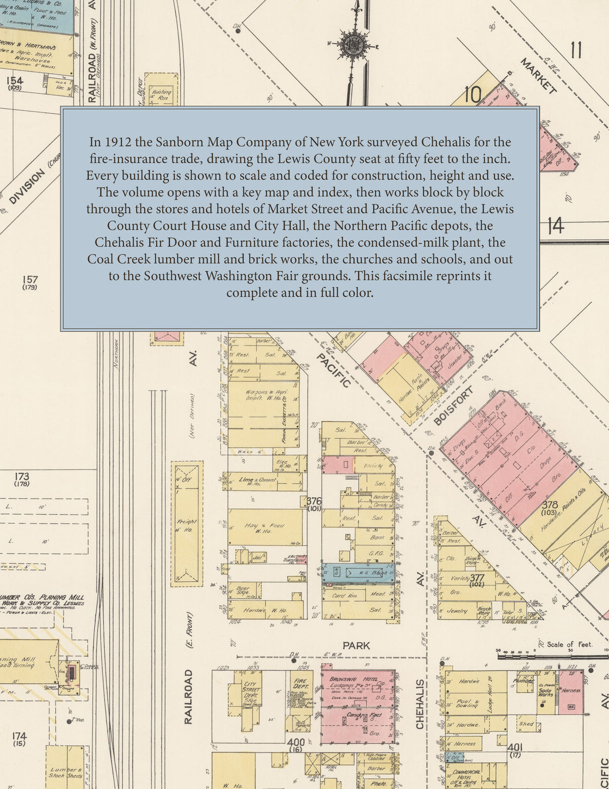
Facsimile of the 1912 Sanborn fire-insurance atlas of Chehalis, Washington, reproduced in full color from the Library of Congress copy. It covers the Lewis County seat of 5,000 people, from the stores, hotels and Court House along Market Street and Pacific Avenue and the Northern Pacific depot, through the fir door, furniture, tank and condensed-milk factories and the lumber mills, to the schools, churches and residential streets east of Washington Avenue and along the Newaukum River, and out to the Coal Creek mill, the 'Twin City' coal mine and the Southwest Washington Fair grounds.
The twenty-four numbered sheets work block by block from the stores, banks, hotels and halls along Market Street, Main Street, Pacific Avenue, Chehalis Avenue, Railroad Avenue and Park Street - the Lewis County Court House, the City Hall, the Post Office, the Public Library, the Hotel Washington, the Brunswig, Commercial and St. Helen's hotels, the I. O. O. F. Hall, the Liederkranz Hall and the Glide Rink - through the Northern Pacific freight house and passenger station and the O. W. R. & N. right of way, the Brown & Hartman, Everett, Ludwig, Scherer and Hartman & Nathan warehouses, the Chehalis Fir Door Company, the Chehalis Furniture & Manufacturing Company, the Pacific Coast Tank & Silo Company's tank factory, the Pacific Coast Condensed Milk Company, the U. S. Flax Twine & Manufacturing Company, the Builders Mill Work & Supply and Palmer Lumber planing mills, the Coal Creek Lumber Company's saw and planing mill, the Chehalis Brick & Tile Company's kilns, the Schuermann and Gustavson foundries and machine shops, the Chehalis Ice & Cream creamery and ice factory, the Western Oil Company, the Centralia & Chehalis Gas Company, the Washington & Oregon Corporation's car barns, electric light and power plant and 'Twin City' coal mine, the Oregon-Washington Corporation's Chehalis pump house on the Newaukum River and the Wibra greenhouses, to Dr. Kennicott's hospital and St. Helen's Roman Catholic Hospital, the Chehalis High School, the East Side and West Side public schools, the Convent of the Holy Rosary, St. John the Evangelist Roman Catholic Church, the Epiphany Episcopal Church, the First Baptist, Christian, Methodist Episcopal and Presbyterian churches, St. John's Evangelical Lutheran Church, the Southwest Washington Fair Association grounds two miles north of the city, and the residential streets along St. Helens Avenue, Cascade Avenue, Washington Avenue and the hill east of the business district.
In 1912 the Sanborn Map Company of New York surveyed Chehalis for the fire-insurance trade, drawing the city at fifty feet to the inch. Every building is shown to scale and color-coded for construction (yellow for frame, pink for brick, blue for stone), with heights, uses, windows, party walls, hydrants, water mains and fire stations all marked. The index lists every street and every named business, church, school, hotel, mill and works with the sheet it appears on, and the key map places the colored sheet grid over the whole city.
This edition is an unabridged facsimile republication of the atlas: the combined title, key map and index sheet and all twenty-four numbered map sheets, 2 to 25. Ideal for local historians, genealogists, architects, preservationists and anyone tracing a Chehalis address back to 1912.
32 pages. 8.5" x 11". Full color. Paperback.
Printed to order and shipped directly to you — please allow up to 7 business days before shipment.
Satisfaction guaranteed or you can send it back!