ExileBooks
1912 Fire Insurance Maps and Atlas of Moline, Illinois
1912 Fire Insurance Maps and Atlas of Moline, Illinois
Couldn't load pickup availability
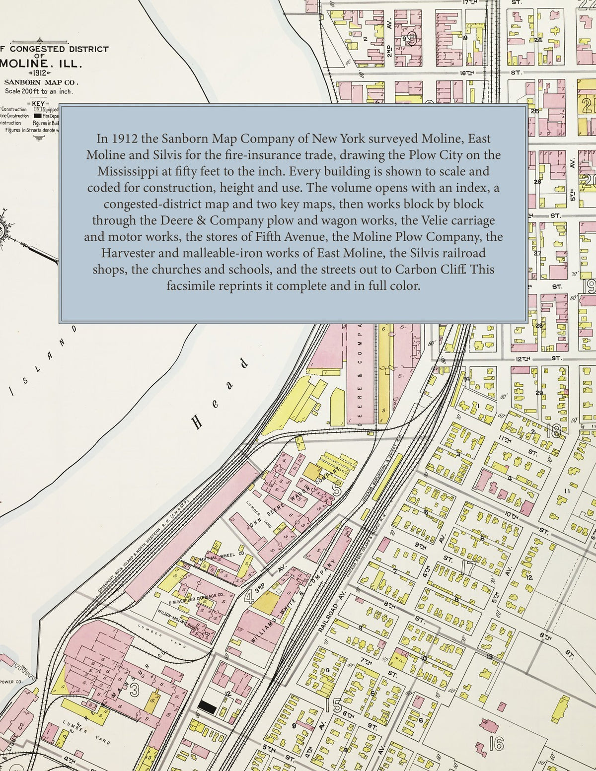
Facsimile of the 1912 Sanborn fire-insurance atlas of Moline, Illinois, reproduced in full color from the Library of Congress copy. It covers the whole city of Moline together with the city of East Moline and the village of Silvis - 41,300 people along the Mississippi - from the Deere, Velie and Williams White works on the Head Race and the stores of Fifth Avenue, through the Rock Island railroad's Silvis Shops, to the residential additions, Stephens and Riverside Parks and the tile works at Carbon Cliff.
The seventy-six numbered sheets work block by block from the stores, banks, hotels and theatres along Fifth Avenue, Third Avenue, Fifteenth Street and Sixteenth Street - the City Hall, the City Market, the Public Library, the Post Office, the Barrymore Theatre and the Family Theatre, the Airdome, Concordia Turner Hall, the B. P. O. E. hall, the Y. M. C. A. building, the Ainsworth and Kerns buildings, the Boston Store, New York Store and Fisk and Loosley department store, the Arlington and Manufacturers' hotels - through the Deere and Company plow, foundry, warehouse and Mansur farm-machinery works, the John Deere Wagon Company, the Moline Plow Company, the Velie Carriage, Engineering and Motor Vehicle companies, the Williams, White and Company machinery works, the Barnard and Leas milling-machinery works, the Moline Wagon, Moline Pressed Steel, Moline Automobile, Mutual Wheel, Wilson-Moline Buggy and Sechler carriage companies, the Plow City Brass Works, the Peterson piano factory, the Moline Water Power Company and the People's Power and Light Company on the Tail Race, the Burlington, Rock Island, Milwaukee and Davenport, Rock Island and North Western depots and freight houses, the Tri-City Railway car barn, the Naval Reserve boathouse, and in East Moline the Deere Harvester Department, the Union Malleable Iron Company, the Root and Vandervoort engineering works, the Midland Motor Company and the Republic Iron and Steel Company's Sylvan Works, the Rock Island railroad's Silvis Shops and round house, the Walsh Brake Shoe and Foundry and the Argillo tile and pipe works at Carbon Cliff, to the Moline Public Hospital, the Tri-City and Battle Creek sanitariums, the Moline High School and the Garfield, Grant, Irving, Lincoln, Washington and Willard schools, Sacred Heart and St. Mary's, Christ Church, the Swedish Baptist, Lutheran and Mission churches, Stephens and Riverside Parks and Riverside Cemetery, and the residential streets of Velie's and Fairmount additions, Prospect Park, Glenview, East Moline, Silvis and Mineral Springs Park.
In 1912 the Sanborn Map Company of New York surveyed Moline for the fire-insurance trade, drawing the city at fifty feet to the inch. Every building is shown to scale and color-coded for construction (yellow for frame, pink for brick, blue for stone), with heights, uses, windows, party walls, hydrants, water mains and fire stations all marked. The index lists every street and every named business, church, school, hotel, mill and works with the sheet it appears on, and the key map places the colored sheet grid over the whole city.
This edition is an unabridged facsimile republication of the atlas: the title sheet, the index, the map of the congested district, the two key maps and all seventy-six numbered map sheets. Ideal for local historians, genealogists, architects, preservationists and anyone tracing a Moline address back to 1912.
82 pages. 8.5" x 11". Full color. Paperback.
Printed to order and shipped directly to you — please allow up to 7 business days before shipment.
Satisfaction guaranteed or you can send it back!