1912 Fire Insurance Maps and Atlas of Ontario and Upland, California
1912 Fire Insurance Maps and Atlas of Ontario and Upland, California
Couldn't load pickup availability
Facsimile of the 1912 Sanborn fire-insurance atlas of Ontario and Upland, California, reproduced in full color from the Library of Congress copy. It covers the San Bernardino County town of 6,654 people and its neighbour Upland of 3,582, from the stores, hotels and banks of Euclid Avenue and Main Street and the Southern Pacific depots through the orange and lemon packing houses, canneries and lumber yards, to the schools, churches and residential streets of both towns, Upland's business blocks on Second Avenue and the Santa Fe depot.
The twenty-seven numbered sheets that follow work block by block from the stores, banks and offices along Euclid Avenue, Main Street, Emporia Street and Transit Street - the City Hall and City Park, the Post Office, the Carnegie Library, the Chamber of Commerce, the Masonic Hall, the San Antonio Water Company's office, the Park Hotel, the Hotel Royal and the Southern Hotel - through the Southern Pacific and the San Pedro, Los Angeles & Salt Lake depots, the Citrus Fruit Association of Ontario packing house, the Walker Fruit Company, the Southern California Canning Company's fruit cannery and the Golden State Canning Company, the Hot Point Electric Heating Company, the Blinn and Hammond lumber yards, the Ontario Laundry and the Armstrong Nursery, to the Chaffey Union High School, the G Street, San Antonio Avenue and South Side Grammar schools, St. George's Catholic Church, Christ Church (Episcopal), the Bethel Congregational, Congregational, First Baptist, First M. E., M. E. (South), German Evangelical Lutheran, Westminster Presbyterian, Christian and Pentecostal Nazarene churches and the Christian Science Society, and the residential streets of Ontario; then north to Upland - the Algonquin Hotel, the Hotel Bellevue and the I. O. O. F. Hall on Second Avenue, the A. T. & S. F. depot and freight house, the packing houses of the Upland Citrus Association, the Lemon Growers' Exchange, the Mountain View Orange and Lemon Growers, the Upland Heights Orange Association, the Stewart Citrus Association, Hanson & Searles, the Growers' Fruit Company and the Fay Fruit Company, the Eyman and Fox-Woodsum lumber yards, the Ontario Power Company, the Brennan Tannery and Shoe Manufacturing Company, the Eighth Street Public School and the Upland Grammar School, the First M. E., Presbyterian, Brethren and Nazarene churches, and the residential streets of Upland.
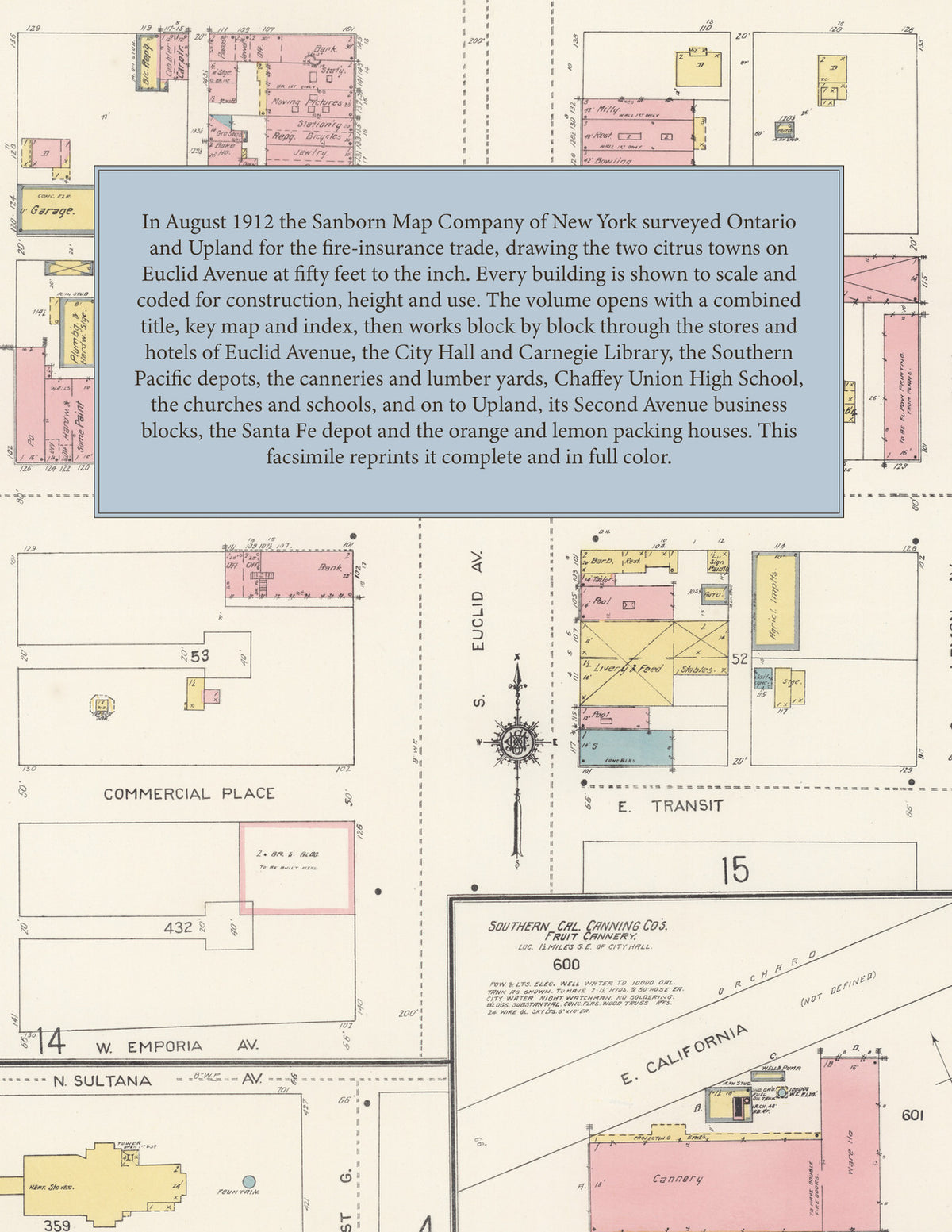
In August 1912 the Sanborn Map Company of New York surveyed Ontario and Upland for the fire-insurance trade, drawing both towns at fifty feet to the inch. Every building is shown to scale and color-coded for construction (yellow for frame, pink for brick, blue for stone), with heights, uses, windows, party walls, hydrants, water mains and fire stations all marked. The index lists every street and every named business, church, school, hotel, mill and works with the sheet it appears on, and the key map places the colored sheet grid over the whole city.
This edition is an unabridged facsimile republication of the atlas: all twenty-eight numbered map sheets, 1 to 28, sheet 1 being the combined title, key map and index sheet with its reports on the water works and fire departments of Ontario and Upland, sheets 2 to 19 covering Ontario and sheets 20 to 28 covering Upland. Ideal for local historians, genealogists, architects, preservationists and anyone tracing a Ontario address back to 1912.
32 pages. 8.5" x 11". Full color. Paperback.
Printed to order and shipped directly to you — please allow up to 7 business days before shipment.
Satisfaction guaranteed or you can send it back!