1912 Fire Insurance Maps and Atlas of Tyler, Texas
1912 Fire Insurance Maps and Atlas of Tyler, Texas
Couldn't load pickup availability
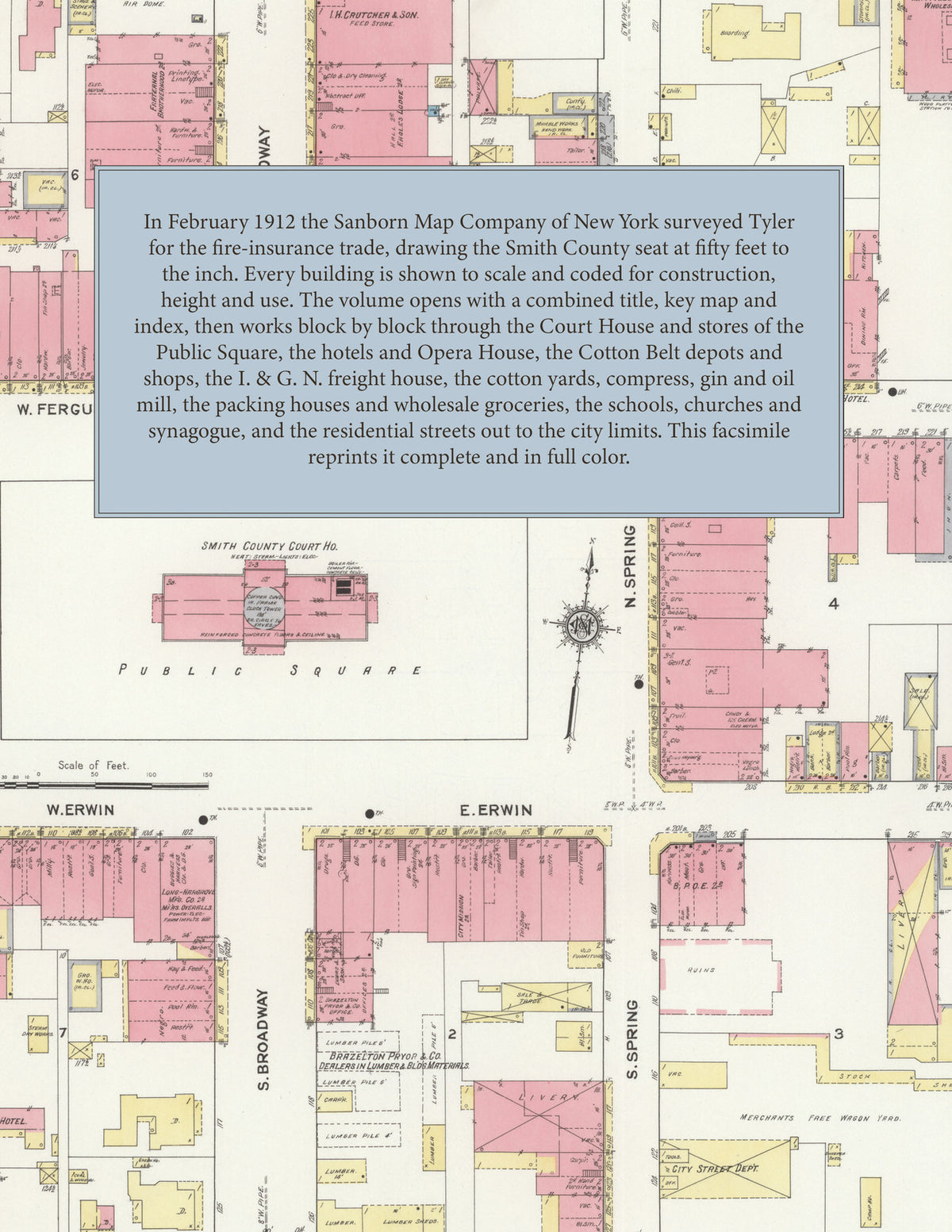
Facsimile of the 1912 Sanborn fire-insurance atlas of Tyler, Texas, reproduced in full color from the Library of Congress copy. It covers the whole Smith County seat of 12,000 people, from the Court House, stores, banks and hotels of the Public Square, through the Cotton Belt and International & Great Northern depots, the cotton yards, compress, gin and oil mill, to the St. Louis Southwestern round house and shops, the schools and churches, and the residential streets of North and South Tyler.
The twenty-six numbered sheets that follow work block by block from the stores, banks and offices around the Public Square along Broadway, Spring, College, Erwin, Ferguson and Locust Streets - the Smith County Court House and Jail, the City Hall and Fire Department, the Government Building and Post Office, the Public Library, the Opera House, the Air Dome, the St. Charles, Central, Herring's, National and New Capitol hotels and the Griffin House - through the St. Louis Southwestern (Cotton Belt Route) passenger and freight depots, general offices, storehouses, yards, round house and shops, the International & Great Northern freight house, T. A. Pinkerton's cotton yard, the Tyler Compress Company, the Roberts & McMillan cotton gin, the Tyler Cotton Oil Company, D. White's cotton warehouse, the Swift & Co. and National packing houses, the Armour & Co. meat depot, the Moore and Mayfield wholesale groceries, the Wadel-Dickey Hardware Company, the National Biscuit Company, the Long-Hargrove overall factory, the Mayer & Schmidt fire-extinguisher works, the W. Connally & Co. machine shop, the Tyler Ice Company, creamery, bottling works, canning and pickling works and produce company, the C. Wiley fertilizer works, the Morris Bros. granite works, the Carlton, Palmore & Dean, Brazelton, Pyror & Co. and Tyler Box and Lumber yards, the W. T. Wilson grain company, the Tyler Electric Light and Power and Tyler Gas works, the city and reserve pumping stations and the Gulf Refining and Pierce-Fordyce oil depots, to the Tyler Surgical Sanitarium, the High School, the Tyler Commercial College, the Bonner, Douglas, Gary and North public schools, the Immaculate Conception R. C. Church, the First Baptist, First Christian, First Methodist Episcopal, First and Central Presbyterian and Episcopal churches, the colored Baptist, Methodist and A. M. E. churches, Bethel Temple and the Orthodox Synagogue, and the residential streets of North and South Tyler.
In 1912 the Sanborn Map Company of New York surveyed Tyler for the fire-insurance trade, drawing the city at fifty feet to the inch. Every building is shown to scale and color-coded for construction (yellow for frame, pink for brick, blue for stone), with heights, uses, windows, party walls, hydrants, water mains and fire stations all marked. The index lists every street and every named business, church, school, hotel, mill and works with the sheet it appears on, and the key map places the colored sheet grid over the whole city.
This edition is an unabridged facsimile republication of the atlas: all twenty-seven numbered map sheets, 1 to 27, sheet 1 being the combined title, key map and index sheet with its report on the water facilities and fire department, the others covering the city from the Court House and stores of the Public Square to the cotton yards, mills and depots on the railroads, the Cotton Belt shops and the residential streets. Ideal for local historians, genealogists, architects, preservationists and anyone tracing a Tyler address back to 1912.
32 pages. 8.5" x 11". Full color. Paperback.
Printed to order and shipped directly to you — please allow up to 7 business days before shipment.
Satisfaction guaranteed or you can send it back!