1913 Fire Insurance Maps and Atlas of Cedar Rapids, Iowa
1913 Fire Insurance Maps and Atlas of Cedar Rapids, Iowa
Couldn't load pickup availability
The complete 1913 Sanborn fire-insurance atlas of Cedar Rapids, Iowa, reprinted in full color. It covers Cedar Rapids and Kenwood Park, from the downtown blocks out to the city limits.
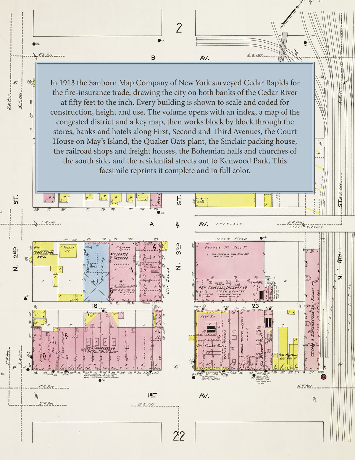
The one hundred and ten numbered sheets work block by block from the stores, banks and hotels along First, Second and Third Avenues and Second and Third Streets, the Linn County Court House on May's Island, City Hall, the Federal Building, the Carnegie Public Library, Greene's Opera House, the Majestic and People's theatres, the Allison, Montrose, Grand and Magnus hotels, the Killian, Denecke, Franchere and Fair department stores and the Security, American Trust and Cedar Rapids Savings bank buildings, through the Quaker Oats Company's mills, the T. M. Sinclair & Company packing house, the Union Mills and the Anchor flour mill, the Douglas starch works, the Iowa Steel and Iron Works, the Iowa Wind Mill and Pump Company, the Cherry creamery machinery works, the Peerless belting works, the Tokheim oil-tank and pump works, the Rock Island, North-Western, Milwaukee and Illinois Central freight houses, shops and round houses, the Cedar Rapids and Iowa City railway car barns, the lumber and coal yards, Coe College, Mercy and St. Luke's hospitals and the Sacred Heart Academy, to the Bohemian Hall, St. Wenceslaus Church and the Matice school of the south side, the Washington High School and the public schools, and the residential additions out to Kenwood Park.
In 1913 the Sanborn Map Company of New York surveyed Cedar Rapids for the fire-insurance trade, drawing the city at fifty feet to the inch. Every building is shown to scale and color-coded for construction (yellow for frame, pink for brick, blue for stone), with heights, uses, windows, party walls, hydrants, water mains and fire stations all marked. The index lists every street and every named business, church, school, hotel, mill and works with the sheet it appears on, and the key map places the colored sheet grid over the whole city.
This edition is an unabridged facsimile republication of the atlas: the title sheet, the index sheet, the map of the congested district, the key map and all one hundred and ten numbered map sheets. Ideal for local historians, genealogists, architects, preservationists and anyone tracing a Cedar Rapids address back to 1913.
116 pages. 8.5" x 11". Full color. Paperback.
Printed to order and shipped directly to you — please allow up to 7 business days before shipment.
Satisfaction guaranteed or you can send it back!