1913 Fire Insurance Maps and Atlas of Greenville, South Carolina
1913 Fire Insurance Maps and Atlas of Greenville, South Carolina
Couldn't load pickup availability
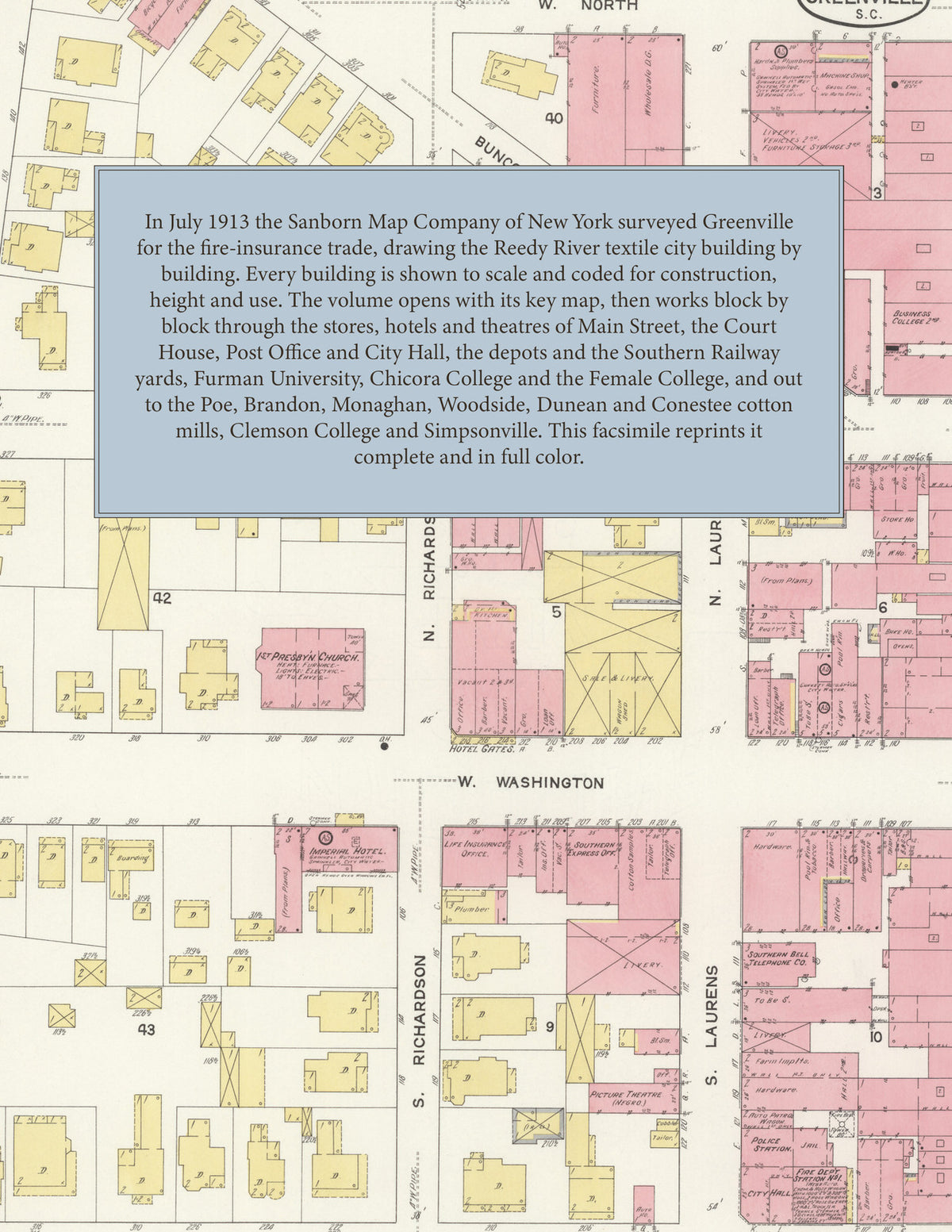
Facsimile of the 1913 Sanborn fire-insurance atlas of Greenville, South Carolina, reproduced in full color from the Library of Congress copy. It covers the whole Greenville County seat of 32,000 people on the Reedy River, from the stores, hotels and banks of Main Street and the Court House out through the depots, warehouses and the Southern Railway yards to Furman University and the colleges, then the great cotton mills and their villages around the city, and the outlying plates of Travelers Rest, Clemson College and Simpsonville.
The forty numbered sheets work block by block from the stores, banks and offices along Main Street, Washington, Coffee and McBee - the Greenville County Court House and Jail, the Government Building and Post Office, the City Hall, Police Station and fire station, the Masonic Hall, the Elks' Home, the Y. M. C. A., the Palmetto Building, the Grand Opera House and the picture theatre, and the Imperial, Gates and West End hotels - through the Charleston and Western Carolina depot and freight house, the Southern Railway depot, freight houses, yards and roundhouse, the Piedmont and Northern car barns, the gas, electric light and power plant, the Southern Power steam plant, the Swift and Cudahy packing houses, the wholesale grocers and fruit houses, the bonded warehouses and the cotton compress, the American Machine and Palmetto iron works, the Markley hardware, Greenville mantel and Coca-Cola bottling works, the Eagle and Mountain City mills, the Oregon, Lawton and Morgan-Austin lumber yards, the cotton oil and fertilizer works, the McGee woolen mill and the Camperdown, Vardry, Poe, Brandon, American Spinning, Monaghan, Woodside, Mills, Carolina, Dunean, Westervelt, Conestee, Pelham and Batesville cotton mills, to the City Hospital, the Odd Fellows Orphans Home, Furman University, the Greenville Female College, Chicora College for Young Ladies, the Park and Pinkney Street schools, the First Baptist, First and Second Presbyterian and Buncombe Street Methodist churches, Springwood Cemetery, the Sans Souci Country Club, the residential streets on both sides of the Reedy River, and the outlying plates of Travelers Rest, Clemson College and Simpsonville.
In July 1913 the Sanborn Map Company of New York surveyed Greenville and the cotton mills of the county for the fire-insurance trade, drawing the city at fifty feet to the inch. Every building is shown to scale and color-coded for construction (yellow for frame, pink for brick, blue for stone), with heights, uses, windows, party walls, hydrants, water mains and fire stations all marked. The key map places the colored sheet grid over the whole city and its mill villages, and its printed report describes the water works and the fire department.
This edition is an unabridged facsimile republication of the atlas: all forty numbered map sheets, the first of them the key map with its report on the water works and fire department, the later ones covering the cotton mills around the city, Travelers Rest, Clemson College and Simpsonville (the Library of Congress copy has no separate title or index sheet). Ideal for local historians, genealogists, architects, preservationists and anyone tracing a Greenville address back to 1913.
42 pages. 8.5" x 11". Full color. Paperback.
Printed to order and shipped directly to you — please allow up to 7 business days before shipment.
Satisfaction guaranteed or you can send it back!