1913 Fire Insurance Maps and Atlas of Oil City, Pennsylvania
1913 Fire Insurance Maps and Atlas of Oil City, Pennsylvania
Couldn't load pickup availability
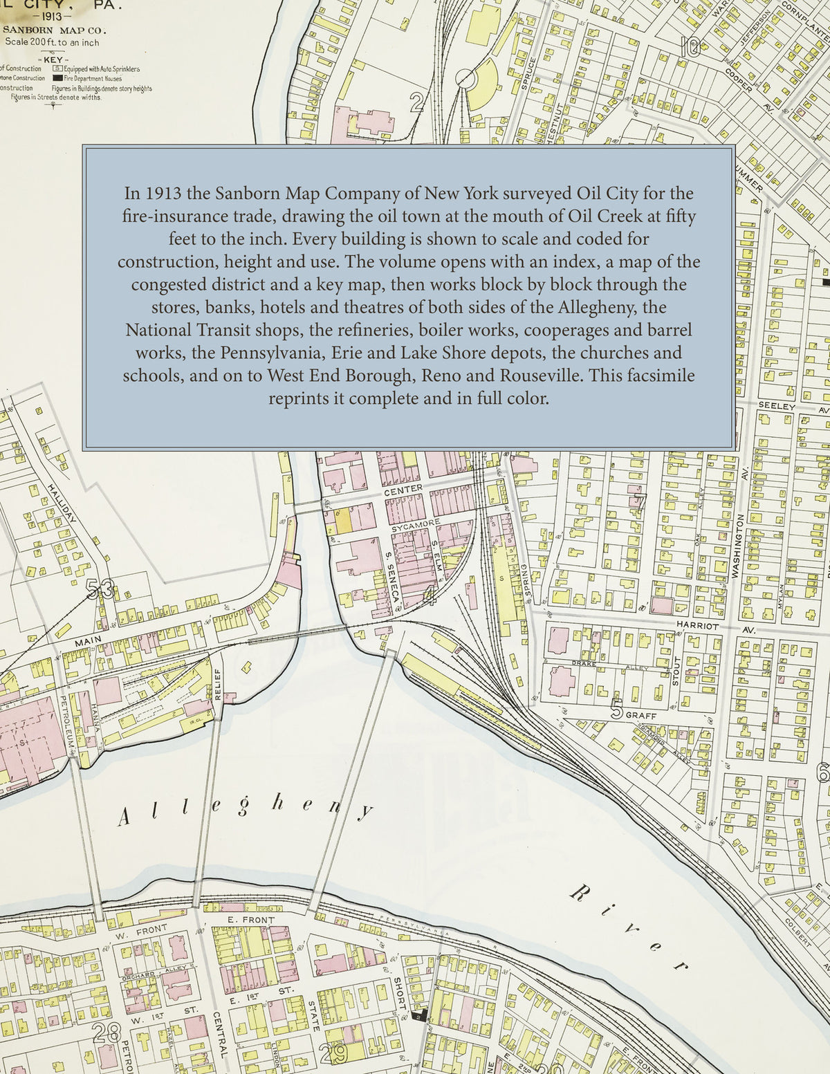
Facsimile of the 1913 Sanborn fire-insurance atlas of Oil City, Pennsylvania, reproduced in full color from the Library of Congress copy. It covers the whole city of 16,000 people where Oil Creek meets the Allegheny River, from the stores, banks and hotels of Seneca, Elm and Center Streets and the South Side out through Siverly, Oak Grove and Hassan Park, with West End Borough and the refining villages of Reno and Rouseville up the river and the creek.
The sixty-five numbered sheets work block by block from the stores, banks, hotels and theatres along Seneca, Elm, Center, Sycamore and Main Streets and Front and Wilson Avenues on the South Side - the City Hall, the Post Office, the Carnegie Library, the Lamberton Bank, Oil City Trust, Savings Bank, Scranton and Ivy Club buildings, the Masonic Temple, the Y. M. C. A., the Elks' lodge, the Opera House and the Orpheum, Majestic, Princess and Theatorium theatres, and the Imperial, Bellevue, Exchange, Commercial, National, New York, Cottage, City and United States hotels - through the Union Station, the Pennsylvania round house and shops, the Erie and Lake Shore & Michigan Southern depots, the Citizens' Traction car barn and power plant, the National Transit Company's office and shops, the Oil Well Supply Company's Imperial Works, the Continental, Penn, Independent and Germania refineries, the Crystal and Empire oil works, the Oil City Boiler Works, Foundry, Barrel Works, Asbestos and Oil and Grease companies, the Reid and Holbeck gas-engine works, the Pennsylvania and Rouseville cooperages, the Kramer Wagon Company, the Enterprise and Model mills, the Saltzmann brewery, the Venango Cigar Company, the Elk suspender factory and the lumber and coal yards, to the Oil City Hospital, the Children's Home, the High School and the ward schools, Carroll Hall, St. Joseph's church and school, Christ Church, the Swedish Lutheran, Methodist, Baptist and Presbyterian churches and the synagogue, Monarch Park and Hassan Park, and the residential streets of both sides of the river, Siverly, West End Borough, Reno and Rouseville.
In 1913 the Sanborn Map Company of New York surveyed Oil City for the fire-insurance trade, drawing the city at fifty feet to the inch. Every building is shown to scale and color-coded for construction (yellow for frame, pink for brick, blue for stone), with heights, uses, windows, party walls, hydrants, water mains and fire stations all marked. The index lists every street and every named business, church, school, hotel, mill and works with the sheet it appears on, and the key map places the colored sheet grid over the whole city.
This edition is an unabridged facsimile republication of the atlas: the title sheet, the index, the map of the congested district, the key map with the report, all sixty-five numbered map sheets and the two skeleton sheets of the business district. Ideal for local historians, genealogists, architects, preservationists and anyone tracing a Oil City address back to 1913.
72 pages. 8.5" x 11". Full color. Paperback.
Printed to order and shipped directly to you — please allow up to 7 business days before shipment.
Satisfaction guaranteed or you can send it back!