1913 Fire Insurance Maps and Atlas of Poughkeepsie, New York
1913 Fire Insurance Maps and Atlas of Poughkeepsie, New York
Couldn't load pickup availability
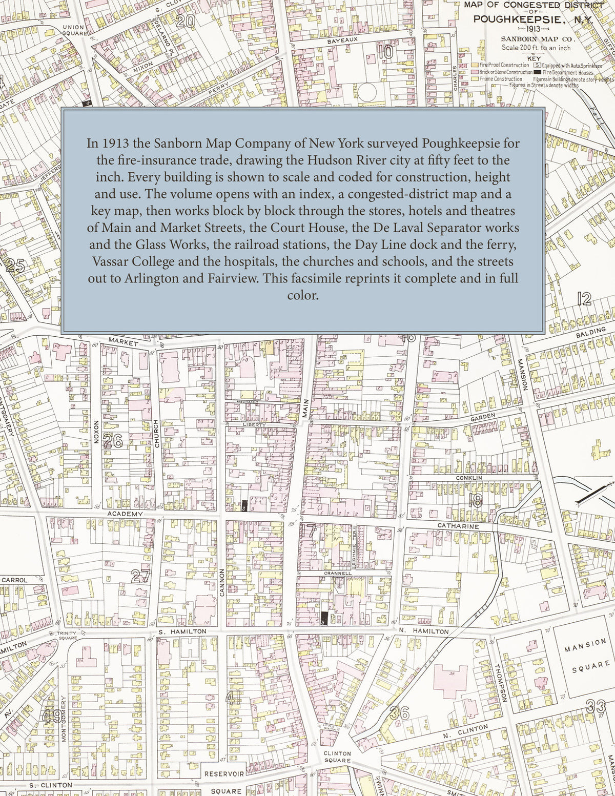
The complete 1913 Sanborn fire-insurance atlas of Poughkeepsie, New York, reprinted in full color. It covers Poughkeepsie, Arlington and Fairview, from the downtown blocks out to the city limits.
The seventy-seven numbered sheets work block by block from the stores, banks, hotels and theatres along Main, Market, Cannon, Academy, Mill and Union Streets - the County Court House, the Municipal Building, the Post Office, the Adriance Memorial Library, the Collingwood Opera House, the Masonic Temple, the Amrita Club House, the Luckey, Platt & Company department store, the Poughkeepsie Savings Bank and Poughkeepsie Trust Company buildings, the Nelson House, the Morgan House, the Hotel Irvington and the Wagner Inn, the Y. M. C. A. and Y. W. C. A. - through the De Laval Separator Company's factory, the Poughkeepsie Glass Works, the Moline Plow Company's Adriance, Platt works, the Phoenix Horse Shoe Company, the Sedgwick and Tiffany machine works, the Dutchess and Whenitz & Vanzile foundries, the Poughkeepsie Foundry and Machine Company, the Kaal Rock and Poughkeepsie chair companies, the Dutchess Manufacturing Company's trousers factory, the Queen Undermuslin and Valley Muslin Underwear companies, the Stearns silk mill, the Hoag knit goods mill, the Pioneer Pearl Button and Seneca Button companies, the Schatz hardware works, the Trussell loose-leaf device factory, the Type-Writer Chair Company, the Welte piano and organ works, the Schmidt piano-hammer factory, the Smith Brothers cough-drop factory, the National Biscuit Company's cracker bakery, the Frank brewery, the Hygeia ice plant, the New York Central and New Haven railroad stations and round houses, the Hudson River Day Line dock, the Poughkeepsie & Highland ferry house, the electric railway car barn and the water works, to Vassar College, Eastman Business College, Riverview Academy, Putnam Hall, Glen Eden and St. Peter's Male Academy, the High School and the Lincoln, Livingston, Morse, Warring, Governor Clinton and Benjamin Franklin schools, Vassar Brothers Hospital and Institute, the Vassar Home for Aged Men, the Old Ladies' Home, the Home for the Friendless and the Pringle Home, St. Andrew-on-Hudson and the Marist Brothers' hermitage, Christ Church, the First and Second Reformed, Hedding, Trinity, Washington Street, First Baptist, First Congregational, First Presbyterian, Holy Comforter, St. Paul's, St. Peter's, St. Mary's, St. Joseph's and Mount Carmel churches and the synagogues, and the streets out to Arlington and Fairview.
In 1913 the Sanborn Map Company of New York surveyed Poughkeepsie for the fire-insurance trade, drawing the city at fifty feet to the inch. Every building is shown to scale and color-coded for construction (yellow for frame, pink for brick, blue for stone), with heights, uses, windows, party walls, hydrants, water mains and fire stations all marked. The index lists every street and every named business, church, school, hotel, mill and works with the sheet it appears on, and the key map places the colored sheet grid over the whole city.
This edition is an unabridged facsimile republication of the atlas: the title sheet, the index, the map of the congested district, the key map and all seventy-seven numbered map sheets together with the six skeleton sheets. Ideal for local historians, genealogists, architects, preservationists and anyone tracing a Poughkeepsie address back to 1913.
88 pages. 8.5" x 11". Full color. Paperback.
Printed to order and shipped directly to you — please allow up to 7 business days before shipment.
Satisfaction guaranteed or you can send it back!