1914 Fire Insurance Maps and Atlas of Aberdeen, Washington
1914 Fire Insurance Maps and Atlas of Aberdeen, Washington
Couldn't load pickup availability
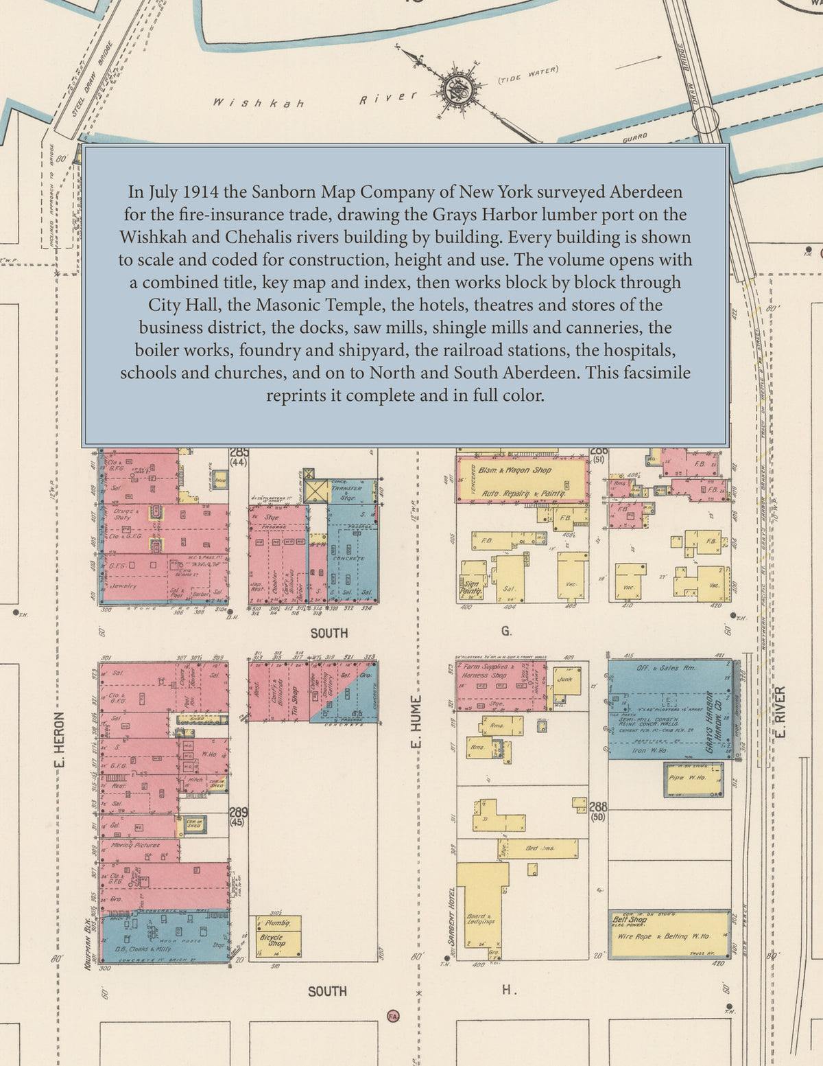
Facsimile of the 1914 Sanborn fire-insurance atlas of Aberdeen, Washington, reproduced in full color from the Library of Congress copy. It covers the whole Grays Harbor lumber port of 18,000 people where the Wishkah River meets the Chehalis, from City Hall and the stores, hotels and theatres of Heron, Wishkah, Market and G Streets out through the docks, saw mills, shingle mills, canneries and rail depots along both rivers, to the residential streets on the hills, North Aberdeen up the Wishkah, and South Aberdeen across the Chehalis.
The thirty-eight numbered sheets work block by block from the stores, banks and offices along Heron, Wishkah, Market, Broadway, F and G Streets - City Hall and the jail, the Public Library, the Masonic Temple, the Elks, Ninemire and Morgan, Dabney, Finch and Weatherwax buildings, the Kaufman Block, Union Hall, the Knights of Pythias and Eagles halls, the Finnish Socialist Hall, Livingston's department store, the Weir, Grand and Bijou theatres, and the Grand Central, Savoy, Kendall, Fairmont, Olympia, Snyder, Washington, Windsor and Turner hotels - through the G Street, Burrows and Wilson Brothers docks, the Union Passenger Station and the Northern Pacific, Milwaukee and O. W. R. and N. freight houses and South Aberdeen stations, the American, Federal, Wilson Brothers, Hurlbert, West, Bay City, Western, Donovan and Anderson and Middleton saw and lumber mills, the Slade, Wishkah, Wilcox, Grays Harbor and Aberdeen shingle mills, the Elmore, Carstens, Sea Beach and Fishermen's Co-operative packing plants and canneries, the Lindstrom shipyard, the Grays Harbor boiler works, the Douglas foundry, the Western Cooperage works, the flour mill, the Aberdeen brewery and bottling works, the furniture, package and planing mills, the gas works, the street railway power house and car barn, and the Stewart Creek pumping station, to St. Joseph's, the General, Grays Harbor and Chehalis County hospitals, the High School, the Academy of St. Rose and the Whitman, Franklin, Stevens, Terrace Heights and Sam Benn schools, St. Mary's, St. Peter and St. Paul's, St. Andrew's and the Baptist, Methodist, Presbyterian, Congregational, Christian, Lutheran, Scandinavian and Swedish churches, and the residential streets of the city, North Aberdeen and South Aberdeen.
In July 1914 the Sanborn Map Company of New York surveyed Aberdeen for the fire-insurance trade, drawing the city, its docks, saw mills and shingle mills building by building. Every building is shown to scale and color-coded for construction (yellow for frame, pink for brick, blue for stone), with heights, uses, windows, party walls, hydrants, water mains and fire stations all marked. The index lists every street and every named business, church, school, hotel, mill and works with the sheet it appears on, and the key map places the colored sheet grid over the whole city.
This edition is an unabridged facsimile republication of the atlas: the combined title, key map and index sheet with its report on the water works and fire department, and all thirty-eight numbered map sheets that follow it, from North Aberdeen on the Wishkah to South Aberdeen across the Chehalis River. Ideal for local historians, genealogists, architects, preservationists and anyone tracing a Aberdeen address back to 1914.
40 pages. 8.5" x 11". Full color. Paperback.
Printed to order and shipped directly to you — please allow up to 7 business days before shipment.
Satisfaction guaranteed or you can send it back!