1914 Fire Insurance Maps and Atlas of Lock Haven, Pennsylvania
1914 Fire Insurance Maps and Atlas of Lock Haven, Pennsylvania
Couldn't load pickup availability
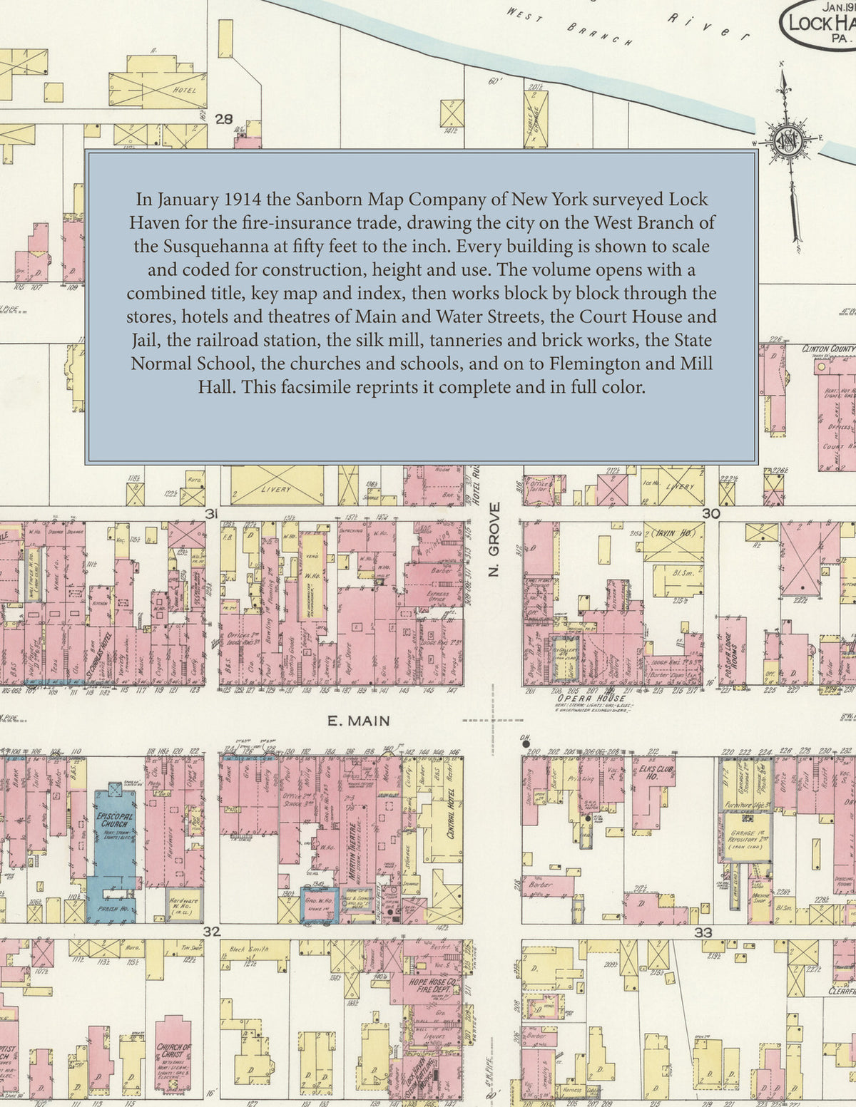
Facsimile of the 1914 Sanborn fire-insurance atlas of Lock Haven, Pennsylvania, reproduced in full color from the Library of Congress copy. It covers the Clinton County city on the West Branch of the Susquehanna, from the stores, hotels, theatres and Court House of Main and Water Streets, through the Pennsylvania Railroad yards, the silk mill, tanneries and brick works, to the State Normal School and the residential streets out to the city line, together with the villages of Flemington and Mill Hall.
The twenty-four numbered sheets that follow work block by block from the stores, banks, hotels and theatres along Main Street, Water Street, Church Street, Grove Street and Bellefonte Avenue - the County Court House and Jail, the Post Office, the Annie Halenbake Ross Free Library, the Armory, the Opera House, the Martin and Garden theatres, the First National Bank Building, the Elks' Club House, the Hotel Clinton and the Beck's, Central, Commercial, Eagle, National, St. Charles and St. Cloud hotels - through the Pennsylvania Railroad passenger station, Bellefonte Avenue station and repair shop on the Philadelphia & Erie and Bald Eagle Valley lines, the Susquehanna Traction Company's car barn and power house, the Lock Haven Light and Power Company, the Lock Haven Silk Company, the Rich woolen mill, the Kistler, Lesh & Co. and West Branch tanneries, the Pennsylvania Woven Wire Company, the Elliot Novelty Iron Works, the Lock Haven Construction and Concrete Company, the Clinton Furniture Company, the Foresman & Kelsey milling company, the planing mills, the American, Eagle and Lock Haven brick works, the Lock Haven Clay Works and Fire Brick Company, the Queens Run Fire Brick Company, the Atlantic Refining Company, the bottling works and steam laundries and the coal, lumber and junk yards, to the Lock Haven Hospital, the Poor House, the State Normal School, the First, Second, Third and Fourth Ward public schools, the Convent of St. Francis, the Immaculate Conception and St. Agnes Roman Catholic churches and schools, the Great Island Presbyterian, Trinity, East Main Street and Linden Street Methodist, St. John's English Lutheran, St. Luke's Reformed, First Baptist, Episcopal and German and United Evangelical churches, the Church of Christ, Zion A. M. E. Church and the synagogue, and the residential streets out to the city line - with Flemington on the canal, and Mill Hall with the Mann Edge Tool Company, the Mill Hall Brick Works, the Harbison Walker Refractories Company's Clinton County works, the Continental Condensed Milk Company, the McGhee saw and planing mill, the Castanea, Mountain Spring, Widman and Lucas breweries and the Mill Hall churches, post office and public school.
In 1914 the Sanborn Map Company of New York surveyed Lock Haven for the fire-insurance trade, drawing the city at fifty feet to the inch. Every building is shown to scale and color-coded for construction (yellow for frame, pink for brick, blue for stone), with heights, uses, windows, party walls, hydrants, water mains and fire stations all marked. The index lists every street and every named business, church, school, hotel, mill and works with the sheet it appears on, and the key map places the colored sheet grid over the whole city.
This edition is an unabridged facsimile republication of the atlas: all twenty-five map sheets, sheet 1 being the combined title, key map and index sheet with its report on the water facilities and fire department, sheets 2 to 20 covering Lock Haven and sheets 21 to 25 the neighbouring villages of Flemington and Mill Hall. Ideal for local historians, genealogists, architects, preservationists and anyone tracing a Lock Haven address back to 1914.
32 pages. 8.5" x 11". Full color. Paperback.
Printed to order and shipped directly to you — please allow up to 7 business days before shipment.
Satisfaction guaranteed or you can send it back!