1915 Fire Insurance Atlas of Fond du Lac & North Fond du Lac, WI
1915 Fire Insurance Atlas of Fond du Lac & North Fond du Lac, WI
Couldn't load pickup availability
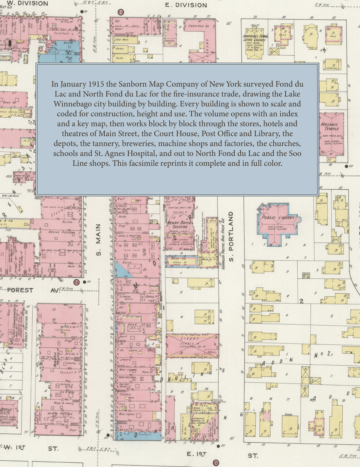
Facsimile of the 1915 Sanborn fire-insurance atlas of Fond du Lac and North Fond du Lac, Wisconsin, reproduced in full color from the Library of Congress copy. It covers the whole Fond du Lac County seat of 22,000 people at the foot of Lake Winnebago, from the stores, hotels and theatres of Main Street out through the depots, the tannery, the machine, refrigerator and woodworking factories along the river and the railroads to the schools, churches and hospital, the additions on every side, and the railroad village of North Fond du Lac with the Soo Line shops.
The forty numbered sheets work block by block from the stores, banks and offices along Main Street, Division Street, Forest Avenue and Western Avenue - the Fond du Lac County Court House and Jail, the Post Office, the Public Library, the Police Station, the Armory of Company E, the Masonic Temple, Turner Hall, the Y. M. C. A., the Lange Block, the Public Service Building, the Henry Boyle and Idea theatres, and the Hotel English, the Palmer House, the Park Hotel, the New Erving, the Forest Avenue Hotel, the Northwestern House and the Cary House - through the Chicago and North Western, Milwaukee Road and Soo Line depots, the city water works, the gas plant and car barn, the Rueping tannery, the Giddings and Lewis foundry and machine shop, the Keller pneumatic-tool, Gurney refrigerator, Harris typewriter and Wells auto-specialty works, the Vulcan structural iron works, the Globe stove works, the Fountain City Plow Works, the Northern Casket Company, the furniture, table, door, sash, file, brick, shirt and paper-box factories, the wagon and sleigh works, the Bechaud, Sander, Miller and Pabst breweries and the malting company, the Helmer mill, the cheese, candy and ice cream plants, the lumber and coal yards and the Zinke wholesale grocery, to St. Agnes Hospital, Convent and Music Academy, the Henry Boyle Catholic Home for the Aged, the Home of the Friendless, the county asylum and poor house, the High School, Grafton Hall, the Cleveland, Franklin, Grant, Jefferson, Lincoln, McKinley and Washington schools, St. Paul's Cathedral, St. Patrick's, St. Joseph's, St. Mary's and St. Louis French churches, the Baptist, Presbyterian, Congregational, Methodist and Lutheran churches, Lakeside Park, the residential additions of Darling, McWilliams, Ingram, Taylor and Waterbury, and in North Fond du Lac the Hotel Beine, the Village Hall, the schools, the Church of the Presentation and the Soo Line roundhouse and shops.
In January 1915 the Sanborn Map Company of New York surveyed Fond du Lac and North Fond du Lac for the fire-insurance trade, drawing the city at fifty feet to the inch and the outer streets at one hundred feet to the inch. Every building is shown to scale and color-coded for construction (yellow for frame, pink for brick, blue for stone), with heights, uses, windows, party walls, hydrants, water mains and fire stations all marked. The index lists every street and every named business, church, school, hotel, mill and works with the sheet it appears on, and the key map places the colored sheet grid over the whole city.
This edition is an unabridged facsimile republication of the atlas: the combined title and index sheet and all forty numbered map sheets, the first of them the key map with its report on the water works and fire department, the last four covering North Fond du Lac. Ideal for local historians, genealogists, architects, preservationists and anyone tracing a Fond du Lac address back to 1915.
42 pages. 8.5" x 11". Full color. Paperback.
Printed to order and shipped directly to you — please allow up to 7 business days before shipment.
Satisfaction guaranteed or you can send it back!