ExileBooks
1915 Fire Insurance Maps and Atlas of Hammond, Indiana
1915 Fire Insurance Maps and Atlas of Hammond, Indiana
Couldn't load pickup availability
Facsimile of the 1915 Sanborn fire-insurance atlas of Hammond, Indiana, reproduced in full color from the Library of Congress copy. It covers four towns at the foot of Lake Michigan: Hammond from the State Line and West Hammond to the Grand Calumet River, Whiting beside the Standard Oil refinery, and East Chicago and Indiana Harbor with the Inland Steel plants and the canal to the lake.
The one hundred twenty-two numbered sheets work block by block from the stores, banks, hotels and theatres of downtown Hammond - the City Building and City Hall, the Superior Court buildings, the U. S. Government Building and Post Office, the Public Library, the Masonic Temple, the Orpheum and De Luxe theatres, the Lion and Minas department stores, the Hotel Carleton, Hotel Mee, Hotel Bluff, Monon, Columbia and State Line hotels - through the Michigan Central, Nickel Plate, Pennsylvania, Chicago & Erie, Baltimore & Ohio, Chicago, Indiana & Louisville and Elgin, Joliet & Eastern depots, the Chicago, Lake Shore & South Bend electric station, the American Steel Foundries' Simplex works, the Standard Steel Car Company, the Illinois Car and Manufacturing Company, the Hammond Malleable Iron, Brass, Machine and Forge, Pattern and Model works, Registered Distillery No. 10, the Straube piano factory, the W. B. Conkey publishing house, the Champion potato-machinery works, the American Maize Products Company, the Swift ice houses on Wolf Lake and the Hammond Water Works; through Whiting, with its City Hall, Carnegie library, the Petrolene floor-covering works and the Standard Oil refinery; and through East Chicago and Indiana Harbor, with the Inland Steel plants, the Republic Iron & Steel works, the Grasselli Chemical Company, the Harbison-Walker refractories, the Hubbard, Interstate and Standard Forgings steel works, the Graver tank works, the lead, detinning and metals refineries, the car, valve and baling-press works and the Cudahy and Schlitz depots - to St. Margaret's Hospital, the Hammond, Whiting and East Chicago public schools, the Polish, Slovak, Hungarian, Rumanian, Servian, Greek Catholic and Swedish churches, the synagogues, Harrison Park and Gruener's Summer Resort, and the residential streets of Hammond, West Hammond, Whiting, East Chicago and Indiana Harbor.
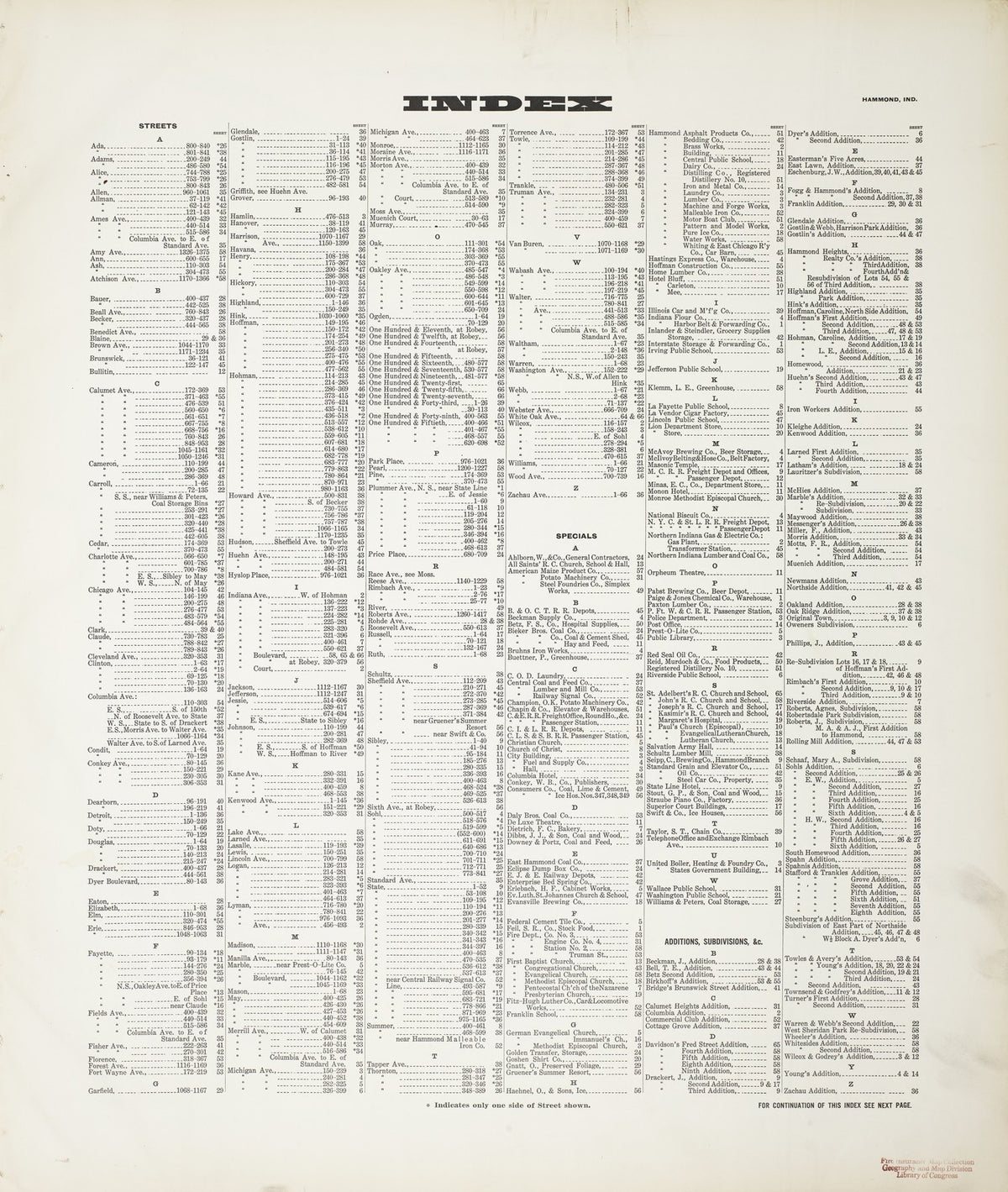
In 1915 the Sanborn Map Company of New York surveyed Hammond for the fire-insurance trade, drawing the city at fifty feet to the inch. Every building is shown to scale and color-coded for construction (yellow for frame, pink for brick, blue for stone), with heights, uses, windows, party walls, hydrants, water mains and fire stations all marked. The index lists every street and every named business, church, school, hotel, mill and works with the sheet it appears on, and the key map places the colored sheet grid over the whole city.
This edition is an unabridged facsimile republication of the atlas: the title sheet, the two index sheets, the key map and all one hundred twenty-two numbered map sheets. Ideal for local historians, genealogists, architects, preservationists and anyone tracing a Hammond address back to 1915.
128 pages. 8.5" x 11". Full color. Paperback.
Printed to order and shipped directly to you — please allow up to 7 business days before shipment.
Satisfaction guaranteed or you can send it back!