ExileBooks
1915 Fire Insurance Maps and Atlas of Lafayette, Indiana
1915 Fire Insurance Maps and Atlas of Lafayette, Indiana
Couldn't load pickup availability
Facsimile of the 1915 Sanborn fire-insurance atlas of Lafayette, Indiana, reproduced in full color from the Library of Congress copy. It covers the whole city of 30,500 people on the Wabash River, from the Court House square and the stores of Main Street out through Linwood, Highland Park, Columbian Park and the Belt Railway Addition to the Monon shops, and across the river the whole of West Lafayette with Purdue University and its Experimental Farm, with the Indiana State Soldiers' Home up the Wabash.
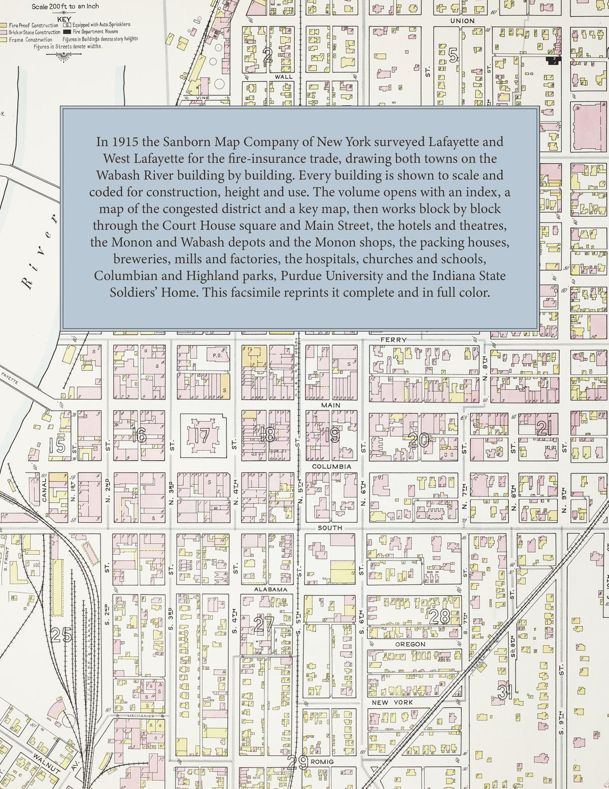
The sixty-seven numbered sheets work block by block from the stores, banks, hotels and theatres around the Tippecanoe County Court House and along Main, Columbia, Ferry and Fourth Streets - the Post Office, the Public Library, the County Jail, the Central fire station, the Masonic Temple, the Chamber of Commerce, the Haywood and Lincoln Club buildings, the Y. M. C. A., Columbian Hall, the Family and Victoria theatres, the Loeb and Hene, Schultz and Zinn stores, and the Lahr, Fowler, Bramble, Palace, Plaza, Shank's and St. Nicholas hotels - through the Monon depots and shops, the Wabash depots and round house, the Lake Erie and Western and Big Four depots, the traction car barns and power plant, the water works, gas plant and electric plant, the Box Board, Ross Gear and Tool, Duncan Electric, Indiana Wagon, Schwab Safe, Barbee Wire and Iron, Wallace Machine and Foundry and Heinz tomato works, the Imperial Corn Product, flour and planing mills, the Bohrer and Thieme and Wagner breweries, the Union Stock Yards and packing houses, the refineries and May Brothers brick works, to the Home and St. Elizabeth's hospitals, the Wabash Valley Sanitarium, St. Anthony's Home, the St. Joseph Orphan Asylum, the Children's Home and County Infirmary, the Indiana State Soldiers' Home, the Fair Grounds, Jefferson High School, St. Ignatius Academy and the ward schools, St. Mary's, St. Boniface and St. Ann's churches and the synagogue, Columbian and Highland parks, and the residential streets of Linwood and West Lafayette, with Purdue University, its Experimental Farm and the Bureau of Entomology.
In 1915 the Sanborn Map Company of New York surveyed Lafayette and West Lafayette for the fire-insurance trade, drawing the business district and older streets at fifty feet to the inch and the outer additions, Purdue University and the Soldiers' Home at one hundred feet to the inch. Every building is shown to scale and color-coded for construction (yellow for frame, pink for brick, blue for stone), with heights, uses, windows, party walls, hydrants, water mains and fire stations all marked. The index lists every street and every named business, church, school, hotel, mill and works with the sheet it appears on, and the key map places the colored sheet grid over the whole city.
This edition is an unabridged facsimile republication of the atlas: the title sheet, the index, the map of the congested district, the key map with the report, and all sixty-seven numbered map sheets. Ideal for local historians, genealogists, architects, preservationists and anyone tracing a Lafayette address back to 1915.
72 pages. 8.5" x 11". Full color. Paperback.
Printed to order and shipped directly to you — please allow up to 7 business days before shipment.
Satisfaction guaranteed or you can send it back!