1915 Fire Insurance Maps and Atlas of Sacramento, California, Volume 1
1915 Fire Insurance Maps and Atlas of Sacramento, California, Volume 1
Couldn't load pickup availability
The complete 1915 Sanborn fire-insurance atlas of Sacramento, California (Volume One), reprinted in full color. It covers Sacramento, Volume One: Downtown, the Southern Pacific Shops, the Riverfront, Oak Park and Washington in Yolo County, from the downtown blocks out to the city limits.
The ninety-two numbered sheets work block by block from the stores, banks, hotels and theatres along K Street, J Street, Second Street and Tenth Street - the State Capitol, the County Court House and Jail, the City Hall, the Post Office and the Public Library on I Street, the Federal Building, the Police Headquarters, the Chamber of Commerce, the Don Lee, Forum, Ochsner, Physicians, People's Savings Bank, Farmers & Mechanics' Bank and Crocker buildings, the Crocker Art Gallery, the Empress, Cluni, Grand and Clunie theatres, the Sacramento, Hotel, Roma, Commercial, Columbia, St. Francis and Sacramento hotels, Hale Brothers' and Weinstock-Lubin's department stores, the Sacramento Athletic Club, Pythian Castle, Forresters' Hall, Portuguese Hall and the Y. M. C. A. - through the Southern Pacific shops, round house, boiler shop and freight yards, the Oakland, Antioch & Eastern electric terminal, the Sacramento Transportation Company's shipbuilding yard and wharf, the P Street municipal wharf, the Pacific Gas and Electric Company's gas works and power plant, the Sacramento Natural Gas Company's holders and works, the Ruhstaller and Sacramento breweries, the Eagle Winery, the Sacramento Valley Winery, the Central California and Sacramento Packing canneries, the Phillips Rice Milling Company, the Phoenix, Peerless and Palm Bridge iron works, the Sacramento Pipe Works and Soap Company, the Sacramento Planing Mill and Furniture Company, the Sacramento, Friend & Terry and Fuller lumber yards, the Consumers' Ice and Cold Storage Company, the Cascade and Eight Hour steam laundries, the Golden Eagle Dairy, the Perfection Bakery, the Chinese and Japanese quarters, to the Sacramento High School, the Grammar School, the Christian Brothers' College, St. Joseph's Academy, the Chinese and Ninth Street public schools, the Children's Home, the churches of every denomination and the Buddhist church, and the residential streets of the city, Oak Park, Colonial Heights and Washington across the Sacramento River in Yolo County.
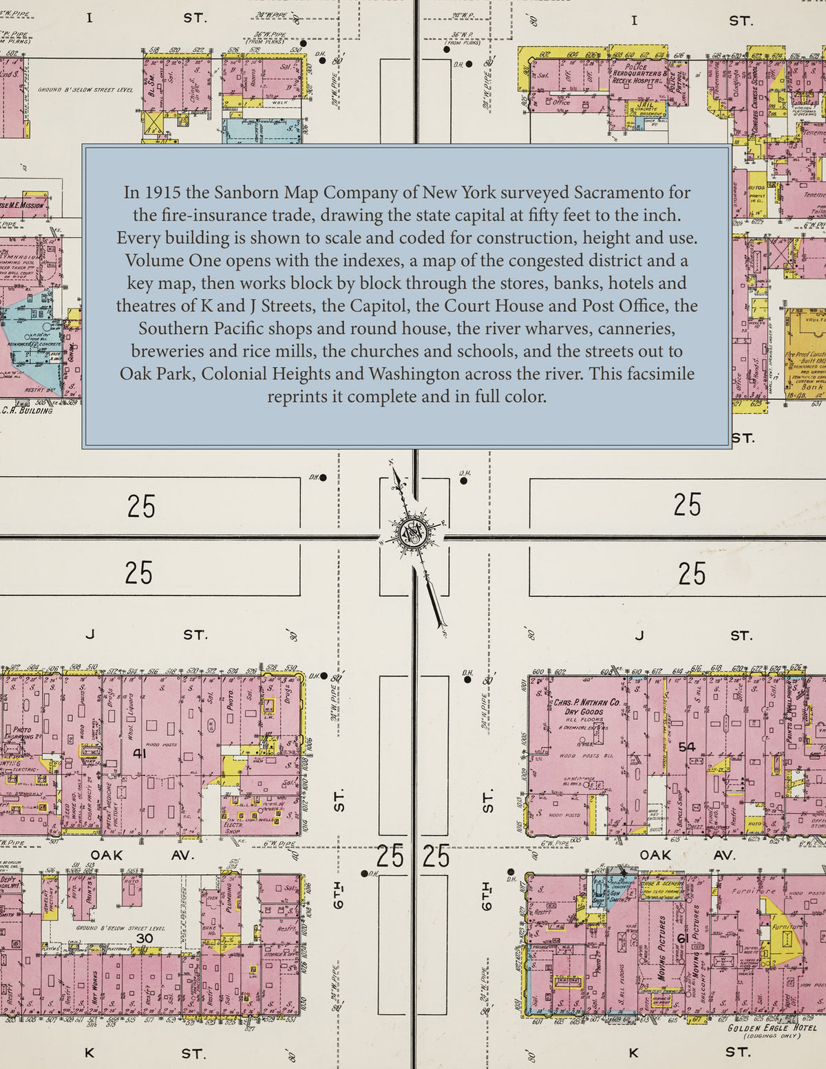
In 1915 the Sanborn Map Company of New York surveyed Sacramento for the fire-insurance trade, drawing the city at fifty feet to the inch. Every building is shown to scale and color-coded for construction (yellow for frame, pink for brick, blue for stone), with heights, uses, windows, party walls, hydrants, water mains and fire stations all marked. The index lists every street and every named business, church, school, hotel, mill and works with the sheet it appears on, and the key map places the colored sheet grid over the whole city.
This edition is an unabridged facsimile republication of the atlas: the title sheet, the two index sheets, the map of the congested district, the key map and all ninety-two numbered map sheets. Ideal for local historians, genealogists, architects, preservationists and anyone tracing a Sacramento address back to 1915.
98 pages. 8.5" x 11". Full color. Paperback.
Printed to order and shipped directly to you — please allow up to 7 business days before shipment.
Satisfaction guaranteed or you can send it back!