ExileBooks
1917 Fire Insurance Maps and Atlas of Laurium, Michigan
1917 Fire Insurance Maps and Atlas of Laurium, Michigan
Couldn't load pickup availability
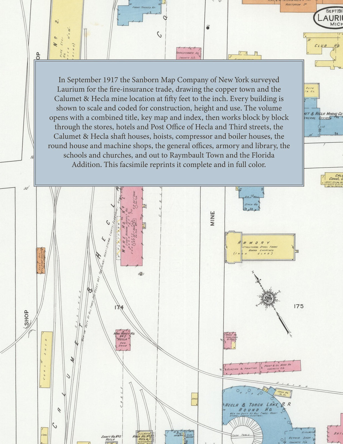
Facsimile of the 1917 Sanborn fire-insurance atlas of Laurium, Michigan, reproduced in full color from the Library of Congress copy. It covers the Houghton County copper town and the mine locations around it, 20,000 people in all: the stores, hotels and halls of Hecla, Osceola and Third streets, the shaft houses, hoists, compressor houses, shops and warehouses of the Calumet & Hecla Mining Company's location, Raymbault Town and the Florida Mining Company's Addition, and the schools, churches and residential additions between them.
The twenty-eight numbered sheets that follow work block by block from the stores, banks and offices of the Original Town along Hecla, Osceola, Third and Fourth streets - the Post Office, the City Hall and fire station, the Central Hotel, the Loraine Hotel, the Calumet Hotel and the Palestra skating rink - through the Calumet & Hecla Mining Company's location: the general offices, employment office and club house, the Calumet, Hecla and South Hecla shaft houses, Shafts No. 1 to 17 and the man hoists, the Hancock & Pewabic and Houghton & Seneca hoist and boiler houses, the Frontenac, Mackinac and Superior compressor houses, the Hecla machine shop and drill-sharpening shop, the Calumet and Hecla barns, the supply warehouses, the company hospital and the Calumet, Hecla and South Hecla fire stations, then the Hecla & Torch Lake Railroad round house and repair shop, the Copper Range and Mineral Range depots, the Houghton County Traction transformer house, the Lake Superior Brass Foundry, the Calumet Gas Company, the Standard Oil distributing station and the coal yards, to the Washington High School and Manual Training High School, the Public Library, the Armory, the Calumet Public Hospital, the Albion, Charles Briggs, John Duncan, Florida, Garfield, Hamilton, Hawthorn, Holmes, Horace Mann, Irving, Jefferson and Rockefeller schools and the German Lutheran school, the Sacred Heart Roman Catholic Church, high school and convent, the Calumet Congregational and Methodist Episcopal churches, the First Baptist and First Methodist Episcopal churches, the Finnish Lutheran and Finnish Methodist Episcopal churches, St. Paul's Evangelical Lutheran, the Reformed Lutheran, Methodist Protestant and Swedish Mission churches, and the residential streets of the First to Ninth Additions, Raymbault Town and the Florida Mining Company's Addition.
In 1917 the Sanborn Map Company of New York surveyed Laurium for the fire-insurance trade, drawing the city at fifty feet to the inch. Every building is shown to scale and color-coded for construction (yellow for frame, pink for brick, blue for stone), with heights, uses, windows, party walls, hydrants, water mains and fire stations all marked. The index lists every street and every named business, church, school, hotel, mill and works with the sheet it appears on, and the key map places the colored sheet grid over the whole city.
This edition is an unabridged facsimile republication of the atlas: all twenty-nine numbered map sheets, 1 to 29, sheet 1 being the combined title, key map and index sheet with its report on the water works and fire departments, the others covering the village together with the Calumet & Hecla Mining Company's location, Raymbault Town and the Florida Mining Company's Addition. Ideal for local historians, genealogists, architects, preservationists and anyone tracing a Laurium address back to 1917.
30 pages. 8.5" x 11". Full color. Paperback.
Printed to order and shipped directly to you — please allow up to 7 business days before shipment.
Satisfaction guaranteed or you can send it back!