ExileBooks
1917 Fire Insurance Maps and Atlas of Stockton, California
1917 Fire Insurance Maps and Atlas of Stockton, California
Couldn't load pickup availability
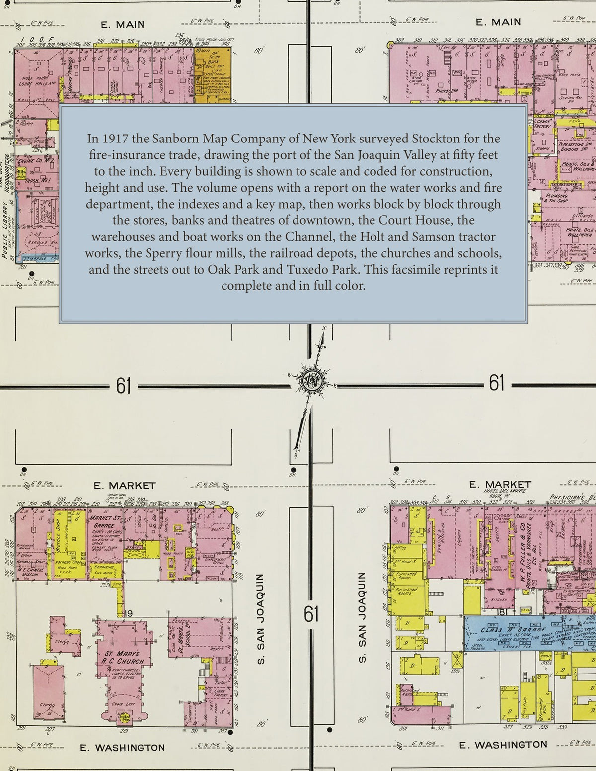
Facsimile of the 1917 Sanborn fire-insurance atlas of Stockton, California, reproduced in full color from the Library of Congress copy. It covers the whole city of 40,000 people, from the stores, hotels and theatres of downtown and the warehouses and boat works on the Stockton Channel, through the Holt tractor works, the flour mills and the railroad yards, to the residential streets out to Oak Park, Tuxedo Park, Fair Oaks and the State Hospital grounds.
The one hundred twenty numbered sheets work block by block from the stores, banks, hotels and theatres along Main Street, Weber Avenue, Market Street, Hunter Street, El Dorado Street and San Joaquin Street - the County Court House and Jail, the Post Office, the Federal Building, the Public Library, the Yosemite Building and Yosemite Theatre, the San Joaquin Valley National Bank, Physicians', I. O. O. F. and Belding buildings, the Colonial, Lincoln, Lyric, Strand and Turner & Dahnken theatres, the Sutter, Clark, Del Monte, Arlington, Imperial and Leo hotels, the Japanese Nippon and Fukuoka hotels, and the Y. M. C. A. - through the Southern Pacific passenger depot, freight house and locomotive house, the Santa Fe passenger station, round house and freight house, the Western Pacific station and engine house, the Central California Traction car shops, the California Navigation and Improvement Company's grain warehouses and ship yard, the Banner Island and Stephens Bros. boat works on the Stockton Channel, the Holt Manufacturing Company's foundry, machine shops and tractor warehouse, the Samson Sieve-Grip Tractor Company, the Harris combined-harvester works, the Sperry Flour Company's Capitol and Union mills, the Crown, Peerless and Farmers' Union mills, the Monarch, Sterling, Geiger and Stockton iron works, the Pacific Tannery, the enamel-brick, box, glass and flax works, the Simpson-Gray lumber yards, the El Dorado brewery, the El Pinal and West wineries and distilleries, the California Packing Corporation's factory, the ice plants, gas and electric works and the Stockton and Tuxedo Park water works - to St. Joseph's Hospital and Home for the Aged, the Dameron and Emergency hospitals, the County Hospital, the Stockton Children's Home, the State Hospital grounds, the Stockton High School, St. Agnes Academy, Heald's Business College, the Lafayette, Jackson, Franklin, Fremont and Japanese public schools, St. Mary's and St. Gertrude's Catholic churches, St. John's Episcopal Church, the Protestant churches of every denomination, Temple Israel and Congregation Adas Yeshurun, the Buddhist church, the Sikh temple and the Chinese mission, the Oak Park recreation grounds and the San Joaquin Valley Agricultural Society's race track, and the residential streets out to Oak Park, Tuxedo Park and Fair Oaks.
In 1917 the Sanborn Map Company of New York surveyed Stockton for the fire-insurance trade, drawing the city at fifty feet to the inch. Every building is shown to scale and color-coded for construction (yellow for frame, pink for brick, blue for stone), with heights, uses, windows, party walls, hydrants, water mains and fire stations all marked. The index lists every street and every named business, church, school, hotel, mill and works with the sheet it appears on, and the key map places the colored sheet grid over the whole city.
This edition is an unabridged facsimile republication of the atlas: the title sheet, the report and index sheet, the second index sheet with the block index, the key map and all one hundred twenty numbered map sheets. Ideal for local historians, genealogists, architects, preservationists and anyone tracing a Stockton address back to 1917.
126 pages. 8.5" x 11". Full color. Paperback.
Printed to order and shipped directly to you — please allow up to 7 business days before shipment.
Satisfaction guaranteed or you can send it back!