1917 Fire Insurance Maps and Atlas of Winona, Minnesota
1917 Fire Insurance Maps and Atlas of Winona, Minnesota
Couldn't load pickup availability
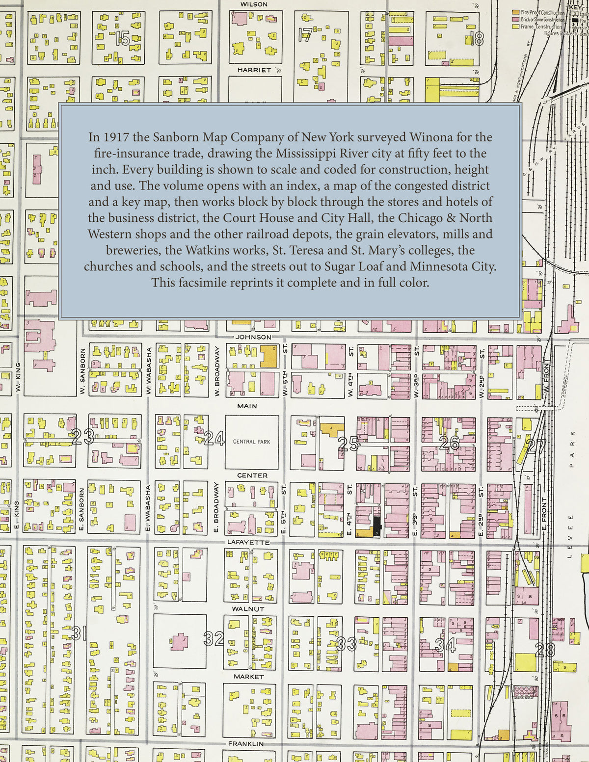
Facsimile of the 1917 Sanborn fire-insurance atlas of Winona, Minnesota, reproduced in full color from the Library of Congress copy. It covers the whole city of 24,500 people between the Mississippi River and Lake Winona, from the stores, hotels and City Hall of the business district and the river-front mills and elevators out through the railroad shops and the east and west ends to the Sugar Loaf district and Minnesota City.
The fifty-nine numbered sheets work block by block from the stores, banks, hotels and theatres of the business district - the County Court House and Jail, the City Hall, the Post Office, the Free Public Library, the Masonic Temple, the Exchange and Lumber Exchange buildings, the Choate Block, the Opera House, the Colonial Theatre, Philharmonic Hall, the Y. M. C. A. and Y. W. C. A., and the Winona, Schlitz, Commercial, Merchants', Windsor, Burmeister and West hotels - through the Chicago and North Western passenger and freight depots, shops and division headquarters, the Chicago, Milwaukee and St. Paul, Burlington and Great Western depots and round houses, the Streckfus steamboat freight house, the Bay State Milling Company, the Gould and Western elevators, the J. R. Watkins Medical Company, the McConnon stock food works, the Winona Wagon Company, the Winona Machinery and Boat Works, the Gate City and Phenix iron works, the Pioneer Tractor and International Harvester works, the Winona Packing and Soap Company, the Interstate Packing Company, the Park, Sugar Loaf and Shellhas breweries, the Schroth and Ahrens sash and door factory, the Botsford and Standard lumber yards, the Union Fibre, paper box and candy works, the Wisconsin Railway and Light Company's car barn and power plants and the water works, to the Winona General Hospital, the College of St. Teresa, St. Mary's College, the Senior and Junior High Schools, the Jefferson, Madison, Jackson, Kosciusko and Lincoln schools, St. Thomas Pro-Cathedral, St. Stanislaus Polish church, St. John Nepomuk Bohemian church, St. Casimir's and St. Joseph's churches, St. Paul's Episcopal and St. Martin's Lutheran churches, the County Poor Farm, and the residential streets of the east and west ends, Sugar Loaf and Minnesota City.
In 1917 the Sanborn Map Company of New York surveyed Winona for the fire-insurance trade, drawing the city at fifty feet to the inch and two outlying sheets at one hundred feet to the inch. Every building is shown to scale and color-coded for construction (yellow for frame, pink for brick, blue for stone), with heights, uses, windows, party walls, hydrants, water mains and fire stations all marked. The index lists every street and every named business, church, school, hotel, mill and works with the sheet it appears on, and the key map places the colored sheet grid over the whole city.
This edition is an unabridged facsimile republication of the atlas: the title sheet, the index, the map of the congested district, the key map with the report, and all fifty-nine numbered map sheets. Ideal for local historians, genealogists, architects, preservationists and anyone tracing a Winona address back to 1917.
64 pages. 8.5" x 11". Full color. Paperback.
Printed to order and shipped directly to you — please allow up to 7 business days before shipment.
Satisfaction guaranteed or you can send it back!