1918 Fire Insurance Atlas of Morristown, NJ and Vicinity
1918 Fire Insurance Atlas of Morristown, NJ and Vicinity
Couldn't load pickup availability
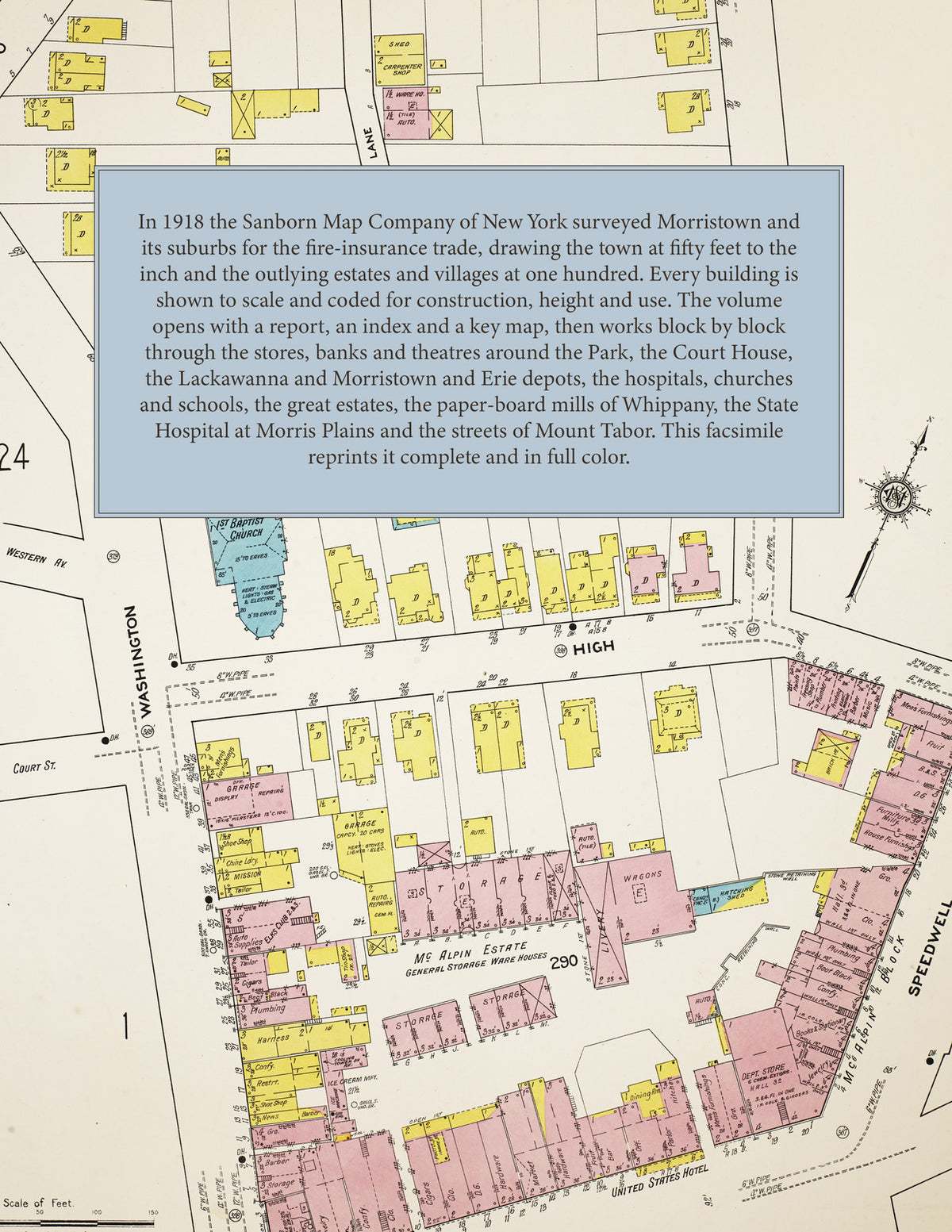
Facsimile of the 1918 Sanborn fire-insurance atlas of Morristown, New Jersey, with its suburbs, Whippany, Morris Plains and Mount Tabor, reproduced in full color from the Library of Congress copy. It covers the Morris County seat and its neighbours, 15,000 people in all, from the Park, the Court House and the stores of Speedwell Avenue, South Street and Morris Street out through Collinsville, Normandy Heights and the country estates to the paper-board mills of Whippany, the State Hospital at Morris Plains and the streets of Mount Tabor.
The forty-nine numbered sheets, with skeleton outlines of the first two, work block by block from the stores, banks and halls around the Park and along Speedwell Avenue, South Street, Market Street and Morris Street - the Morris County Court House and Jail, the Post Office, the Public Library, the Armory, the Masonic Hall, the American Trust Company, the National Iron Bank and the McAlpin and Farrelly buildings, the Palace and Park theatres, the Washington Headquarters, the Y. M. C. A., the Mansion House and the Washington, West End and Piper's hotels - through the Delaware, Lackawanna and Western depots and the Morristown and Erie depots and locomotive house, the Morris and Somerset Electric Company, the Carpenter and Knight feed mill, elevator and stone crusher, the Butters aluminum-bronze works, the Electrical Alloy Company, the Eureka rug and Elfio hosiery mills, the Mountain Ice Company, the lumber, coal and wood yards and the garages, to All Souls Hospital, the Morristown Memorial Hospital, Shongum Sanatorium, the County Alms House and Tuberculosis Home, the High School and the Liberty Street, Speedwell Avenue and Hillside schools, the Church of the Assumption, St. Margaret's, St. Mary's and St. Virgil's Catholic churches, St. Peter's Episcopal, the Church of the Redeemer, the First and South Street Presbyterian, First Baptist, Methodist, Union Baptist and Bethel A. M. E. churches, the synagogue, the Morristown Field Club and the Morris County Golf Club, the estates - Alnwick Hall, Ellerslea, Fair Acres, Cedar Court, Cherry Croft, Featherleigh Farm, Greystone, Llwynderry and Sunny Mede - and the streets of Collinsville, Normandy Heights and Burnham Park; beyond them the McEwan Brothers' Eden and Stoney Brook paste-board mills and J. R. Muir's mill at Whippany and Malapardis, the New Jersey State Hospital for the Insane and Morris Plains Academy at Morris Plains, and the streets of Mount Tabor.
In 1918 the Sanborn Map Company of New York surveyed Morristown, Whippany, Morris Plains and Mount Tabor for the fire-insurance trade, drawing the town at fifty feet to the inch and most of the outlying suburbs, estates and villages at one hundred feet to the inch. Every building is shown to scale and color-coded for construction (yellow for frame, pink for brick, blue for stone), with heights, uses, windows, party walls, hydrants, water mains and fire stations all marked. The index lists every street and every named business, church, school, hotel, mill and works with the sheet it appears on, and the key map places the colored sheet grid over the whole city.
This edition is an unabridged facsimile republication of the atlas: the title sheet, the combined report and index sheet, the key map, and all forty-nine numbered map sheets together with the two skeleton sheets of sheets 1 and 2, covering Morristown, its suburbs, Whippany, Morris Plains and Mount Tabor. Ideal for local historians, genealogists, architects, preservationists and anyone tracing a Morristown address back to 1918.
56 pages. 8.5" x 11". Full color. Paperback.
Printed to order and shipped directly to you — please allow up to 7 business days before shipment.
Satisfaction guaranteed or you can send it back!