ExileBooks
1919 Fire Insurance Maps and Atlas of Tucson, Arizona
1919 Fire Insurance Maps and Atlas of Tucson, Arizona
Couldn't load pickup availability
Facsimile of the 1919 Sanborn fire-insurance atlas of Tucson, Arizona, reproduced in full color from the Library of Congress copy. It covers the whole city of 25,000 people, from the adobe and brick blocks of Congress Street, Church Plaza and Military Plaza, through the Southern Pacific depot, yards and shops, to the University of Arizona, the streets north of Speedway and west of the Santa Cruz River, and outlying St. Mary's Hospital, the Tucson Indian Training School, St. Joseph's Orphan Home and the city pumping plant.
The seventy-four numbered sheets work block by block from the stores, banks, hotels and halls along Congress Street, Broadway, Pennington Street, Stone Avenue and Meyer Street - the Pima County Court House and Jail, the City Hall, the Post Office, the Federal offices and United States Court, the Carnegie Free Library, the Chamber of Commerce, the Scottish Rite Cathedral, Albert Steinfeld and Company's department store, the Opera House, the Broadway Theatre, the Teatro Carmen, the Pioneer Historical Society, the Y.M.C.A. and Y.W.C.A., the Woman's Club, and the Occidental, Congress, Heidel, Orndorff, Tucsonia, Willard, Santa Rita, Broadway and Park View hotels and the Mission Inn - through the Southern Pacific passenger depot, freight house, yards, roundhouse, machine shops and supply warehouses, the El Paso and Southwestern depots, the Tucson Gas, Electric Light and Power plant, the Tucson Rapid Transit car barns, the Eagle and Tucson flour mills, the Santa Cruz Valley and Tucson ice plants, the Tucson Iron Works, the Tucson Pressed Brick yard, the Arizona Lumber and Mill, Corbett, O'Malley and Pima lumber yards, the Southwestern Sash and Door works, the Arizona Rare Metals concentrating plant, the Standard and Union oil plants and the city water works, to the University of Arizona with its Main, Agriculture, Mines and Engineering, Science and Library buildings, the Arizona Deaf and Dumb School, the Tucson High and Roskruge schools, St. Joseph's Academy, Marist College, the Mary J. Platt Industrial School, the Tucson Indian Training School, St. Mary's Hospital and Sanatorium, the Tucson-Arizona Sanitarium, St. Augustine Cathedral, the Carmelite monastery and Santa Cruz Church, the Papago church, Temple Emanuel, Military Plaza with the Armory, Catalina and Rincon parks, and the residential streets north of Speedway, around the University, south to 29th Street and west of the Santa Cruz River.
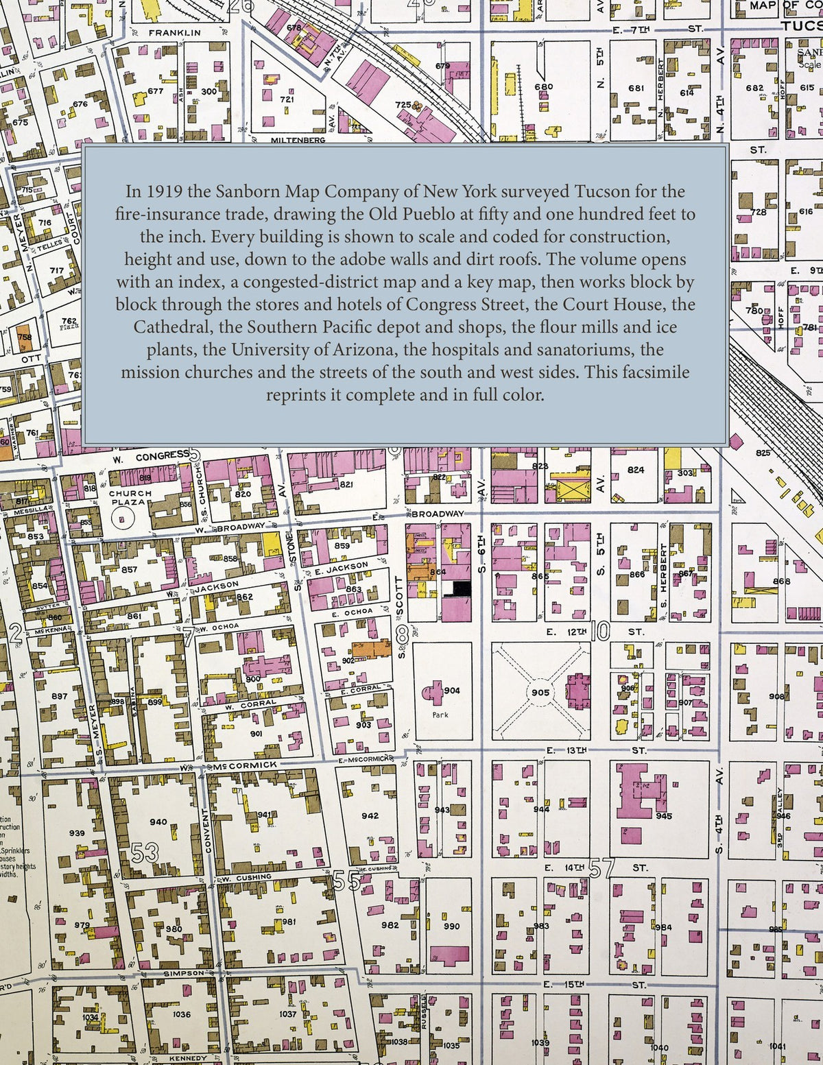
In 1919 the Sanborn Map Company of New York surveyed Tucson for the fire-insurance trade, drawing the city at fifty feet to the inch, the University of Arizona, the streets north of Speedway, the south side and the district west of the Santa Cruz River at one hundred feet to the inch, and the congested district at two hundred feet to the inch. Every building is shown to scale and color-coded for construction (yellow for frame, pink for brick, blue for stone), with heights, uses, windows, party walls, hydrants, water mains and fire stations all marked. The index lists every street and every named business, church, school, hotel, mill and works with the sheet it appears on, and the key map places the colored sheet grid over the whole city.
This edition is an unabridged facsimile republication of the atlas: the title sheet, the two index sheets with the fire and water report, the map of the congested district, the key map and all seventy-four numbered map sheets, 1 to 74. Ideal for local historians, genealogists, architects, preservationists and anyone tracing a Tucson address back to 1919.
80 pages. 8.5" x 11". Full color. Paperback.
Printed to order and shipped directly to you — please allow up to 7 business days before shipment.
Satisfaction guaranteed or you can send it back!