1920 Fire Insurance Atlas of San Mateo & Hillsborough, California
1920 Fire Insurance Atlas of San Mateo & Hillsborough, California
Couldn't load pickup availability
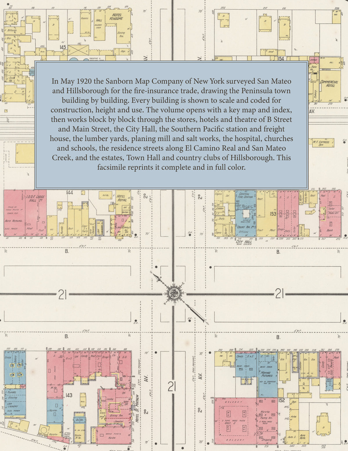
Facsimile of the 1920 Sanborn fire-insurance atlas of San Mateo, California, with Hillsborough, reproduced in full color from the Library of Congress copy. It covers the whole San Mateo County town of 6,000 people on the Peninsula and the residence town of Hillsborough beside it, from the City Hall, the hotels and the stores of B Street and Main Street by the Southern Pacific station out along El Camino Real to San Mateo Park, the Homestead, the salt works on the bay and the great estates and country clubs of the Hillsborough hills.
The forty-two numbered sheets work block by block from the stores, banks and halls along B Street, Main Street, Second and Third Avenues and El Camino Real - the City Hall, the Post Office, the Public Library, the Masonic Temple, the I. O. O. F. Lodge Hall, the B. P. O. E. Building, the Regent Theatre, the Wells Fargo Express office, and the Hotel Mateo, the Hotel Royal, the Hotel St. Mathew, the Hotel Vendome, the Commercial Hotel, the Union Hotel and the Perichon House - through the Southern Pacific passenger station, freight house and pumping plant, the Leslie Salt Refining Company on the bay, the Wisnom Lumber Company and its branch yard, the San Mateo Planing Mill Company, the Pacific Gas and Electric Company, Chanteloup's French laundry, and the California, Homestead, San Mateo and Sunshine Service garages, to St. Mathew's Hospital, the San Mateo Union High School and its gymnasium, the Lawrence, Peninsula Avenue and Homestead public schools, St. Mathew's Catholic Church and the Church of St. Mathew, the Congregational and First Methodist Episcopal churches, and the residential streets of San Mateo Park and the Homestead outside the city limits, and in Hillsborough the Town Hall, the Hillsborough District School, the Beresford and Burlingame country clubs, the former Armitage Orphanage, and the houses, stables and gardens of the great estates along Crystal Springs Road, El Cerrito Avenue and Hillsborough Boulevard, among them the places of W. H. Crocker, Charles Templeton Crocker, the Carolans, the Hobarts, the Popes and the Whitmans.
In May 1920 the Sanborn Map Company of New York surveyed San Mateo and Hillsborough for the fire-insurance trade, drawing the town at fifty feet to the inch and the Hillsborough estates at one hundred and two hundred feet to the inch. Every building is shown to scale and color-coded for construction (yellow for frame, pink for brick, blue for stone), with heights, uses, windows, party walls, hydrants, water mains and fire stations all marked. The index lists every street and every named business, church, school, hotel, mill and works with the sheet it appears on, and the key map places the colored sheet grid over the whole city.
This edition is an unabridged facsimile republication of the atlas: all forty-two numbered map sheets, the first of them the title sheet, key map and index with the reports on the water works and fire departments of San Mateo and Hillsborough. Ideal for local historians, genealogists, architects, preservationists and anyone tracing a San Mateo address back to 1920.
44 pages. 8.5" x 11". Full color. Paperback.
Printed to order and shipped directly to you — please allow up to 7 business days before shipment.
Satisfaction guaranteed or you can send it back!