1920 Fire Insurance Maps and Atlas of Bartlesville, Oklahoma
1920 Fire Insurance Maps and Atlas of Bartlesville, Oklahoma
Couldn't load pickup availability
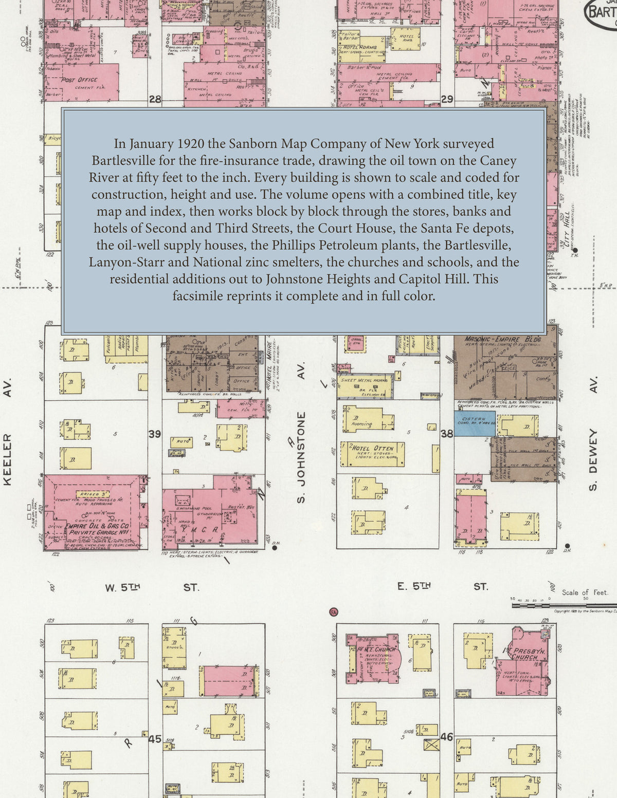
Facsimile of the 1920 Sanborn fire-insurance atlas of Bartlesville, Oklahoma, reproduced in full color from the Library of Congress copy. It covers the whole Washington County city of 20,000 people on the Caney River, from the stores, banks, hotels and Court House of Second, Third and Fourth Streets and the Santa Fe and M. K. & T. joint track, through the oil-well supply houses, the Phillips Petroleum plants and the zinc smelters, to the schools, churches and residential additions out to Johnstone Heights, Capitol Hill and Washington Terrace.
The twenty-four numbered sheets work block by block from the stores, banks and hotels along Second Street, Third Street, Fourth Street, Johnstone Avenue, Dewey Avenue and Keeler Avenue - the Court House, the City Hall and Jail, the Post Office, the Carnegie Library, the First National Bank Building, the Masonic-Empire Building, the Lannon Building, the Y. M. C. A., the B. P. O. E. Home, the Oklah Theatre, Fosters Business College, and Hotel Adams, the Almeda, Biery, Congress, Keystone, Lahoma, St. Clair and Star hotels - through the A. T. & S. F. union passenger depot and freight depot on the joint track with the M. K. & T., the Bartlesville Interurban car barn and power house, the Bartlesville Zinc Company's oxide plant and smelters A and B, the Lanyon-Starr and National zinc smelters, the Phillips Petroleum Company's Hamilton, Osage and oil steaming plants, the Prairie and Gulf pipe-line gathering stations, the Mid-Co. gasoline plant, the Bartlesville Boiler Works, the Bell Pump, Leidecker Tool, Larkin Packer, Oil Well Supply, Oklahoma Pipe and Machine and Union Machine shops, the Black, Sivalls & Bryson oil-tank works, the Osage Foundry, the oil company warehouses of Barnsball, Pierce, Standard, Texas and Wolverine, the American, Clark & Bates, Gloyd, Kidd and Toalson lumber yards and the Bartlesville and Crescent planing mills, the Turner grain elevator, the Crystal and Bartlesville ice plants, the Waukesha ice cream works, the Bartlesville bottling works and laundries, the United States Bureau of Mines and the Bartlesville Water Company's pumping plant on the Caney River, to the Bartlesville Hospital, the High School, the Junior High School, the Garfield, Horace Mann, Jefferson, Lincoln and Washington schools, St. John's R. C. Church and school, St. Luke's Church, the First Baptist, Christian, M. E., Presbyterian and United Brethren churches, the Epworth M. E., Virginia Avenue Baptist, Bethel A. M. E., Dunkard, Holiness and Seventh Day Adventist churches, the City Park, and the residential additions out to Johnstone Heights, Capitol Hill, Pemberton Heights and Washington Terrace.
In 1920 the Sanborn Map Company of New York surveyed Bartlesville for the fire-insurance trade, drawing the city at fifty feet to the inch. Every building is shown to scale and color-coded for construction (yellow for frame, pink for brick, blue for stone), with heights, uses, windows, party walls, hydrants, water mains and fire stations all marked. The index lists every street and every named business, church, school, hotel, mill and works with the sheet it appears on, and the key map places the colored sheet grid over the whole city.
This edition is an unabridged facsimile republication of the atlas: the combined title, key map and index sheet with its report on the water facilities and fire department, and all twenty-four numbered map sheets, 2 to 25, the last five drawn at one hundred feet to the inch. Ideal for local historians, genealogists, architects, preservationists and anyone tracing a Bartlesville address back to 1920.
32 pages. 8.5" x 11". Full color. Paperback.
Printed to order and shipped directly to you — please allow up to 7 business days before shipment.
Satisfaction guaranteed or you can send it back!