ExileBooks
1920 Fire Insurance Maps and Atlas of Evanston, Illinois
1920 Fire Insurance Maps and Atlas of Evanston, Illinois
Couldn't load pickup availability
Facsimile of the 1920 Sanborn fire-insurance atlas of Evanston, Illinois, reproduced in full color from the Library of Congress copy. It covers the whole city of 38,000 people, from the stores, banks, hotels and theatres of Sherman Avenue, Davis Street and Orrington Avenue and the Northwestern University campus on the lake shore, west across the Ridge to the North Shore Channel, and from the Wilmette line to Howard Street and the Chicago city limits.
The one hundred fifteen numbered sheets work block by block from the stores, banks, hotels and theatres along Sherman Avenue, Davis Street, Orrington Avenue, Church Street, Chicago Avenue, Main Street and Central Street - the City Hall and city department buildings, the Post Office, the Police Department, the Fire Department headquarters and engine houses, the Evanston Library, the Century Building, the State Bank of Evanston, Rosenberg's and W. S. Lord's department stores, the Strand and Hoyburn theatres, the Hotel Monnett, the North Shore, Evanston, Asbury and Arbor Inn hotels, the Greenwood Inn, the Evanston Club, the University Club, the B. P. O. E. Lodge, the Y. M. C. A. and the apartment houses - through the Chicago & North Western stations at Calvary, Main Street, Davis Street, Central Street and Greenwood Boulevard and its freight depot, the Northwestern Elevated stations, the North Shore electric depots, the Evanston Railway car barns, the Chicago Telephone Company's Evanston exchange, the filtration plant and pumping station, the Illinois Brick Company and LaBahn Bros. brick yards, the Lyon concrete-brick works, the Hines, Evanston and Mears-Slayton lumber sheds and saw mills, the Consumers Company, Central Coal and Foley coal yards, the Evanston Sash & Screen and Myers sash and door factories, the Weise Bros. mill works, the Toy Tinkers' Tinker Toy factory, the Watson ice cream factory, the Powers ice plant, the Borden's and Weiland's dairy stables, the Washington and Nelson Bros. laundries and the greenhouses of Weiland-Risch, Schumer, Gloede, Jacobsen and a score of florists, to the Evanston and St. Francis hospitals, the Grove House for convalescents, the Children's Home, the Northwestern University buildings, athletic field and Willard Hall, the Norwegian-Danish and Swedish theological seminaries, the Evanston Township High School and Haven Annex, the Dewey, Foster Street, Grandon, Larimer, Lincoln, Lincolnwood, Miller, Noyes Street, Oakton, Orrington and Washington schools, the Roycemore and Mary Wood schools, St. Mary's, St. Nicholas and Ascension churches and schools, the churches of every denomination, the North Moor Country Club, Calvary Cemetery, and the residential streets from the Wilmette line to Howard Street, the Ridge, Evanston Heights and Oakton.
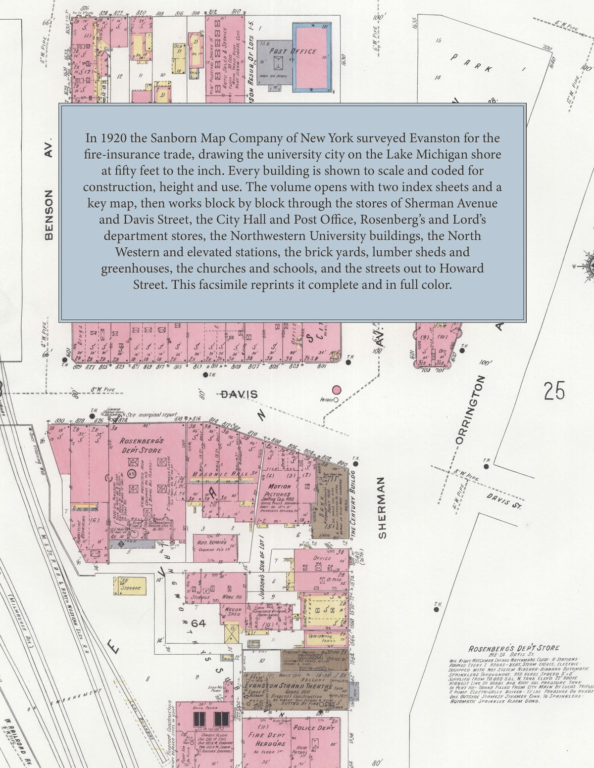
In 1920 the Sanborn Map Company of New York surveyed Evanston for the fire-insurance trade, drawing the city at fifty feet to the inch. Every building is shown to scale and color-coded for construction (yellow for frame, pink for brick, blue for stone), with heights, uses, windows, party walls, hydrants, water mains and fire stations all marked. The index lists every street and every named business, church, school, hotel, mill and works with the sheet it appears on, and the key map places the colored sheet grid over the whole city.
This edition is an unabridged facsimile republication of the atlas: the title sheet, the two index sheets, the key map and all one hundred fifteen numbered map sheets. Ideal for local historians, genealogists, architects, preservationists and anyone tracing a Evanston address back to 1920.
120 pages. 8.5" x 11". Full color. Paperback.
Printed to order and shipped directly to you — please allow up to 7 business days before shipment.
Satisfaction guaranteed or you can send it back!