1920 Fire Insurance Maps and Atlas of Yakima, Washington
1920 Fire Insurance Maps and Atlas of Yakima, Washington
Couldn't load pickup availability
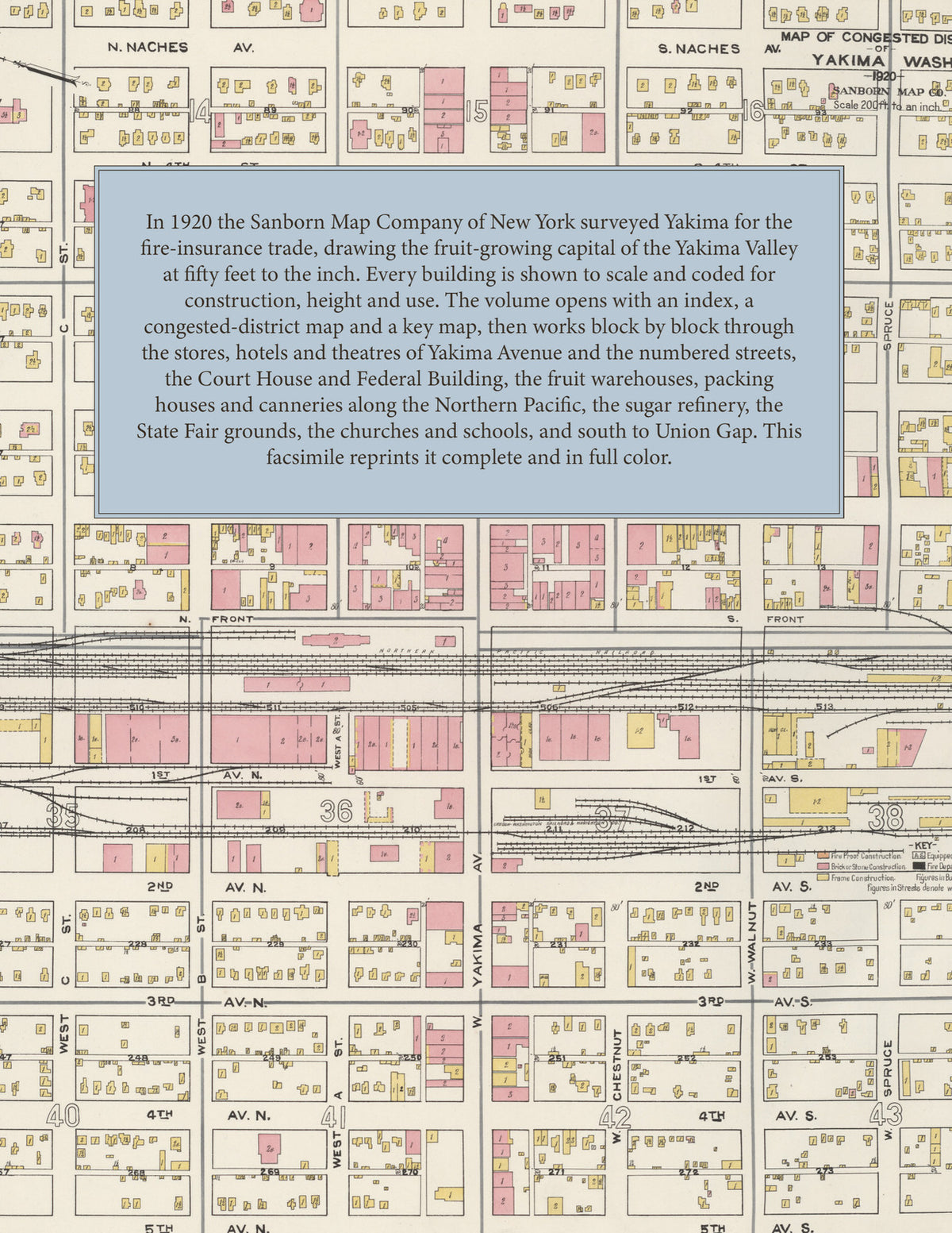
The complete 1920 Sanborn fire-insurance atlas of Yakima, Washington, reprinted in full color. It covers Yakima and Union Gap, from the downtown blocks out to the city limits.
The eighty-two numbered sheets work block by block from the stores, banks, hotels and theatres along Yakima Avenue and the numbered streets and avenues - the County Court House and Jail, the Federal Building, the Public Library, the Armory, the Masonic Temple, the B. P. O. E. Temple, the I. O. O. F. Building, the Miller Building, the Empire, Mercy and Majestic theatres, the Commercial, Donnelly, Elk, Pacific, Tieton, Washington and Yakima hotels and the Nob Hill Inn, the Women's Club House, the Natatorium and the Y. M. C. A. - through the Yakima Fruit Growers Association warehouse and cider and vinegar factory, the Yakima Valley Fruit Growers Association buildings, the Horticultural Union cold storage, the Congdon, Pyramid and Wright fruit packing houses, the Richey & Gilbert, Ryan, Sansom, Perry and Paddock fruit warehouses, the Pacific and Washington fruit and produce companies, the Libby, McNeill & Libby cannery, the California Packing Company's apple evaporator, the Washington Dehydrated Food Company, the Lust & Walters cider and jelly factory, the Yakima Rex Spray Company, the Yakima Sash and Box Company, the Cascade Lumber Company's saw and planing mill and box factory, the Pioneer, Rovig and Dower lumber yards, the Portland Flouring Mills and the Lewiston and Miller milling companies, the Utah-Idaho Sugar Company's refinery, the Yakima Iron Works, the Yakima Artificial Ice and Cold Storage Company, the creameries and dairies, the Yakima Meat Company's abattoir, the Cascade Bottling Company, the Yakima Glazed Cement Pipe Company, the Pacific Power & Light gas works and electric plant, the Yakima Valley Transportation Company's car barns, the Standard, Shell and Union oil warehouses, the Northern Pacific passenger and freight depots, the O. W. R. R. & Navigation Company depots and the Washington State Fair grounds, to St. Elizabeth's Hospital, the Reclamation Service office, the Yakima High School, Marquette College, St. Joseph's Academy and the Adams, Barge, Columbia, Garfield, Lincoln, McKinley, Roosevelt and Central schools, St. Joseph's and St. Michael's, the First Baptist, First Christian, First Methodist, First Presbyterian, Calvary Baptist, Holy Trinity, St. Luke's, the Swedish and German Lutheran, Seventh Day Adventist, Nazarene and Free Methodist churches and the Salvation Army, the nurseries, and south to Union Gap with its Northern Pacific depot and post office.
In 1920 the Sanborn Map Company of New York surveyed Yakima for the fire-insurance trade, drawing the city at fifty feet to the inch. Every building is shown to scale and color-coded for construction (yellow for frame, pink for brick, blue for stone), with heights, uses, windows, party walls, hydrants, water mains and fire stations all marked. The index lists every street and every named business, church, school, hotel, mill and works with the sheet it appears on, and the key map places the colored sheet grid over the whole city.
This edition is an unabridged facsimile republication of the atlas: the title sheet, the two-sheet index, the map of the congested district, the key map and all eighty-two numbered map sheets. Ideal for local historians, genealogists, architects, preservationists and anyone tracing a Yakima address back to 1920.
88 pages. 8.5" x 11". Full color. Paperback.
Printed to order and shipped directly to you — please allow up to 7 business days before shipment.
Satisfaction guaranteed or you can send it back!