1921 Fire Insurance Maps and Atlas of Delphos, Ohio
1921 Fire Insurance Maps and Atlas of Delphos, Ohio
Couldn't load pickup availability
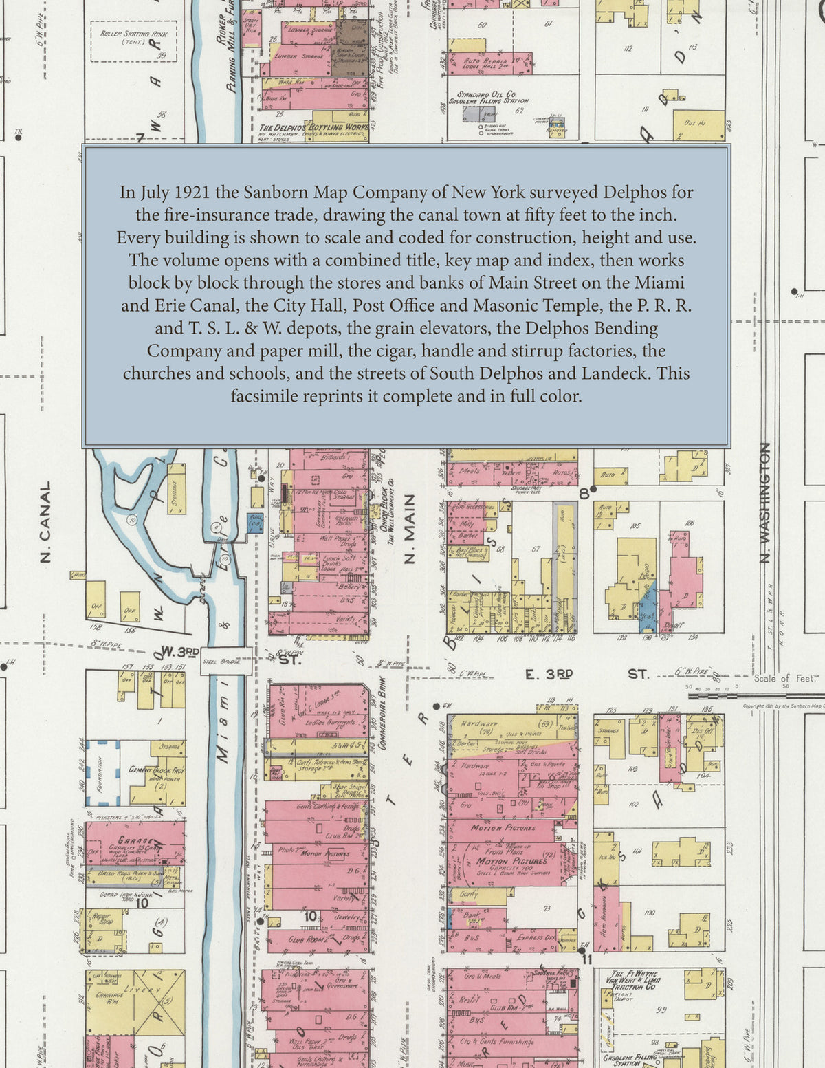
Facsimile of the 1921 Sanborn fire-insurance atlas of Delphos, Ohio, reproduced in full color from the Library of Congress copy. It covers the whole town of 5,745 people astride the Miami and Erie Canal, from the stores, banks and hotels of Main Street and Second Street, through the railroad depots, grain elevators, mills and factories, to the schools, churches and residential streets of South Delphos and out to Landeck.
The twenty-four numbered sheets work block by block from the stores, banks and hotels along Main Street, Second Street, Third Street, Canal Street and Washington Street - the City Hall, the Post Office, the Public Library, the Masonic Temple, the K. of P. Building, the Commercial Bank Building, the Metzger, Onion and Peoples blocks, Hotel Delphos, Hotel Wayne, the Phelan Hotel and the Beckman House - through the P. R. R. depot, the T. S. L. & W. R. R. depot and shops, the Ft. Wayne, Van Wert & Lima Traction freight depot, the Garman, Hessian, Landeck, Luersman and Lutz grain elevators, the Delphos Equity Exchange feed mill, the Delphos Bending Company, the Delphos Paper Mill, the Delphos Manufacturing Company's galvanized oil-can works, the Deisel Wemmer cigar factory, the Shaffer handle factory and saw mill, the Whirpett stirrup factory, the Ricker planing mill and furniture factory, the Horine planing mill and concrete block factory, the Lime Stone Quarry Company, the American Road Machinery Company, the Sudmoeller brass and aluminum foundry, the Johnson machine and boiler shop, the Kollsmith carriage and wagon works, the Minzing brick yard, the Scherger marble and granite works, the Rapid Bottle Washer Company, the Steinle ice and beverage works, the Well Creamery, the Lincoln Highway Dairy, the Delphos bottling, gas and water works, the Northern Ohio Light Company, the Paragon Refining Company and the Standard Oil Company, to the Jefferson High School, the Franklin Street, Garfield and South Delphos public schools, St. John's Roman Catholic Church and school, St. Peter's Evangelical Lutheran Church, the Methodist Episcopal, Presbyterian, First Christian, Reformed United Brethren and A. M. E. churches, St. John the Baptist church at Landeck, and the residential streets of Delphos, South Delphos and Landeck.
In 1921 the Sanborn Map Company of New York surveyed Delphos for the fire-insurance trade, drawing the city at fifty feet to the inch. Every building is shown to scale and color-coded for construction (yellow for frame, pink for brick, blue for stone), with heights, uses, windows, party walls, hydrants, water mains and fire stations all marked. The index lists every street and every named business, church, school, hotel, mill and works with the sheet it appears on, and the key map places the colored sheet grid over the whole city.
This edition is an unabridged facsimile republication of the atlas: the combined title, key map and index sheet with its report on the water facilities and fire department, and all twenty-four numbered map sheets, 2 to 25. Ideal for local historians, genealogists, architects, preservationists and anyone tracing a Delphos address back to 1921.
32 pages. 8.5" x 11". Full color. Paperback.
Printed to order and shipped directly to you — please allow up to 7 business days before shipment.
Satisfaction guaranteed or you can send it back!