1921 Fire Insurance Maps and Atlas of Sandpoint, Idaho
1921 Fire Insurance Maps and Atlas of Sandpoint, Idaho
Couldn't load pickup availability
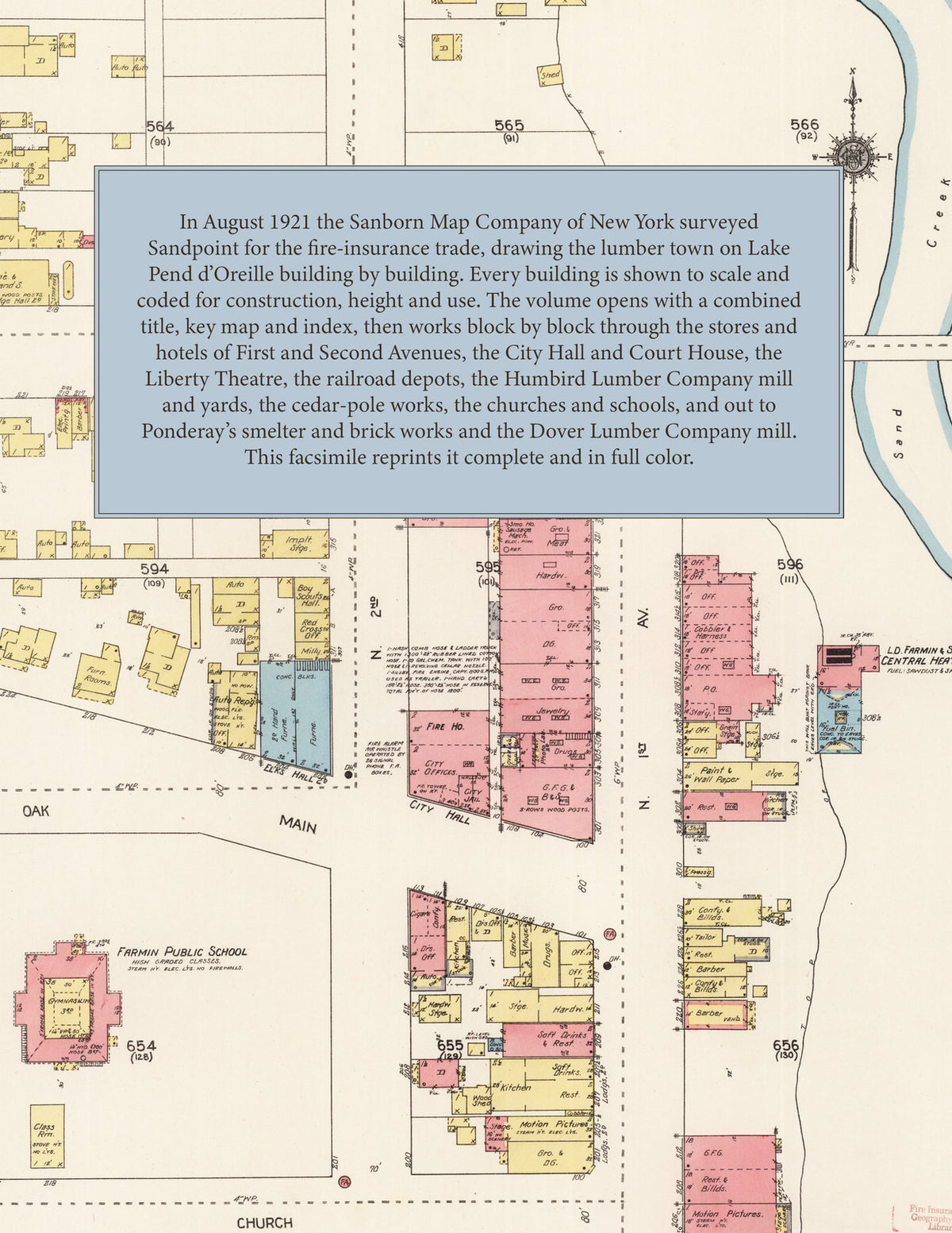
Facsimile of the 1921 Sanborn fire-insurance atlas of Sandpoint, Idaho, reproduced in full color from the Library of Congress copy. It covers the Bonner County town of 2,876 people on Lake Pend d'Oreille, from the stores, hotels and City Hall of First and Second Avenues along Sand Creek, past the Northern Pacific and Spokane International depots and the Humbird Lumber Company mill on the lake shore, to the schools, churches and residential streets, and out to Ponderay with its smelter and brick works and Dover with the Dover Lumber Company mill.
The thirty numbered sheets that follow work block by block from the stores, banks, hotels and garages along First Avenue, Second Avenue, Third Avenue, Main Street, Cedar Street, Oak Street and Church Street beside Sand Creek - the City Hall, the Post Office, the Bonner County Court House and Jail, the Elks' Hall, the G. A. R. Hall, the Episcopal Guild Hall, the Liberty Theatre, Hotel Idaho, the St. James and Eureka hotels, the F. F. Reem Motor Company, the Motor Inn, City and Bonner County garages, and the L. D. Farmin & Sons central heating plant - through the Northern Pacific passenger depot and freight warehouse, the Spokane International depot, the Humbird Lumber Company's saw mill, planing mill, lumber yards, store and hay warehouse, the L. D. McFarland & Co. and Western Cedar Pole Preservers yards, the King Iron Works, the Farmers' General Supply Company and its union warehouse, the Bonner Meat Company, the Pend d'Oreille Creamery Company, the Continental Oil Company, the Mountain States Power Company, the Lakeside Laundry and the University of Idaho Experimental Sub-Station, to the City Hospital, the Farmin, Lincoln, Jefferson and Washington public schools, St. Joseph's Church, the First Baptist, First Methodist, First Presbyterian, Christian and Norwegian Lutheran churches and the Church of God, and the residential streets along Superior, Pine, Alder, Poplar and Ruth Avenues; and out to Ponderay, with its public school, the Idaho Smelting & Refining Company, the Anderson Brick Company, the Star Market slaughter house and the Bonner County Infirmary, and to Dover on the Pend d'Oreille River, with the Dover Lumber Company's saw and planing mill, yards, bunk and boarding houses and the Dover Public School.
In August 1921 the Sanborn Map Company of New York surveyed Sandpoint, Ponderay and Dover for the fire-insurance trade, drawing the town at fifty feet to the inch and the big lumber mills at one hundred feet to the inch. Every building is shown to scale and color-coded for construction (yellow for frame, pink for brick, blue for stone), with heights, uses, windows, party walls, hydrants, water mains and fire stations all marked. The index lists every street and every named business, church, school, hotel, mill and works with the sheet it appears on, and the key map places the colored sheet grid over the whole city.
This edition is an unabridged facsimile republication of the atlas: all thirty-one numbered map sheets, 1 to 31, sheet 1 being the combined title, key map and index sheet with its report on the water works and fire department, the others covering the town, the Humbird Lumber Company mill and yards, Ponderay and Dover. Ideal for local historians, genealogists, architects, preservationists and anyone tracing a Sandpoint address back to 1921.
32 pages. 8.5" x 11". Full color. Paperback.
Printed to order and shipped directly to you — please allow up to 7 business days before shipment.
Satisfaction guaranteed or you can send it back!