1921 Fire Insurance Maps and Atlas of Tyrone, Pennsylvania
1921 Fire Insurance Maps and Atlas of Tyrone, Pennsylvania
Couldn't load pickup availability
Facsimile of the 1921 Sanborn fire-insurance atlas of Tyrone, Pennsylvania, reproduced in full color from the Library of Congress copy. It covers the Blair County borough of 10,000 people on the Little Juniata River and Bald Eagle Creek, from the stores, banks and theatres of Pennsylvania and Logan Avenues and the Pennsylvania Railroad depots, through the West Virginia Pulp and Paper mill and the foundries, to East Tyrone, Greensburg, Northwood, Nealmont, Hillcrest and the lime and limestone plants at Ironville.
The twenty-four numbered sheets work block by block from the stores, banks, hotels and theatres along Pennsylvania Avenue, Logan Avenue, Washington Avenue, Tenth Street and Blair Avenue - the Municipal Building, the Borough Building, the Post Office, the First National Bank Building, the Sheridan Troop Drill Hall, the Y. M. C. A. and Salvation Army buildings, the Wilson Theatre, the Herald and Tyrone Times printing offices, Templeton's and the M. & M. Company's department stores, the Arlington House, Ward House, Pennsylvania House and Colonial Hotel - through the Pennsylvania Railroad passenger depot, freight depot and round house, the Altoona & Logan Valley Electric Railway's office, the West Virginia Pulp and Paper Company's mill, the Home Electric Light and Steam Heating Company, the Tyrone Gas and Water Company's gas plant, the Burley Heater Company's foundry and machine shop, the J. C. Stine Company's foundry and machine shop, the Reeder Bros. & Hoffman boiler shop, the Pennsylvania Brick Company, the American Lime and Stone Company's Plant No. 8, the Pittsburg Limestone Company, the Stevens-Webb shovel storage, the Eyre Shoemaker Tennant Building, the Tauber & Lipton garment factory, the Wilson Chemical Company's salve and talc works, the Tyrone Milling Company and the Juniata Feed and Flour Company, the Beyer lumber yard and planing mill, the Hoffman ice-cream factory, the Rothrock and Bayer Gillam wholesale houses, the Tyrone Laundry, the Atlantic Refining Company, the garages and the coal and builders' supply yards, to the Methodist Home for the Aged, the Tyrone High School and Annex, the Adams Avenue, Park Avenue, West Fourteenth Street, Nealmont, Northwood and Ironville public schools, St. Matthew's Roman Catholic church and school, Trinity Protestant Episcopal, the First Baptist, Evangelical Lutheran, Methodist Episcopal, Presbyterian and United Brethren churches, the Columbia Avenue Presbyterian, Second and Free Methodist, Church of God, Church of the Brethren and A. M. E. Zion churches, and the residential streets of East Tyrone, Greensburg, Northwood, Nealmont and Hillcrest, out along the William Penn Highway to Ironville.
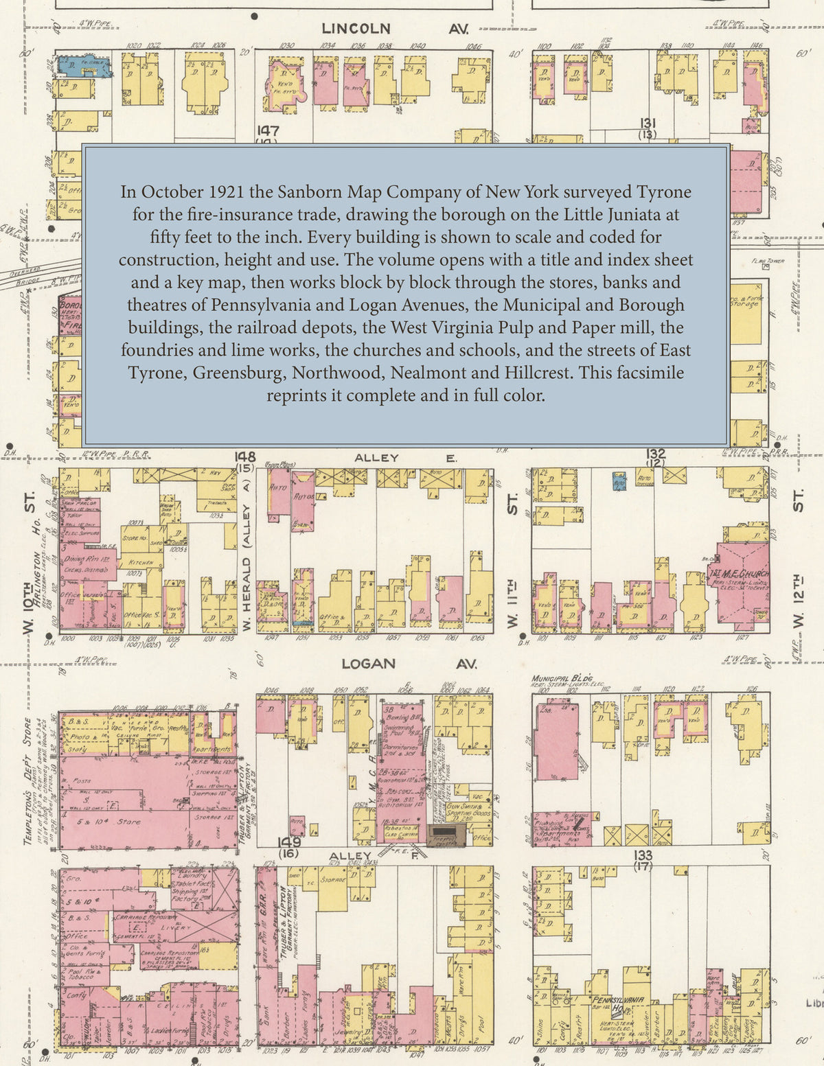
In 1921 the Sanborn Map Company of New York surveyed Tyrone for the fire-insurance trade, drawing the city at fifty feet to the inch. Every building is shown to scale and color-coded for construction (yellow for frame, pink for brick, blue for stone), with heights, uses, windows, party walls, hydrants, water mains and fire stations all marked. The index lists every street and every named business, church, school, hotel, mill and works with the sheet it appears on, and the key map places the colored sheet grid over the whole city.
This edition is an unabridged facsimile republication of the atlas: the combined title and index sheet, the key map with its report on the water facilities and fire department, and all twenty-three further numbered map sheets, 2 to 24, covering Tyrone with East Tyrone, Greensburg, Northwood, Nealmont, Hillcrest and Ironville. Ideal for local historians, genealogists, architects, preservationists and anyone tracing a Tyrone address back to 1921.
32 pages. 8.5" x 11". Full color. Paperback.
Printed to order and shipped directly to you — please allow up to 7 business days before shipment.
Satisfaction guaranteed or you can send it back!