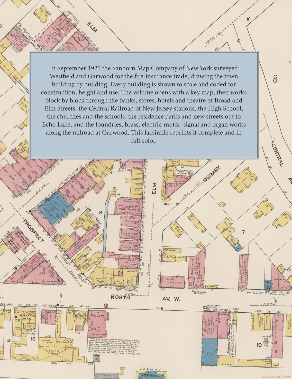
1921 Fire Insurance Maps & Atlas of Westfield and Garwood, New Jersey
1921 Fire Insurance Maps & Atlas of Westfield and Garwood, New Jersey
Couldn't load pickup availability
Facsimile of the 1921 Sanborn fire-insurance atlas of Westfield, New Jersey, with Garwood, reproduced in full color from the Library of Congress copy. It covers the whole Union County commuter town of 9,000 people and the borough of Garwood beside it, from the banks, stores and Post Office of Broad and Elm Streets by the Central Railroad station out through the residence parks and new streets to Echo Lake and the Mountainside line, and along the railroad to the foundries and machine, electric and organ works of Garwood.
The forty-two numbered sheets work block by block from the stores, banks and offices along Broad Street, Elm Street, Prospect Street and North Avenue - the Westfield Trust Company, the Peoples National Bank, the Post Office, the Darsh Building, the Playhouse, The Westfield Leader printing office, the Westfield Garage, the Fire Department headquarters, Woodruff's furniture storage warehouse, and Willetts Hotel and Kelly's Hotel - through the Central Railroad of New Jersey's passenger station and west-bound station, the coal and lumber yards and garages along the tracks, and the factories of Garwood beside the line - the Continuous Casting Corporation's brass works and its Continuous Machine Works, the Bell Electric Motor Company, George C. Moon's wire-rope works, the Esda stove works, the C. and C. Electric and Manufacturing Company's motor and dynamo plant, the Universal Tool Company, the Zobell Electric Motor Company, the Armor Bronze statuary works, the Garwood Bronze and Iron Works, the Hall Switch and Signal Company, the National Boiler Company's foundry, the New Jersey Foundry and Machine Company, the Diamond Expansion Bolt Company, the Beckley Perforating Company, the Aeolian Company's Votey organ and piano works and the Anchor Post Iron Works - to the Westfield High School and the Washington School, the Holy Trinity School and the foundation of the new Holy Trinity Church, the Italian Catholic church and the churches of the town, Becker's Auditorium at Garwood, the Echo Lake Country Club, and the residential streets and new residence parks of Westfield out to the Mountainside, Springfield, Cranford and Fanwood lines, with the streets of the borough of Garwood.
In September 1921 the Sanborn Map Company of New York surveyed Westfield and Garwood for the fire-insurance trade, drawing the business blocks and the Garwood factories at fifty feet to the inch, the residential streets at one hundred feet to the inch and the open country around Echo Lake at four hundred feet to the inch. Every building is shown to scale and color-coded for construction (yellow for frame, pink for brick, blue for stone), with heights, uses, windows, party walls, hydrants, water mains and fire stations all marked, and the key map places the colored sheet grid over the whole town and the borough of Garwood.
This edition is an unabridged facsimile republication of the atlas: all forty-two numbered map sheets, the first of them the key map with its report on the water works and fire department, covering Westfield and Garwood. Ideal for local historians, genealogists, architects, preservationists and anyone tracing a Westfield address back to 1921.
44 pages. 8.5" x 11". Full color. Paperback.
Printed to order and shipped directly to you — please allow up to 7 business days before shipment.
Satisfaction guaranteed or you can send it back!