1921 Sanborn Atlas of Newport, Jamestown, Middletown & Portsmouth, RI
1921 Sanborn Atlas of Newport, Jamestown, Middletown & Portsmouth, RI
Couldn't load pickup availability
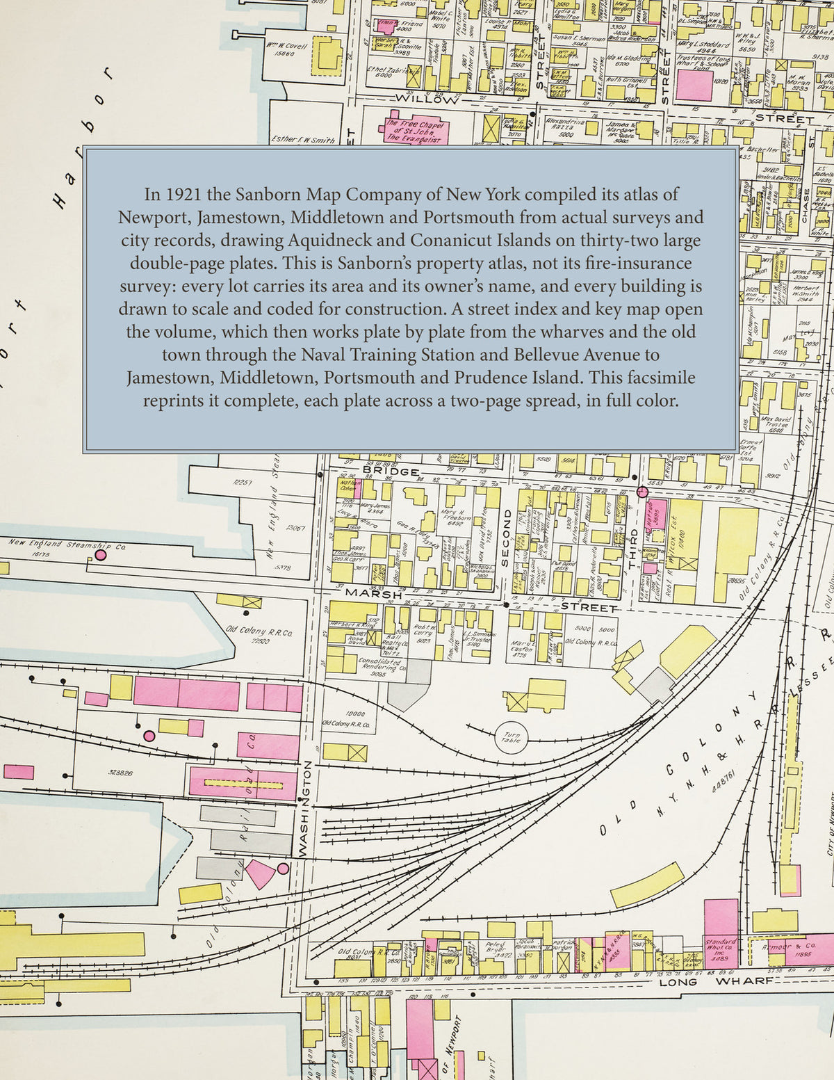
The complete 1921 Sanborn atlas of Newport, Jamestown, Middletown and Portsmouth, Rhode Island, reprinted in full color. This is not the familiar fifty-foot fire-insurance survey but Sanborn's property atlas of Aquidneck and Conanicut Islands: thirty-two large double-page plates that cover the whole city of Newport and the three towns around it, every lot drawn with its area and the name of its owner and every building shown to scale.
The thirty-two plates work across the islands from the wharves, stores and hotels of Thames Street, Long Wharf, Market Square and Broadway - the Court House, the churches and schools of the old town and the Point, the water works and the Old Colony railroad station - through the Naval Training Station on Coasters Harbor Island, the U. S. Marine Hospital and the government land at Coddington Cove, Kay Street, Bellevue Avenue, Casino Terrace and the estates of the summer colony, the cottages along Ocean Avenue, Ledge Road and the Cliffs, Bath Road and Easton's Beach, Fort Adams Road and Harrison Avenue, and the streets off Coggeshall Avenue, Prescott Hall Road and Bliss Mine Road out to the Middletown line, to the town of Jamestown on Conanicut Island, the town of Middletown and the town of Portsmouth with Bristol Ferry, the Cove and Prudence Island - with the name of the owner and the area of every lot, the outline of every house, cottage, stable, store, hotel, church, school and public building, and the lines of the railroad, the trolley, the water pipes and the sewers.
In 1921 the Sanborn Map Company of New York compiled the atlas from actual surveys and the records of the city engineer and the other municipal departments, and printed it on thirty-two double-page plates at one hundred feet to the inch in 1922. Every lot is drawn with its area and the name of its owner, and every building is shown to scale and color-coded for construction (yellow for frame, pink for brick or stone). The street index lists every street of Newport, Jamestown, Middletown and Portsmouth with the plate it appears on, and the key map places the plate grid over the two islands.
This edition is an unabridged facsimile republication of the atlas: the title sheet, the two street-index sheets, the double-page key map and all thirty-two numbered double-page plates, each reproduced across a two-page spread. Ideal for local historians, genealogists, architects, preservationists and anyone tracing a Newport address back to 1921.
70 pages. 8.5" x 11". Full color. Paperback.
Printed to order and shipped directly to you — please allow up to 7 business days before shipment.
Satisfaction guaranteed or you can send it back!