1922 Fire Insurance Maps and Atlas of Bristol, Virginia
1922 Fire Insurance Maps and Atlas of Bristol, Virginia
Couldn't load pickup availability
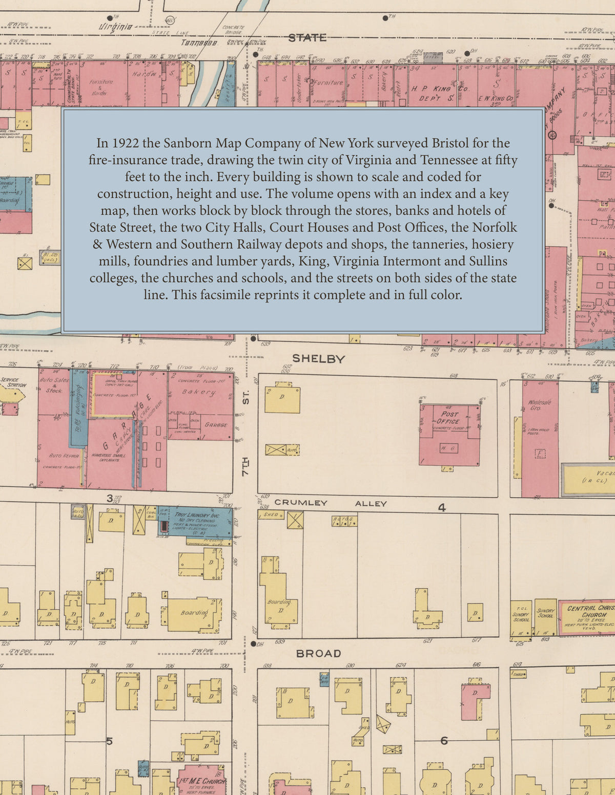
The complete 1922 Sanborn fire-insurance atlas of Bristol, Virginia and Tennessee, reprinted in full color. It covers both cities of the twin town astride the state line, from the stores, hotels and depots along State Street and the tanneries, mills and foundries along Beaver Creek to King College, Virginia Intermont College, Sullins College and the residential streets on both sides of the line.
The eighty-seven numbered sheets work block by block from the stores, banks, hotels and theatres along State Street, Main Street, Shelby Street and Moore Street - the City Halls, Jails and Court House of both Bristols, the Post Offices, the Public Library, the Dominion National, First National, Commonwealth State and Union Trust bank buildings, the Columbia, Eagle, Isis and Cameo theatres, the Hotel Bristol, the Palace Hotel and the Tip-Top, the Elks' Home, the Y. M. C. A. and the Masonic Temple - through the Norfolk & Western depots, round houses and repair shops, the Southern Railway passenger depot, freight warehouse and shops, the Union Depot, the Bristol Tobacco Warehouse Corporation, the Schieren, Dixie and Anderson tanneries, the Bristol, Grey, Wood and Silex hosiery mills, the Big Jack, Eagle and Lockwood overall and shirt factories, the Bristol Stove and Foundry Company, the Enterprise and Southern Brick foundries and machine works, the Twin City Boiler Works, the Interstate Body Company, the Uneeda carriage works, the Taylor spoke factory, the Dominion Handle and Supply Company, the Bristol Door and Lumber, Cortrim, Stone and Virginia Tub lumber companies and planing mills, the Barrow-Scott, Bristol, Sparger, Shankel and Service flour and grist mills, the Bristol Gas and Electric Company, the Water Works and pumping station, the Cumberland Chemical and Bristol Drug companies, the Chero-Cola and Dixie Coca-Cola bottling works, the Bristol Ice Cream Company, the Goodwyn and Dermid coal and ice yards, the Standard Oil and Indian Refining oil storage, the Burcum and Virginia Rock quarries, the Holston Creamery, the Aronhime-May and Armour packing houses, to St. Luke's Hospital, King College, Virginia Intermont College, Sullins College and its bath house and pool, the Virginia and Tennessee high schools, the Bristol Normal Institute and the Douglass, Fifth Street, Jefferson, Kingstown, Lee, Pittstown, Washington Street, Winter Bloom and ward schools, the churches of every denomination, Fairmount Gardens, the Country Club of Bristol, and the residential streets on both sides of the state line.
In 1922 the Sanborn Map Company of New York surveyed Bristol for the fire-insurance trade, drawing the city at fifty feet to the inch. Every building is shown to scale and color-coded for construction (yellow for frame, pink for brick, blue for stone), with heights, uses, windows, party walls, hydrants, water mains and fire stations all marked. The index lists every street and every named business, church, school, hotel, mill and works with the sheet it appears on, and the key map places the colored sheet grid over the whole city.
This edition is an unabridged facsimile republication of the atlas: the title and index sheet, the key map and all eighty-seven numbered map sheets together with the two skeleton sheets. Ideal for local historians, genealogists, architects, preservationists and anyone tracing a Bristol address back to 1922.
92 pages. 8.5" x 11". Full color. Paperback.
Printed to order and shipped directly to you — please allow up to 7 business days before shipment.
Satisfaction guaranteed or you can send it back!