1923 Fire Insurance Maps and Atlas of Cambridge, Ohio
1923 Fire Insurance Maps and Atlas of Cambridge, Ohio
Couldn't load pickup availability
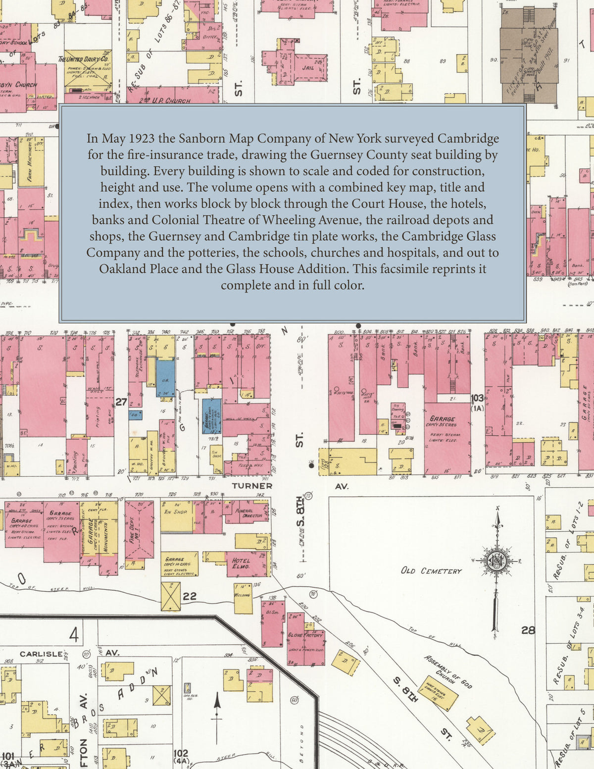
Facsimile of the 1923 Sanborn fire-insurance atlas of Cambridge, Ohio, reproduced in full color from the Library of Congress copy. It covers the whole Guernsey County seat of 14,500 people on both sides of Wills Creek, from the Court House and the stores, banks, hotels and theatre of Wheeling and Steubenville Avenues out along the Baltimore and Ohio and the Cleveland and Marietta railroads to the tin plate works, the Cambridge Glass Company, the potteries, foundries and mills, the schools, churches and hospitals, and the residential additions from Oakland Place to the Glass House district.
The thirty-two numbered sheets that follow work block by block from the stores, banks and offices along Wheeling Avenue, Steubenville Avenue and Eighth, Ninth and Tenth Streets - the Guernsey County Court House and Jail, the Post Office, the Public Library, the Colonial Theatre, the Elks and Moose club houses, the Hotel Berwick, Hotel Elmo, the National, Star, Central and Depot hotels, and the four fire stations - through the Baltimore and Ohio and Cleveland and Marietta depots and shops, the Guernsey Works and the Cambridge Plant of the American Sheet and Tin Plate Company, the Cambridge Glass Company, the Cambridge Sanitary Pottery, the Guernseyware China and Oxford Pottery companies, the Cambridge Steel Products bar iron mill, the Cambridge Foundry and Machine Company, the Cambridge flour mill, the Linton, Hoyle and Scott and Cambridge Lumber and Coal mills, the Gregg crate factory, the Suitt Brothers chair factory, the Duffey cement block works, the Hutchinson candy factory, the Guernsey Creamery and United Dairy, the ice and storage plant, the Standard Oil and Pure Oil stations, the American Gas and Electric power plant and car barns, and the Cambridge Water Works pumping station, to the Wells and Cambridge hospitals, the County Children's Home, the City Refuge, the Brown High School and the Union, Marquand, Lofland, Ninth Street, Oakland, South Side, East End and Glass House Addition schools, St. Benedict's church and school, St. John's Episcopal, the Methodist, Presbyterian, Baptist, Lutheran, United Brethren and Christian churches and the tabernacles and missions, and the residential streets of Oakland Place, Orchard Grove, East Cambridge, Lofland's, Turnbaugh's and the other additions.
In May 1923 the Sanborn Map Company of New York surveyed Cambridge for the fire-insurance trade, drawing the city at fifty feet to the inch and the Oakland Place additions at one hundred feet to the inch. Every building is shown to scale and color-coded for construction (yellow for frame, pink for brick, blue for stone), with heights, uses, windows, party walls, hydrants, water mains and fire stations all marked. The index lists every street and every named business, church, school, hotel, mill and works with the sheet it appears on, and the key map places the colored sheet grid over the whole city.
This edition is an unabridged facsimile republication of the atlas: all thirty-three numbered map sheets, 1 to 33, sheet 1 being the combined key map, title and index sheet with its report on the water works and fire department, the others covering the city on both sides of Wills Creek from the Court House and the business district out to the tin plate works, the Cambridge Glass Company, the potteries, the railroad shops and the additions. Ideal for local historians, genealogists, architects, preservationists and anyone tracing a Cambridge address back to 1923.
34 pages. 8.5" x 11". Full color. Paperback.
Printed to order and shipped directly to you — please allow up to 7 business days before shipment.
Satisfaction guaranteed or you can send it back!