1923 Fire Insurance Maps and Atlas of Fayetteville, North Carolina
1923 Fire Insurance Maps and Atlas of Fayetteville, North Carolina
Couldn't load pickup availability
Facsimile of the 1923 Sanborn fire-insurance atlas of Fayetteville, North Carolina, reproduced in full color from the Library of Congress copy. It covers the whole Cumberland County town of 14,500 people on the Cape Fear River, from the stores and banks of Hay and Person Streets around the Old Market House out along Cross Creek through the cotton mills and warehouses, to Haymount and the Heights, the Fair Grounds, the Puritan and Tolar-Hart mill districts and Victory Mill Village.
The thirty-eight numbered sheets work block by block from the stores, banks and offices along Hay, Person, Green and Gillespie Streets - the Old Market House, the Cumberland County Court House and Jail, City Hall, the Post Office, the Library, the Armory, the Fire Department, the Masonic Temple and Y. M. C. A., the Lafayette Theatre, the Lafayette Bank and National Bank buildings, the Fayetteville Observer, and the Lafayette, Atlantic, Sullivan, Rosemont and Stag hotels - through the Atlantic Coast Line, Norfolk Southern and Aberdeen and Rockfish depots, the Cape Fear, Holt-Granite-Puritan, Holt-Williamson, Tolar-Hart and Holt and Victory cotton mills, the Hawthorn silk mill, the Southern Cotton Oil and Christian-Ewing fertilizer works, the cotton compress and warehouses, the Rankin and Denny veneer factory, the West Lumber and Box, Fayetteville and Sexton lumber yards and the planing mills, the McNeill and Merchants grist mills, the ice, light, power and gas plants, the bottling works and the City Water Works on Glenville Lake, to the Highsmith, Pittman and Cumberland General hospitals, the County Home for the Aged, the Confederate Women's Home, the Donaldson Military School, the High School and graded schools, the State Normal School, the Fair Grounds and Country Club, St. John's, St. Patrick's, the Synagogue, the Hay Street Methodist, First Baptist, First Presbyterian and Evans Metropolitan A. M. E. Zion churches, and the residential streets of Haymount, College, Monticello, Pershing and Triangle Heights and Victory Mill Village.
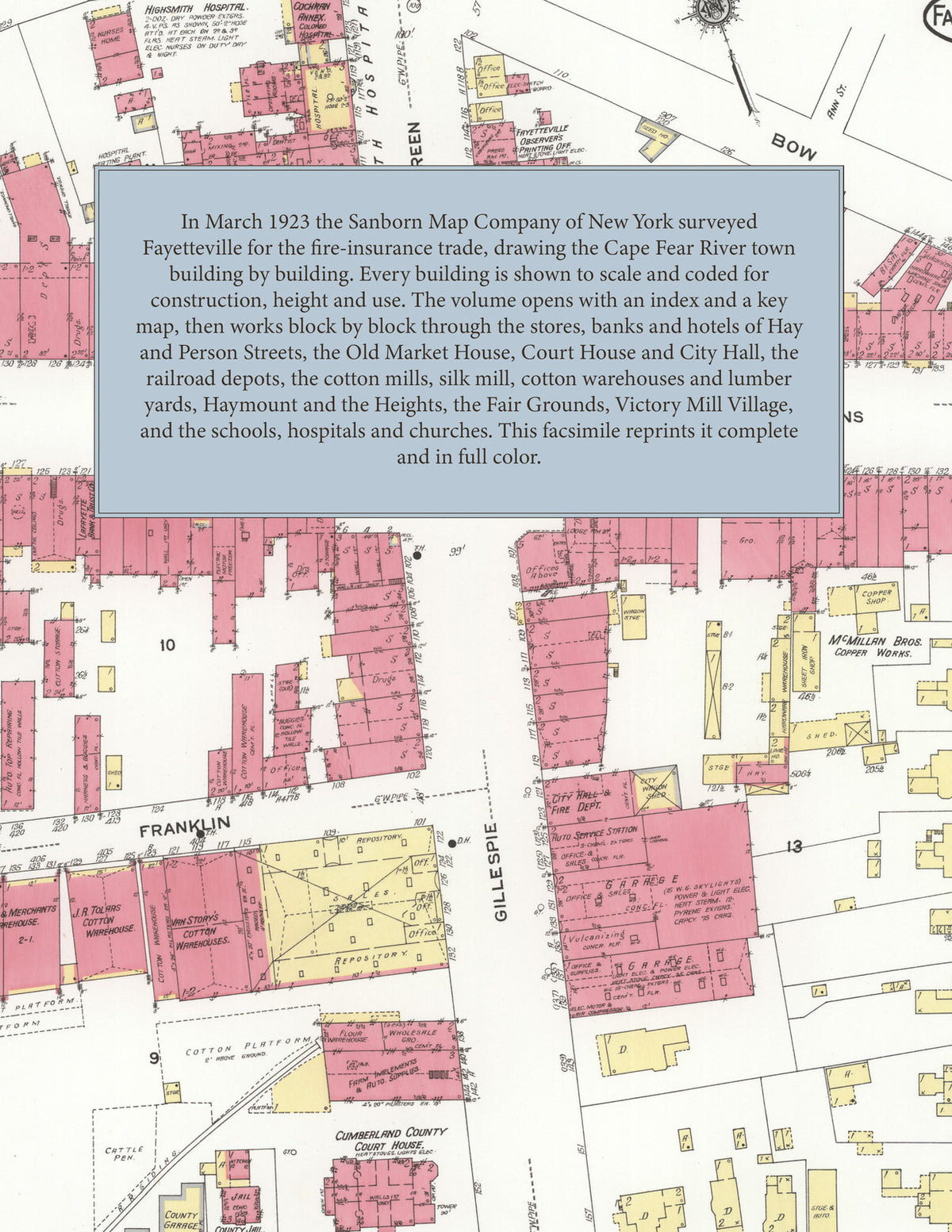
In March 1923 the Sanborn Map Company of New York surveyed Fayetteville for the fire-insurance trade, drawing the town, its cotton mills and mill villages building by building. Every building is shown to scale and color-coded for construction (yellow for frame, pink for brick, blue for stone), with heights, uses, windows, party walls, hydrants, water mains and fire stations all marked. The index lists every street and every named business, church, school, hotel, mill and works with the sheet it appears on, and the key map places the colored sheet grid over the whole city.
This edition is an unabridged facsimile republication of the atlas: the combined title and index sheet and all thirty-eight numbered map sheets, the first of them the key map with its report on the water works and fire department, including Haymount, the mill villages and Victory Mill Village. Ideal for local historians, genealogists, architects, preservationists and anyone tracing a Fayetteville address back to 1923.
40 pages. 8.5" x 11". Full color. Paperback.
Printed to order and shipped directly to you — please allow up to 7 business days before shipment.
Satisfaction guaranteed or you can send it back!