1923 Fire Insurance Maps and Atlas of Middlesboro, Kentucky
1923 Fire Insurance Maps and Atlas of Middlesboro, Kentucky
Couldn't load pickup availability
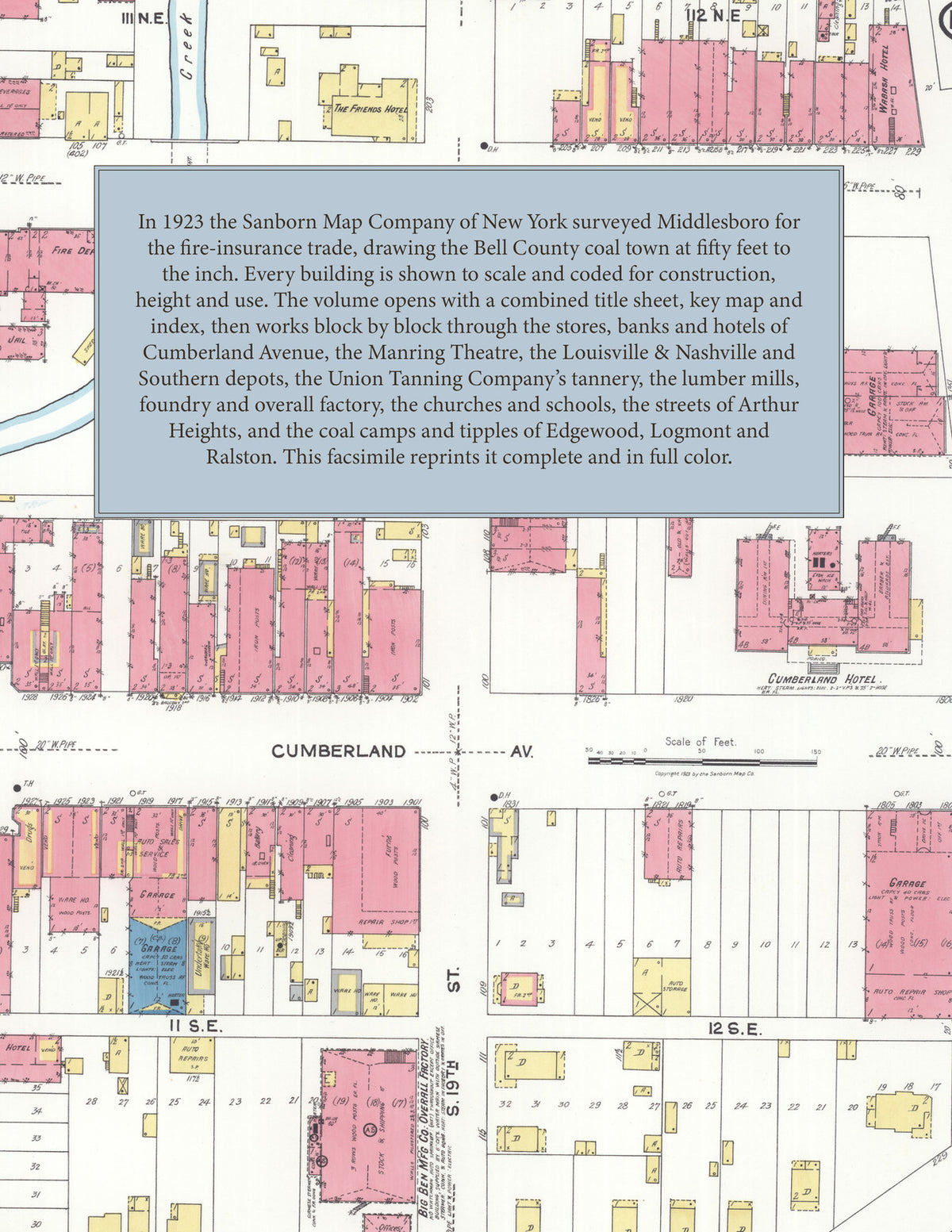
Facsimile of the 1923 Sanborn fire-insurance atlas of Middlesboro, Kentucky, reproduced in full color from the Library of Congress copy. It covers the whole city of 10,000 people, from the stores, banks, hotels and theatres of Cumberland and Lothbury Avenues and Nineteenth and Twentieth Streets, through the Louisville and Nashville and Southern tracks, the tannery, lumber mills and foundry, to the residential streets of Arthur Heights and the grid along Yellow Creek, and out to the coal camps and tipples of Edgewood, Logmont, Ralston and the Yellow Creek valley.
The twenty-four numbered sheets work block by block from the stores, banks, hotels and theatres along Cumberland Avenue, Lothbury Avenue, Ashbury Avenue, Nineteenth Street and Twentieth Street - the City Hall and Jail, the Post Office, the Public Library, the Masonic Building, the Manring Theatre, the Cumberland, Wabash, Piedmont, Bruce and Ashbury hotels, the Booneway Inn and the Albion, the Brummett-Brosheer Hospital and the Salvation Army Building - through the Louisville and Nashville depots and carpenter shop, the Southern Railway, the Union Tanning Company's tannery and cottages, the Kentucky Utilities sub-station, the Lynes Lumber and Manufacturing sawmill, the Bell County Lumber and Coal and Allen Lumber yards, the Hoe foundry and machine shop, the Big Ben overall factory, the Marton-Page suspender factory, the Lone Mountain Milling Company, the Middlesboro Creamery and Ice and Cold Storage companies, the Middlesboro Steam Laundry, the Middlesboro Supply and Wholesale Grocery companies, the Hackney and Jellico wholesale groceries, the Kentucky Mine Supply Company, the Morristown Medicine Company, the New South Packing Company, Armour and Company, the Coca-Cola and Chero-Cola bottling works and the Standard Oil station, out to the mines, tipples and camps of the Virginia Iron, Coal and Coke, Yellow Creek Coal and Coke, Winona, Columbia, Congress, Campbell, Climax, Clover Leaf, Coal Creek, Crystal, Gravity, Hignite, Lower Hignite, Home, Long Branch, Pinacle, Ralston, Stony Fork, Bellman, Hawley, Atlas, Dixie Jim and East Point coal companies at Edgewood, Logmont and Ralston, to the High School, the Ashbury Avenue, North Twentieth Street, South Eighth Street and Division public schools, the First Baptist, Christian, Presbyterian, Methodist Episcopal North and South, St. Julian Roman Catholic and St. Mary's Episcopal churches, the A. M. E. Zion, St. John's A. M. E., Mt. Moriah, Thankful, Missionary and East Side Baptist and Holiness churches, Glenwood Cemetery, and the residential streets of Arthur Heights and the long grid of avenues along Yellow Creek.
In 1923 the Sanborn Map Company of New York surveyed Middlesboro for the fire-insurance trade, drawing the city at fifty feet to the inch. Every building is shown to scale and color-coded for construction (yellow for frame, pink for brick, blue for stone), with heights, uses, windows, party walls, hydrants, water mains and fire stations all marked. The index lists every street and every named business, church, school, hotel, mill and works with the sheet it appears on, and the key map places the colored sheet grid over the whole city.
This edition is an unabridged facsimile republication of the atlas: the combined title, key map and index sheet and all twenty-four numbered map sheets, 2 to 25, including the coal camps around the city. Ideal for local historians, genealogists, architects, preservationists and anyone tracing a Middlesboro address back to 1923.
32 pages. 8.5" x 11". Full color. Paperback.
Printed to order and shipped directly to you — please allow up to 7 business days before shipment.
Satisfaction guaranteed or you can send it back!