1923 Fire Insurance Maps and Atlas of Troy, Ohio
1923 Fire Insurance Maps and Atlas of Troy, Ohio
Couldn't load pickup availability
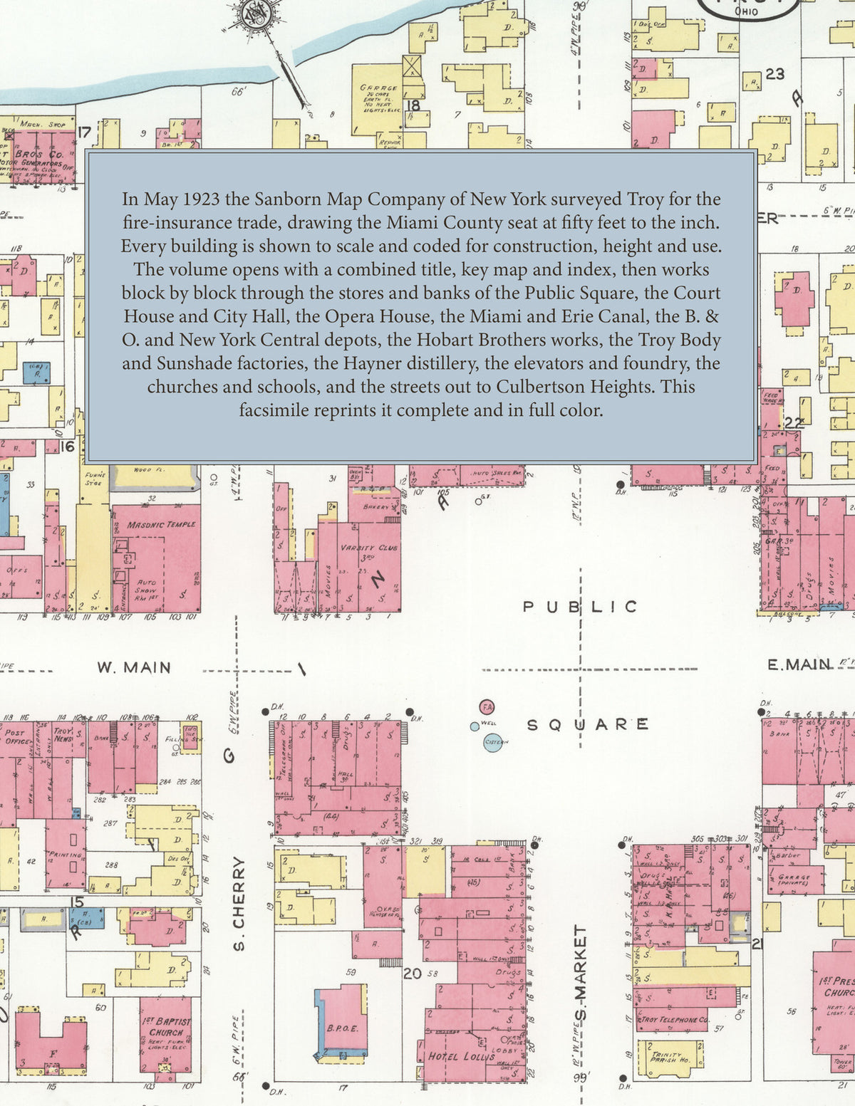
Facsimile of the 1923 Sanborn fire-insurance atlas of Troy, Ohio, reproduced in full color from the Library of Congress copy. It covers the whole Miami County seat of 8,000 people, from the stores, banks and hotels around the Public Square and the Court House on Main and Market Streets beside the Great Miami River, along the Miami and Erie Canal to the depots, mills and factories, and out to the Fair Grounds, the County Infirmary and Culbertson Heights.
The twenty-four numbered sheets work block by block from the stores, banks and hotels around the Public Square and along Main Street, Market Street, Water Street, Franklin Street and Cherry Street - the County Court House and Jail, the City Hall and Jail, the Post Office, the Library, the Opera House, the Masonic Temple, the B. P. O. E. clubhouse, the F. O. E. Hall, Lincoln Community Hall, the Trinity Parish House, the Troy Clubhouse, Hotel Lollis and the Hatfield House - through the Miami and Erie Canal and the race, the B. & O. and N. Y. C. railroad depots, the D. & T. Electric railroad depot, the Hobart Brothers motor-generator, cabinet and food-machine works, the Troy Body Company's auto-body works, the Troy Carriage Sunshade Company, the Troy Trailer & Wagon Works, the Miami Trailer Company, the Troy Foundry Company, the Skinner Irrigation Company, the H. G. Cress educational toy works, the Gummed Products Company, the Hayner Distilling Company's distillery and warehouse with the U. S. bonded warehouses and internal revenue office, the Allen & Wheeler flour mill and grain elevator, the Falknor and Martin & Rehmert grain elevators, the Troy Grain and Supply Company and feed mill, the Francis & Montross and Troy lumber yards and planing mill, the Troy Milk and Butter Company, the Ideal Laundry, the Troy News printing house, the Troy Telephone Company, the Standard Oil Company, the Municipal Lighting Plant and city water works, the Broun and Guelich slaughter houses and the Baird & Hall and Farmer's nurseries, to the County Infirmary, the Knoop Children's Home, the Kyle High School, the Edwards, Forest and Van Cleve public schools, St. Patrick's Roman Catholic Church and parochial school, the First Baptist, Christian, English Lutheran, Methodist Episcopal and Presbyterian churches, the Walnut Street Episcopal, German Evangelical, Conservative Dunkard, Christian Science and Nazarene churches, Richard's Chapel, the St. James A. M. E. Chapel and Second Zion Baptist Church, the County Agricultural Society's Fair Grounds, and the residential streets out to Culbertson Heights.
In 1923 the Sanborn Map Company of New York surveyed Troy for the fire-insurance trade, drawing the city at fifty feet to the inch. Every building is shown to scale and color-coded for construction (yellow for frame, pink for brick, blue for stone), with heights, uses, windows, party walls, hydrants, water mains and fire stations all marked. The index lists every street and every named business, church, school, hotel, mill and works with the sheet it appears on, and the key map places the colored sheet grid over the whole city.
This edition is an unabridged facsimile republication of the atlas: the combined title, key map and index sheet with its report on the water facilities and fire department, and all twenty-four numbered map sheets, 2 to 25. Ideal for local historians, genealogists, architects, preservationists and anyone tracing a Troy address back to 1923.
32 pages. 8.5" x 11". Full color. Paperback.
Printed to order and shipped directly to you — please allow up to 7 business days before shipment.
Satisfaction guaranteed or you can send it back!