1923 Fire Insurance Maps and Atlas of Wooster and Apple Creek, Ohio
1923 Fire Insurance Maps and Atlas of Wooster and Apple Creek, Ohio
Couldn't load pickup availability
Facsimile of the 1923 Sanborn fire-insurance atlas of Wooster and Apple Creek, Ohio, reproduced in full color from the Library of Congress copy. It covers the whole Wayne County seat of 9,000 people, from the Court House and the stores, banks, hotels and Opera House round the Public Square out along the Pennsylvania, Baltimore and Ohio and Cleveland and Southwestern lines to the rubber, brush, aluminum, steel and machinery works and mills, the schools, churches and residential additions, the College of Wooster, the Fair Grounds and the Ohio Agricultural Experiment Station, and the village of Apple Creek.
The thirty-three numbered sheets that follow work block by block from the stores, banks and offices round the Public Square and along Liberty, Market, Buckeye and North Streets - the Wayne County Court House, City Hall and the fire department, the Jail, the Post Office, the Armory, Memorial Hall, the Masonic Temple, the Opera House, the Wayne County National Bank Building, the telephone exchange, and the Archer, American and European hotels - through the Pennsylvania freight and passenger depots, the Baltimore and Ohio depot, the Cleveland and Southwestern freight depot and car barns, the Mackintosh Hemphill rolling-mill machinery works, the Perkins structural steel works, the Wooster weldless tube works, the Akron Brass Company, the Buckeye Aluminum cooking-utensil factory, the Sunshine Rubber Works, the Racer Disc Wheel and Rubber Company, the Canton Rim Company, the Wooster Brush Company, the Toycraft wooden-toy factory, the Ohio Overall factory, the Gerstenslager buggy works, the Medal Paving Brick and Safety Stair Tread companies, the Empire, Smith and Equity flour and feed mills, the Wooster Preserving Company, the Cedar Valley distillery, the ice, coal, oil and lumber yards, the greenhouses and the city pumping stations, to the Wooster and K and K hospitals, the County Children's Home and Infirmary, the Livingston Missionary Home, the College of Wooster with its Conservatory of Music and Westminster Home, the Fair Grounds, the Ohio Agricultural Experiment Station, the Senior High School and the ward schools, the Immaculate Conception, Presbyterian, Methodist, Baptist, Episcopal, Lutheran, Reformed and Evangelical churches, and the residential additions, with the village of Apple Creek and its roller mills, screen-door works, saw mill, Town Hall and schools.
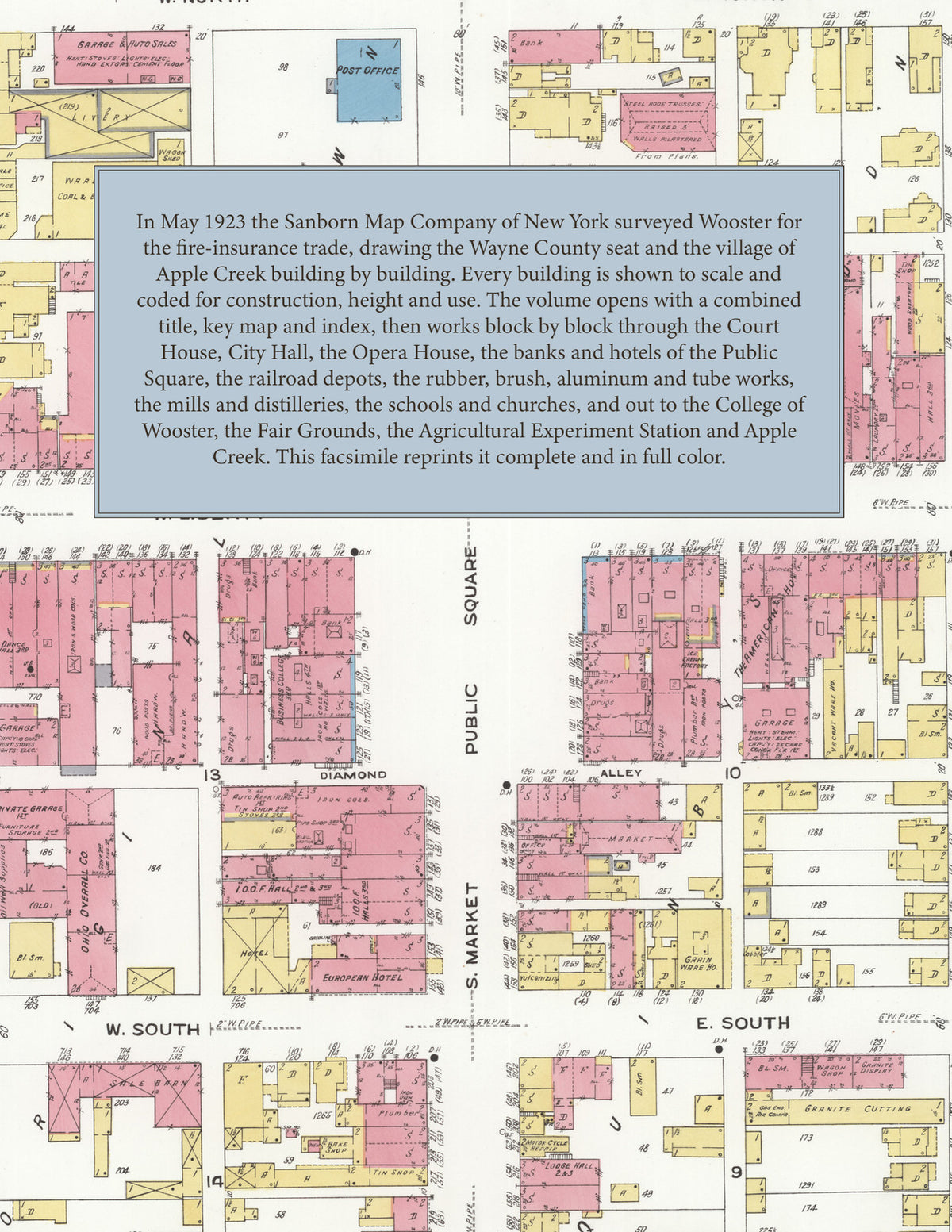
In May 1923 the Sanborn Map Company of New York surveyed Wooster and Apple Creek for the fire-insurance trade, drawing the city at fifty feet to the inch and the fair grounds and experiment station at one hundred feet to the inch. Every building is shown to scale and color-coded for construction (yellow for frame, pink for brick, blue for stone), with heights, uses, windows, party walls, hydrants, water mains and fire stations all marked. The index lists every street and every named business, church, school, hotel, mill and works with the sheet it appears on, and the key map places the colored sheet grid over the whole city.
This edition is an unabridged facsimile republication of the atlas: all thirty-four numbered map sheets, 1 to 34, sheet 1 being the combined title, key map and index sheet with its report on the water works and fire department, the others covering the city, the College of Wooster, the County Fair Grounds and the Ohio Agricultural Experiment Station, the county homes and works on the outskirts, and the village of Apple Creek. Ideal for local historians, genealogists, architects, preservationists and anyone tracing a Wooster address back to 1923.
36 pages. 8.5" x 11". Full color. Paperback.
Printed to order and shipped directly to you — please allow up to 7 business days before shipment.
Satisfaction guaranteed or you can send it back!