1924 Fire Insurance Maps and Atlas of Huntington Park, California
1924 Fire Insurance Maps and Atlas of Huntington Park, California
Couldn't load pickup availability
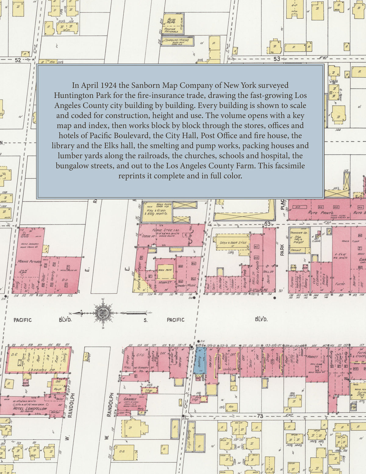
Facsimile of the 1924 Sanborn fire-insurance atlas of Huntington Park, California, reproduced in full color from the Library of Congress copy. It covers the whole Los Angeles County city of 15,000 people on the southern edge of Los Angeles, from the stores, offices and hotels of Pacific Boulevard out across the residential grid from Slauson Avenue to Florence Avenue, the factories, packing houses and lumber yards along the railroads, the edge of Walnut Park, and the Los Angeles County Farm.
The thirty-nine numbered sheets work block by block from the stores, banks and offices along Pacific Boulevard and its cross streets - the City Hall, the Fire Department, the Post Office, the Public Library, the B. P. O. E. Hall, the Women's Club, the Southern California Telephone exchange, and the Hotel Longfellow and Jack Riley Hotel - through the Union Smelting and Refining Trust, the Byron-Jackson Pump Company, Hess and Sackett, the Bayer-Rothgeb Company, the Keesee Manufacturing Company, O'Brien's varnish works, the Roberts-Cohen Company, the Tropical Hardwood Company, the California Vegetable Union packing house, the Southern California Land and Water Company, the Tate lumber yard and the transfer company along the railroads, and the city water works and reservoir, to the Huntington Park Hospital, the Huntington Park Union High School, the Irvington Avenue intermediate school and the Miles Avenue and Malabar schools, the Christian Workers' Training School, St. Mathias Catholic, First Baptist, First Methodist, St. Clement's Methodist, St. Luke's Lutheran, Christian, Friends and Christian Science churches, the bungalow streets from Slauson Avenue to Florence Avenue between the Los Angeles line and Walnut Park, and the Los Angeles County Farm.
In April 1924 the Sanborn Map Company of New York surveyed Huntington Park for the fire-insurance trade, drawing the town at fifty feet to the inch and the county farm at one hundred feet to the inch. Every building is shown to scale and color-coded for construction (yellow for frame, pink for brick, blue for stone), with heights, uses, windows, party walls, hydrants, water mains and fire stations all marked. The index lists every street and every named business, church, school, hotel, mill and works with the sheet it appears on, and the key map places the colored sheet grid over the whole city.
This edition is an unabridged facsimile republication of the atlas: all thirty-nine numbered map sheets, the first of them the title sheet, key map and index with its report on the water works and fire department, and the last the Los Angeles County Farm. Ideal for local historians, genealogists, architects, preservationists and anyone tracing a Huntington Park address back to 1924.
40 pages. 8.5" x 11". Full color. Paperback.
Printed to order and shipped directly to you — please allow up to 7 business days before shipment.
Satisfaction guaranteed or you can send it back!