1924 Fire Insurance Maps and Atlas of Torrington, Connecticut
1924 Fire Insurance Maps and Atlas of Torrington, Connecticut
Couldn't load pickup availability
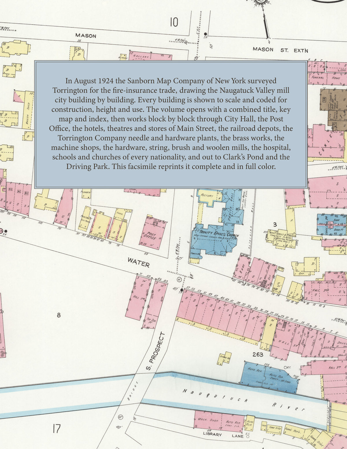
Facsimile of the 1924 Sanborn fire-insurance atlas of Torrington, Connecticut, reproduced in full color from the Library of Congress copy. It covers the whole Litchfield County mill city of 22,055 people at the forks of the Naugatuck River, from City Hall, the Post Office and the stores, hotels and theatres of Main and Water Streets out through the New Haven depots, the Torrington Company plants, the American Brass works and the hardware, machine and woolen mills along both branches of the river, to the Hungerford Memorial Hospital, the residential streets of every district, Clark's Pond and the Driving Park.
The thirty-five numbered sheets that follow work block by block from the stores, banks and offices along Main, Water and Prospect Streets - City Hall, the Post Office, the Y. M. C. A., the fire department headquarters, the Torrington Library, the Armory, the Torrington, B. P. O. E. and Slavonian club houses, Lithuanian Hall, the Southern New England Telephone exchange, the Alhambra Theatre, the Burmor Apartments, and the New Century, Pappas, Raymond and Foth hotels, the Allen House and Conley's Inn - through the New York, New Haven and Hartford passenger and freight depots, the Torrington Company's Excelsior, Progressive and hardware and metal goods plants, the American Brass Company's Torrington Branch and machine shop, the Hendey Machine Company, the Union Hardware Company, Turner and Seymour, the Torrington Manufacturing Company, the Torrington Casting Company, the Diamond Needle Company, the Union String Company, the Severn Brothers hosiery mill, the Warrenton Woolen Company, the Torrington Brush Works, the Graham bicycle pedal works, the Fitzgerald and Schroeder Brothers metal goods works, the Borgeson machine shop, the Hotchkiss Brothers and Torrington lumber mills, the electric light and gas works, the ice, coal and oil yards and the street department, to the Hungerford Memorial Hospital, the Day Nursery, the High School, the Wetmore, Migeon Avenue, Riverside, North, South, East, Southeast and Southwest schools, the Center and French Congregational, Methodist, Baptist, Advent Christian, German Evangelical and A. M. E. Zion churches, St. Francis, Sacred Heart, St. Peter's Italian, St. Maron and St. Mary of Czestochowa Polish Catholic churches, the Sons of Jacob Synagogue, and the residential streets of every district out to the Industrial Reservoir, Clark's Pond and the Torrington Driving Park.
In August 1924 the Sanborn Map Company of New York surveyed Torrington for the fire-insurance trade, drawing the city, its brass, hardware and needle works building by building. Every building is shown to scale and color-coded for construction (yellow for frame, pink for brick, blue for stone), with heights, uses, windows, party walls, hydrants, water mains and fire stations all marked. The index lists every street and every named business, church, school, hotel, mill and works with the sheet it appears on, and the key map places the colored sheet grid over the whole city.
This edition is an unabridged facsimile republication of the atlas: all thirty-six numbered map sheets, 1 to 36, sheet 1 being the combined title, key map and index sheet with its report on the water works and fire department, the later sheets covering the outlying mills, the Hungerford Memorial Hospital and the Driving Park. Ideal for local historians, genealogists, architects, preservationists and anyone tracing a Torrington address back to 1924.
38 pages. 8.5" x 11". Full color. Paperback.
Printed to order and shipped directly to you — please allow up to 7 business days before shipment.
Satisfaction guaranteed or you can send it back!