1925 Fire Insurance Maps and Atlas of Ann Arbor, Michigan
1925 Fire Insurance Maps and Atlas of Ann Arbor, Michigan
Couldn't load pickup availability
Facsimile of the 1925 Sanborn fire-insurance atlas of Ann Arbor, Michigan, reproduced in full color from the Library of Congress copy. It covers the whole Washtenaw County seat of 35,000 people, ten thousand of them students, from the Court House and the stores of Main, Washington, Liberty and State Streets across the University of Michigan campus, its hospital, observatory and Ferry Field, and down to the Huron River with its railroad depots, mills and factories, out to the residential additions on every side.
The forty numbered sheets work block by block from the stores, banks and halls along Main Street, Washington Street, Liberty Street and State Street - the Washtenaw County Court House, the City Hall, the Post Office, the Public Library, the Armory, the Chamber of Commerce, the Masonic Temple and Masonic Lodge Hall, the National Bank Building, Nickel's Arcade, Mack and Company's department store, the Majestic, Whitney and Mimes theatres, Weinburg's Coliseum, the Y. M. C. A. and Y. W. C. A., and the Hotel Allenel, the St. James, the Hotel Whitney and the American Hotel - through the Michigan Central passenger and freight depots, the Ann Arbor Railroad depots, the Detroit United Railway depot, the Detroit Edison Company's Argo Plant, the Michigan Milling Company's Ann Arbor and Central mills, the American Broach and Machine Company, the Motor Products Corporation, the Hoover Steel Ball Company, the Trail-Ford Corporation, the King-Seeley gasoline-gauge works, the Ann Arbor Foundry, Stamping and Metal and Automatic Products companies, the Machine Specialty Company, the Westgate floor-lamp works, the Forge Products Company, the Cook Spring Company, the Lamb Visor Company, the Michigan Furniture Company, the Ann Arbor Packing Company, the Hammond Beef Company, the Artificial Ice Company, the Washtenaw Gas Company, the Broadway and Ann Arbor Floral greenhouses and the water works pumping plants, to the University of Michigan with Hill Auditorium, the Michigan Union, the School of Music, University Hospital, the Observatory, the Botanical Gardens, Ferry Field and the University High School, St. Joseph's Sanitarium, the Cowie Hospital, the Ann Arbor High School and the Bach, Jones, Perry, Tappan, Angell and Eberbach schools, St. Andrew's Episcopal, St. Thomas' Roman Catholic, the First Baptist, Congregational, Methodist Episcopal and Presbyterian churches, the Unitarian Church, Bethlehem Evangelical and the Lutheran churches, Bethel A. M. E. Church, Wesley Hall, Westminster House and the Students' Christian Association, and the residential streets of the additions out to Washington Heights.
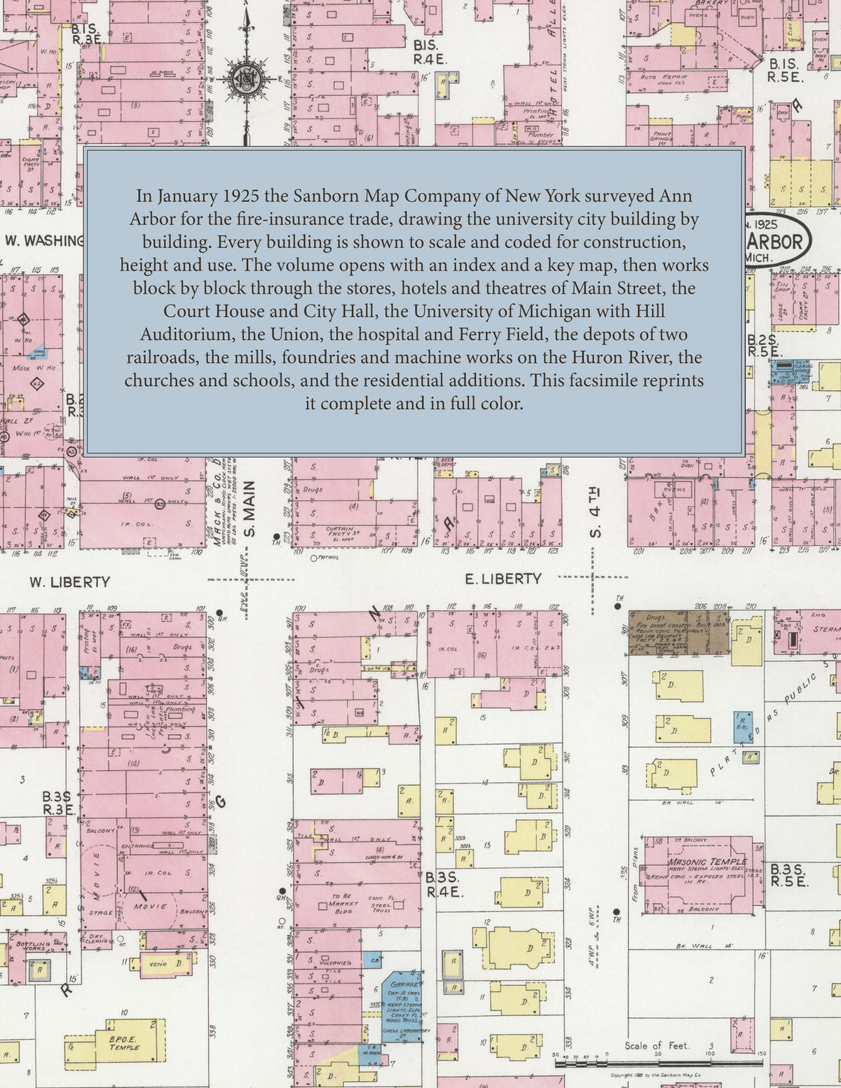
In January 1925 the Sanborn Map Company of New York surveyed Ann Arbor for the fire-insurance trade, drawing the city and the campus at fifty feet to the inch and the outer additions at one hundred feet to the inch. Every building is shown to scale and color-coded for construction (yellow for frame, pink for brick, blue for stone), with heights, uses, windows, party walls, hydrants, water mains and fire stations all marked. The index lists every street and every named business, church, school, hotel, mill and works with the sheet it appears on, and the key map places the colored sheet grid over the whole city.
This edition is an unabridged facsimile republication of the atlas: the combined title and index sheet and all forty numbered map sheets, the first of them the key map with its report on the water works and fire department, with the University of Michigan. Ideal for local historians, genealogists, architects, preservationists and anyone tracing a Ann Arbor address back to 1925.
42 pages. 8.5" x 11". Full color. Paperback.
Printed to order and shipped directly to you — please allow up to 7 business days before shipment.
Satisfaction guaranteed or you can send it back!