ExileBooks
1925 Fire Insurance Maps and Atlas of Jeffersonville, Indiana
1925 Fire Insurance Maps and Atlas of Jeffersonville, Indiana
Couldn't load pickup availability
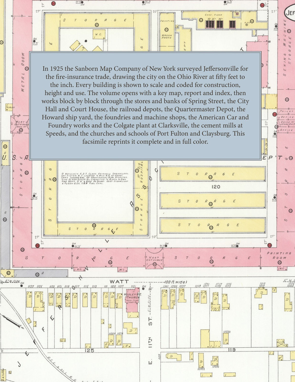
Facsimile of the 1925 Sanborn fire-insurance atlas of Jeffersonville, Indiana, reproduced in full color from the Library of Congress copy. It covers the whole city on the Ohio River, from the stores of Spring Street and the Quartermaster Depot to Port Fulton, Claysburg and the Howard ship yard, together with the neighboring town of Clarksville and the American Car and Foundry works, and the Louisville Cement Company's mills at Speeds.
The thirty-six numbered sheets work block by block from the stores, banks, garages and halls along Spring Street and Market, Chestnut, Wall, Pearl, Front and Court Avenue - the City Hall, the County Court House, the Post Office, the Public Library, the Police Headquarters and fire station, the K. of P. Armory, the Masonic Hall, Spieth Hall and the Strauss Hotel - through the Pennsylvania System passenger depot and yards, the B. and O. freight depot, the L. and J. Bridge and Railroad freight house, the Interstate Service Company's car barn, substation and pumping station, the United Gas and Electric Company, the U. S. A. General Depot Quartermaster Department and the U. S. Government warehouses, the Howard Ship Yard Company and C. E. Howard Lumber Company, the Gorsuch, Anderson and Acme foundries and machine shops, the Hempel Machine Company, G. H. Holzbog and Brother's wagon works, the Jeffersonville Baking, Bottling, Canning and Manufacturing companies, John Gienger and Company's elevator, the Service Ice Company, the American Ice Cream Company, the Standard Oil Company, the P. F. Myers lumber yard and the coal yards, the American Car and Foundry Company's works and lumber yard and the Colgate Company plant at Clarksville, and the Louisville Cement Company's mills at Speeds, to the Sisters of Mercy Hospital, the Jeffersonville High School, the Clarksville, Claysburg, Howard Park, Ingramville, Port Fulton, Rose Hill and Spring Hill public schools, St. Anthony's German and St. Augustine's Roman Catholic churches and schools, St. Paul's Episcopal, St. Luke's Reformed, First Baptist, First Presbyterian, Christian, Indiana Avenue Baptist, Trinity Baptist, Second Baptist, Bethel A. M. E. and the Wall Street, Maple Street, Park, Morton and Wesley Methodist churches, Market Square Park, and the residential streets of Port Fulton, Claysburg, Clarksville, Benson's Addition and the Eastern Division.
In 1925 the Sanborn Map Company of New York surveyed Jeffersonville for the fire-insurance trade, drawing the city at fifty feet to the inch. Every building is shown to scale and color-coded for construction (yellow for frame, pink for brick, blue for stone), with heights, uses, windows, party walls, hydrants, water mains and fire stations all marked. The index lists every street and every named business, church, school, hotel, mill and works with the sheet it appears on, and the key map places the colored sheet grid over the whole city.
This edition is an unabridged facsimile republication of the atlas: all thirty-six numbered map sheets, 1 to 36, sheet 1 being the combined title, key map, fire and water report and index sheet. Ideal for local historians, genealogists, architects, preservationists and anyone tracing a Jeffersonville address back to 1925.
38 pages. 8.5" x 11". Full color. Paperback.
Printed to order and shipped directly to you — please allow up to 7 business days before shipment.
Satisfaction guaranteed or you can send it back!