ExileBooks
1925 Fire Insurance Maps and Atlas of Milford, Connecticut
1925 Fire Insurance Maps and Atlas of Milford, Connecticut
Couldn't load pickup availability
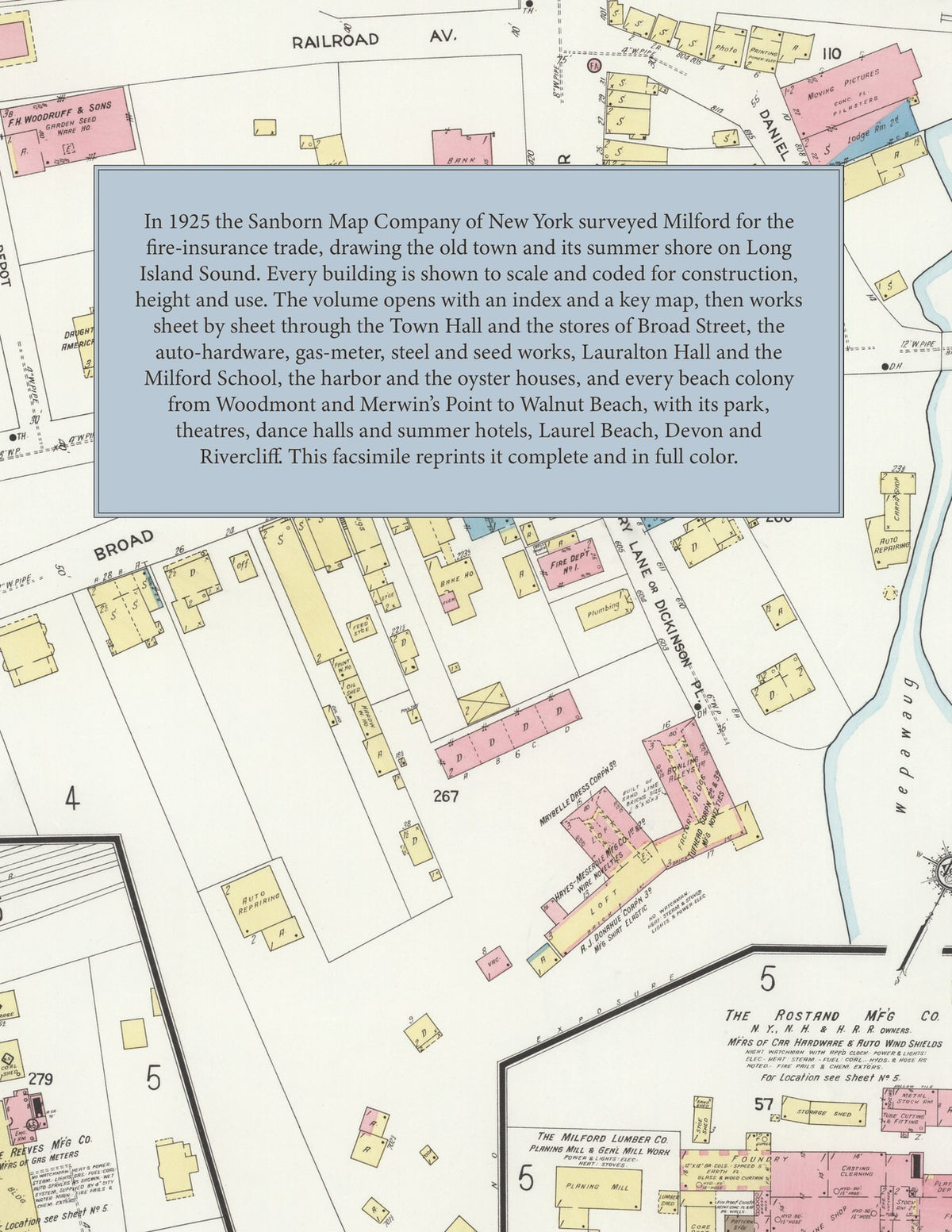
Facsimile of the 1925 Sanborn fire-insurance atlas of Milford, Connecticut, reproduced in full color from the Library of Congress copy. It covers the whole town, a place of 12,000 in winter and 30,000 in summer, from the Town Hall, stores and factories around the green and the harbor, along every beach colony on Long Island Sound - Woodmont, Merwin's Point, Burwell's Beach, Fairview Beach, Morningside, Bay View, Fort Trumbull Beach, Silver Sands, Seaside, Myrtle Beach, Meadows End, Walnut Beach, Wildmere Beach, Laurel Beach and Cedar Beach - to Devon and Rivercliff on the Housatonic.
The thirty numbered sheets work from the stores, banks and offices along Broad Street, River Street, New Haven Avenue and North and South Broad Street - the Town Hall and Municipal Offices, the Post Offices at Milford, Devon and Merwin's Point, the Taylor Free Library, the Telephone Exchange, the American Legion and Daughters of the American Revolution buildings - through the New Haven Railroad passenger and freight depots, the Rostand car-hardware and auto wind-shield works, the Reeves gas-meter works, the Stanford Steel cold-rolled steel mill, the Atlantic screw-machine works, the Baldwin machine shop, the Tufhead and Hayes-Meserole novelty works, the Maybelle dress and Donahue shirt-elastic factories, the Crofut & Knapp straw-hat works, the E. B. Clark seed company and the Woodruff onion-set and seed warehouses, the Milford Lumber Company's yards and planing mill, the Beaver Brook ice house, the New Haven Gas station, the Milford Water Company's pumping station and the oyster houses on the harbor, to the Milford Hospital, the Peck Sanatorium, the Academy of Our Lady of Mercy at Lauralton Hall, the Milford School for boys, the Milford High School and Central Grammar School and the Devon, Fort Trumbull, Walnut Beach and Woodmont schools, St. Mary's, St. Agnes, St. Ann's and St. Gabriel's Catholic churches, St. Peter's and St. Andrew's Episcopal, the First and Plymouth Congregational, the Mary Taylor Methodist and the colored Baptist churches and the union chapels of the beaches, and the summer shore - Walnut Beach Park, the Strand and Tower theatres, the Laurel Beach Casino and the dance halls, the Woodmont Inn, the Tide Water Inn, Merwin's hotels at Meadows End and Cedar Beach, the Crestmont, Sea Breeze, Shoveham, Pembroke and scores of boarding cottages, the Milford Yacht Club, the Morningside club house and the children's summer homes - and the streets of Devon, Rivercliff and every beach from Woodmont to Laurel Beach.
In 1925 the Sanborn Map Company of New York surveyed the town of Milford for the fire-insurance trade, drawing the business blocks of the centre and the Walnut Beach and Myrtle Beach colonies at fifty feet to the inch and the rest of the town and its shore at one hundred feet to the inch. Every building is shown to scale and color-coded for construction (yellow for frame, pink for brick, blue for stone), with heights, uses, windows, party walls, hydrants, water mains and fire stations all marked. The index lists every street and every named business, church, school, hotel, mill and works with the sheet it appears on, and the key map places the colored sheet grid over the whole city.
This edition is an unabridged facsimile republication of the atlas: the combined title and index sheet and all thirty numbered map sheets, sheet 1 being the key map with the report. Ideal for local historians, genealogists, architects, preservationists and anyone tracing a Milford address back to 1925.
32 pages. 8.5" x 11". Full color. Paperback.
Printed to order and shipped directly to you — please allow up to 7 business days before shipment.
Satisfaction guaranteed or you can send it back!