1927 Fire Insurance Maps and Atlas of Oskaloosa and Beacon, Iowa
1927 Fire Insurance Maps and Atlas of Oskaloosa and Beacon, Iowa
Couldn't load pickup availability
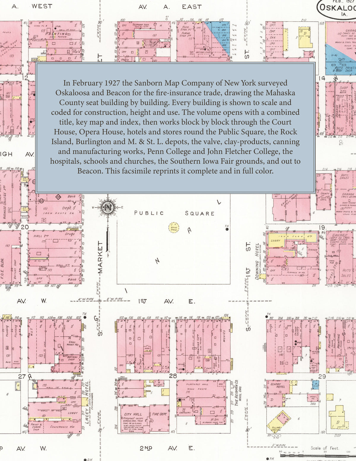
Facsimile of the 1927 Sanborn fire-insurance atlas of Oskaloosa and Beacon, Iowa, reproduced in full color from the Library of Congress copy. It covers the Mahaska County seat of 9,500 people, from the Court House, stores, hotels and Opera House round the Public Square out along the Rock Island, Burlington and Minneapolis & St. Louis railroads to the mills and works, Penn College and John Fletcher College, the Southern Iowa Fair grounds, the water works on the Skunk River, the residential additions, and the neighboring town of Beacon.
The twenty-seven numbered sheets that follow work block by block from the stores, banks and offices round the Public Square and along High Avenue, Market Street, First Avenue and A Street - the Mahaska County Court House and Jail, the City Hall, the Post Office, the Public Library, the Chamber of Commerce, the Masonic Hall and Opera House, the F. O. E. Building, the Telephone Exchange, the Fire Department, the Y. M. C. A. and Y. W. C. A., and the Downing, Gentry, Lacey, LeMartin and Brooks hotels - through the Chicago, Rock Island & Pacific, Chicago, Burlington & Quincy and Minneapolis & St. Louis depots and round house, the Iowa Valve Company, the Standard Clay Products Company, the Hanna, Seevers and Turner Simplicity manufacturing companies, the Oskaloosa and Savage foundries, the Anderson Bros. cannery, the Western Grocery and Reisman wholesale houses, the Hutchinson ice cream and Underwood candy factories, the Star Bottling Works, the Rhynsburger and Reisman poultry houses, the Union Monarch Laundry, the Hawkeye, Ideal and Kalbach lumber companies, the Kemble and Greene floral companies, the stock yards and oil depots, the Oskaloosa Ice and Gas Light & Fuel plants, the Des Moines Electric Company station and the Municipal Water Works on the Skunk River, to the Mercy, Abbott and Oskaloosa hospitals, Penn College and its gymnasium, John Fletcher College, the Barnhouse Conservatory of Music, the High School, the Garfield, Grant, Jefferson, Lincoln, Webster and Whittier schools, the Methodist, Baptist, Christian, Presbyterian, Congregational, Reformed, Episcopal, Lutheran, Catholic, A. M. E. and Swedish churches and the Friends Meeting House, the Southern Iowa Fair grounds, Elm Park, Forrest Cemetery, the residential additions, and Beacon with its town hall, post office, school and Rock Island depots.
In February 1927 the Sanborn Map Company of New York surveyed Oskaloosa and Beacon for the fire-insurance trade, drawing the city at fifty feet to the inch and the fair grounds, colleges and outer additions at one hundred feet to the inch. Every building is shown to scale and color-coded for construction (yellow for frame, pink for brick, blue for stone), with heights, uses, windows, party walls, hydrants, water mains and fire stations all marked. The index lists every street and every named business, church, school, hotel, mill and works with the sheet it appears on, and the key map places the colored sheet grid over the whole city.
This edition is an unabridged facsimile republication of the atlas: all twenty-eight numbered map sheets, 1 to 28, sheet 1 being the combined title, key map and index sheet with its report on the water facilities and fire department, the others covering the city from the business blocks round the Public Square to Penn College and John Fletcher College, the Southern Iowa Fair grounds, the railroad yards and works, the water works on the Skunk River, and Beacon. Ideal for local historians, genealogists, architects, preservationists and anyone tracing a Oskaloosa address back to 1927.
32 pages. 8.5" x 11". Full color. Paperback.
Printed to order and shipped directly to you — please allow up to 7 business days before shipment.
Satisfaction guaranteed or you can send it back!