1928 Fire Insurance Maps and Atlas of Alexandria, Louisiana
1928 Fire Insurance Maps and Atlas of Alexandria, Louisiana
Couldn't load pickup availability
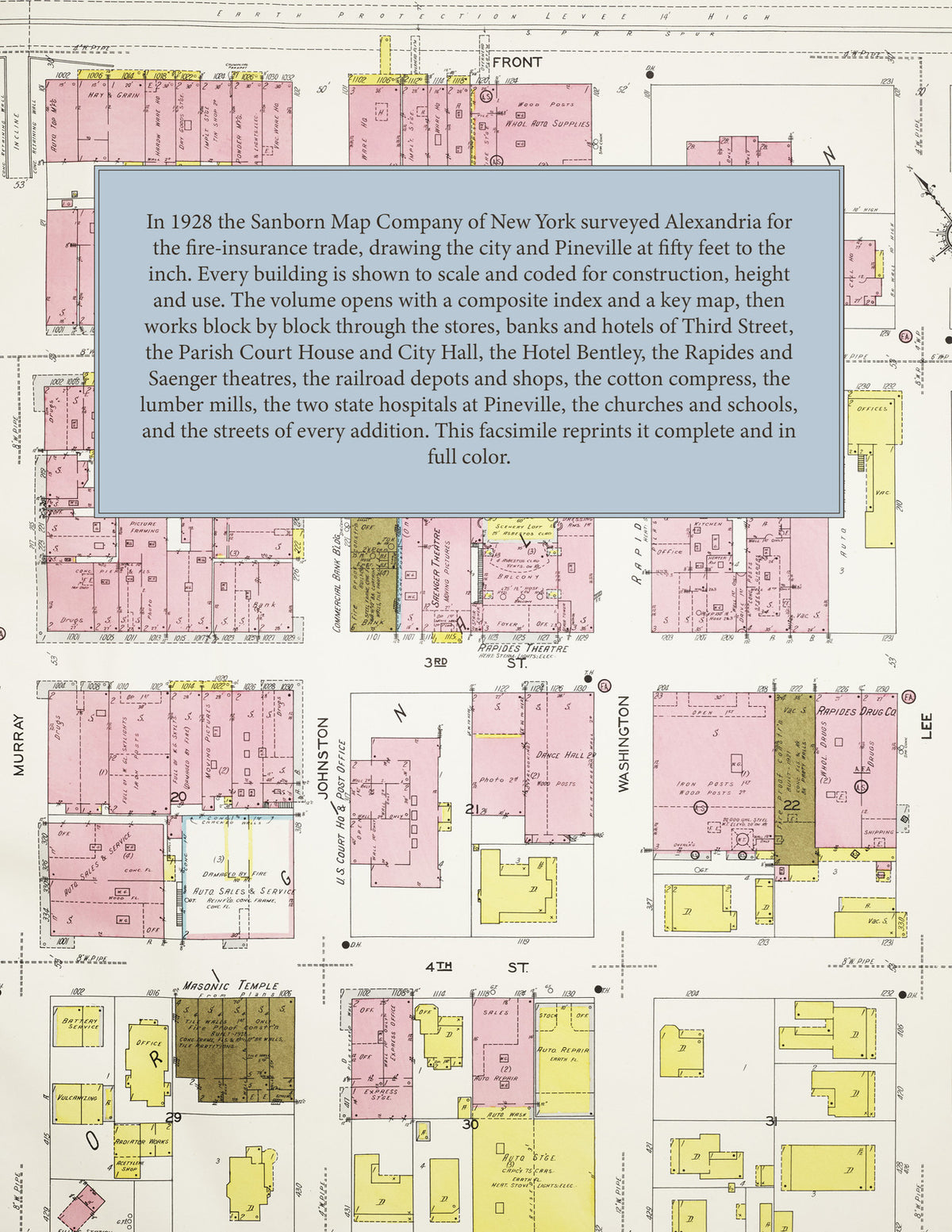
The complete 1928 Sanborn fire-insurance atlas of Alexandria, Louisiana, reprinted in full color. It covers the whole city and Pineville across the Red River, from the stores, hotels and office buildings of downtown along Third Street and the railroad depots and lumber mills to the residential additions on every side.
The seventy numbered sheets work block by block from the stores, banks, hotels and theatres along Third Street, Jackson Street, Murray Street and Lee Street - the Parish Court House and Jail, the City Hall, the United States Court House and Post Office, the Public Library, the Guaranty Bank and Trust and Commercial Bank buildings, the Hotel Bentley, the Jackson, Marion, Southern, Rapides, Union, Hunter and McElroy hotels, the Rapides and Saenger theatres, the Victory Place amusement hall, the Elks' Lodge, the Masonic Temple, the Knights of Columbus Hall and the Temple Gemiluth Chassodim - through the Missouri Pacific, Texas & Pacific, Louisiana & Arkansas, Louisiana Railway & Navigation and Rock Island depots, freight houses, shops and round houses, the Union Depot, the Alexandria Compress and warehouses, the Rapides Packing and Compress Warehouse companies, the Red River Cotton Oil Company, the Cudahy Packing Company, the Coca-Cola, Crystal and Consumers bottling works, the Foote, Vaughan, Calvert and Sondheimer planing and saw mills, the Ball, Fred-Brenner, Hunter Rockwell, Martin, National, Carroll and Pineville lumber companies, the National Lumber & Creosote Works, the Rapides and Adams brick companies, the Alexandria Ice and Utilities plants, the Standard, Gulf, Texas, Pan American, Humble and Louisiana oil companies' plants, the Stucky cabinet shop, the Farmers gin, the Arkansas Oak Flooring Company, the Ruston Foundry and Machine Shops, the Kellam Motor Company and the garages of Chester Place, to the Louisiana State Hospital, the Central Louisiana State Hospital and the State Colony and Training School at Pineville, the Baptist Hospital, the Bolton High School, the Lampton Literary and Industrial College, the Providence Academy, the Menard Memorial Parochial School, the Peabody, West End, Central and ward schools, the churches of every denomination and the synagogue, the Race Track Addition, and the residential streets of Clarence Park, the Hickman Home, Kilpatrick, Sunset, Watson & Wittington, Wheadon & Power's and every other addition of Alexandria and of Pineville across the Red River.
In 1928 the Sanborn Map Company of New York surveyed Alexandria for the fire-insurance trade, drawing the city at fifty feet to the inch. Every building is shown to scale and color-coded for construction (yellow for frame, pink for brick, blue for stone), with heights, uses, windows, party walls, hydrants, water mains and fire stations all marked. The index lists every street and every named business, church, school, hotel, mill and works with the sheet it appears on, and the key map places the colored sheet grid over the whole city.
This edition is an unabridged facsimile republication of the atlas: the title sheet, the composite index, the key map and all seventy numbered map sheets together with the two skeleton sheets. Ideal for local historians, genealogists, architects, preservationists and anyone tracing a Alexandria address back to 1928.
76 pages. 8.5" x 11". Full color. Paperback.
Printed to order and shipped directly to you — please allow up to 7 business days before shipment.
Satisfaction guaranteed or you can send it back!